Tag Archives: banana couloir

Banana Couloir – Prospectors Mountain

Location: GTNP, Prospectors Mountain, Open Canyon
Elevation: 11,180′, 4,894′ gain/loss
Distance: 14 miles RT
Difficulty: 3+ stars
Time: 6-9 hours

Trip Report:

Date: 1/13/2016
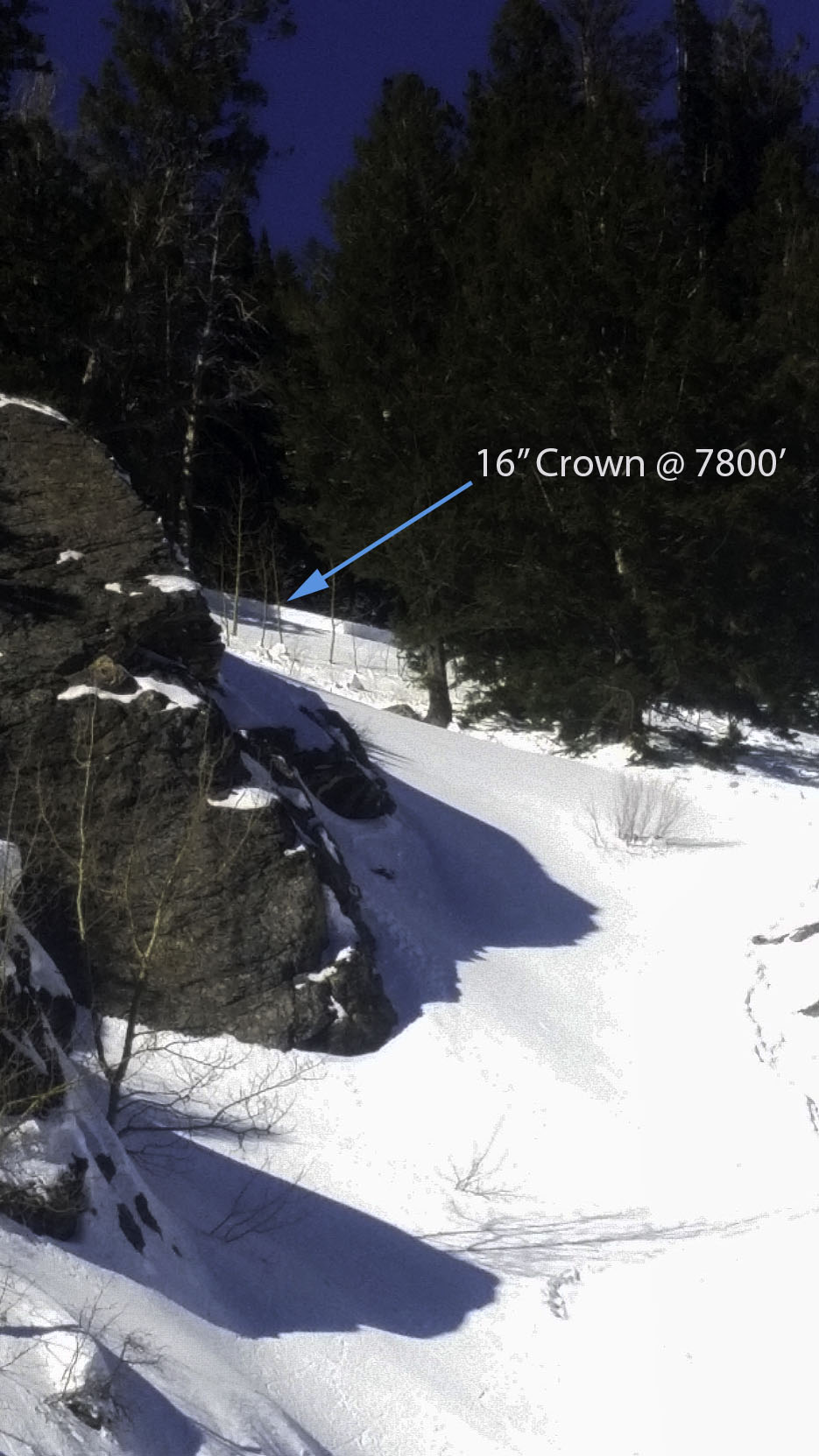
Snow Conditions: Powder, consolidated powder between 10,000′ and 8,000′, wind crust up high-first 400′, sun affected snow down low

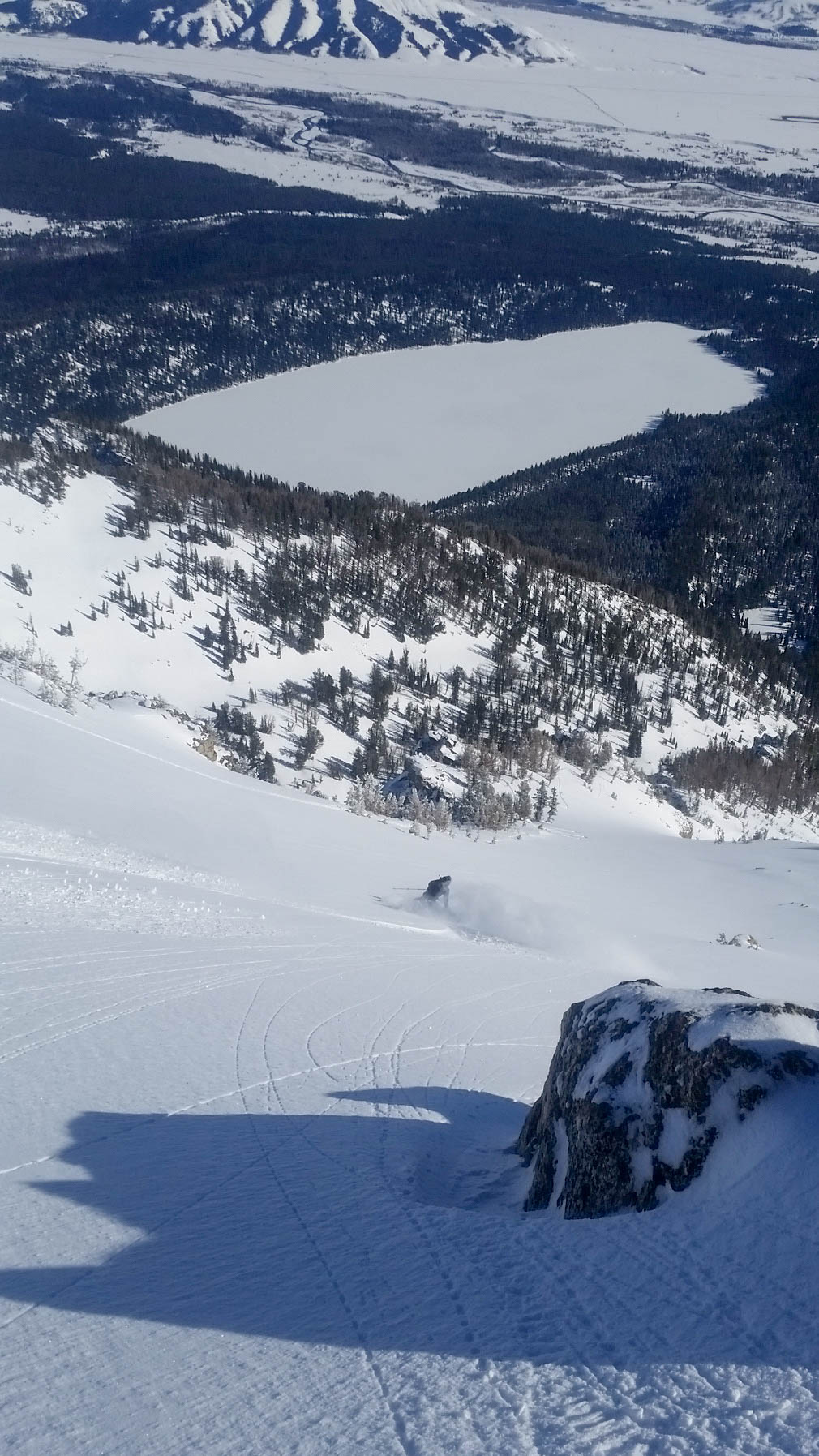
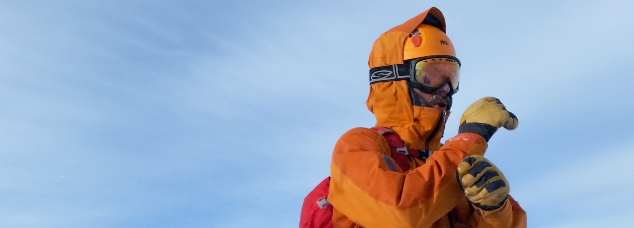
Tuesday night, while tuning some skis at Teton Village Sports–Tristan and I discussed what we should ski the following morning.  There was a chance of some weather blowing in, so we immediately ruled out a few objectives we had been eyeing in the high alpine and decided on skiing something that I was able to accomplish last year.  The Banana Couloir is not quite a couloir, but rather a large gully that runs from the northeastern shoulder of Prospectors Mountain into Open Canyon.  It is fairly steep towards the top, but mellows out near the bottom.  It is a big avalanche path and does have a cliff/waterfall at its precipice, so it is not a run to be taken lightly.

Banana Couloir Vantage
Good view of the entire Banana

The main difficulty with the run is the route finding.  When we skied it last year, we went north on Moose-Wilson Rd, then cut left at a point and broke trail into Open Canyon.  This worked, but I thought that going towards Olive Oil on the normal skin track, then continuing on into the canyon would be a little faster.  I also wanted to test out my navigation capabilities on my new Suunto Traverse.  I mapped out the route to the base of the Banana the night before and was hopeful that it would work.

IMG_2285

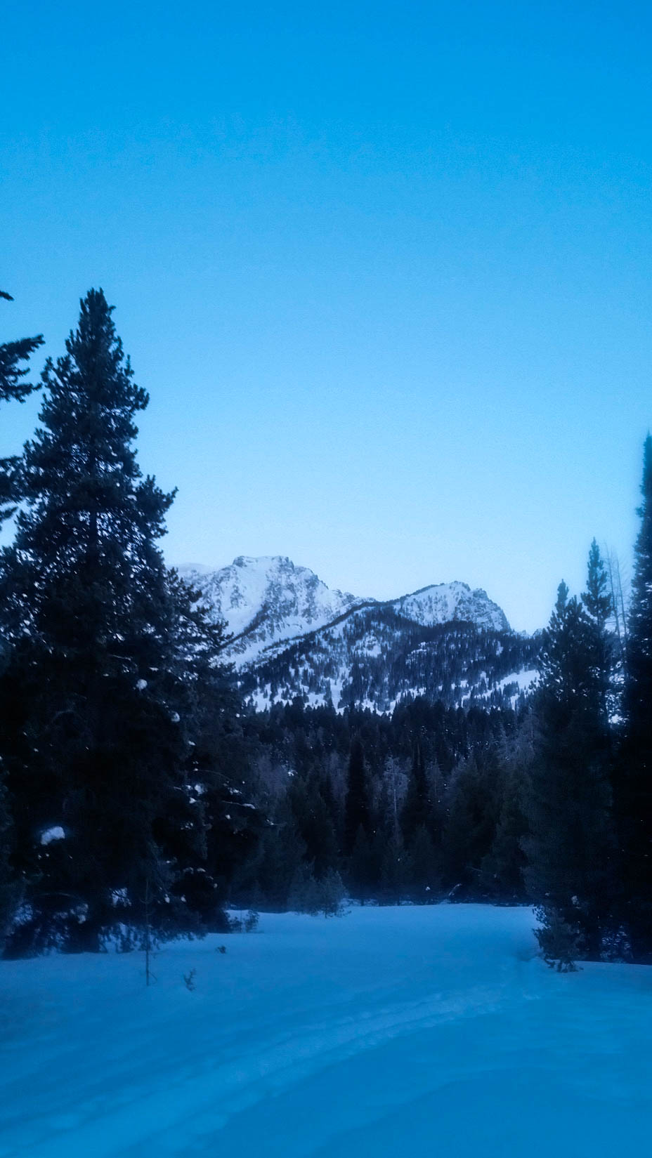
Tristan, Stu and I left the Granite Canyon Trailhead at 7:25am as another group was getting ready a few cars away.  As we passed them, we asked what they were planning on skiing-already pretty sure it was the Banana because of the ice axes.  They confirmed our suspicions, but we were going to have a head start and felt comfortable sharing the line if we had to.

We cruised out on Moose-Wilson Rd., cutting left into the woods about a half-mile from the trailhead.  We followed the track all the way to the northeast ridge of Olive Oil, then continued right (North) into Open Canyon.  We were following an old skin track, but my Suunto said we were on target-so we continued on.  Eventually, we made our way into the canyon and a clearing.  We knew we were a little ways down canyon from the end of the couloir, but decided to take the faded skin track in front of us up for a bit, then cut left and make our way into the Banana.

View of the top of the line from the field.
GPS.  You can see that our uptrack was a bit right of the Banana to start.
GPS. You can see that our uptrack was a bit right of the Banana to start.

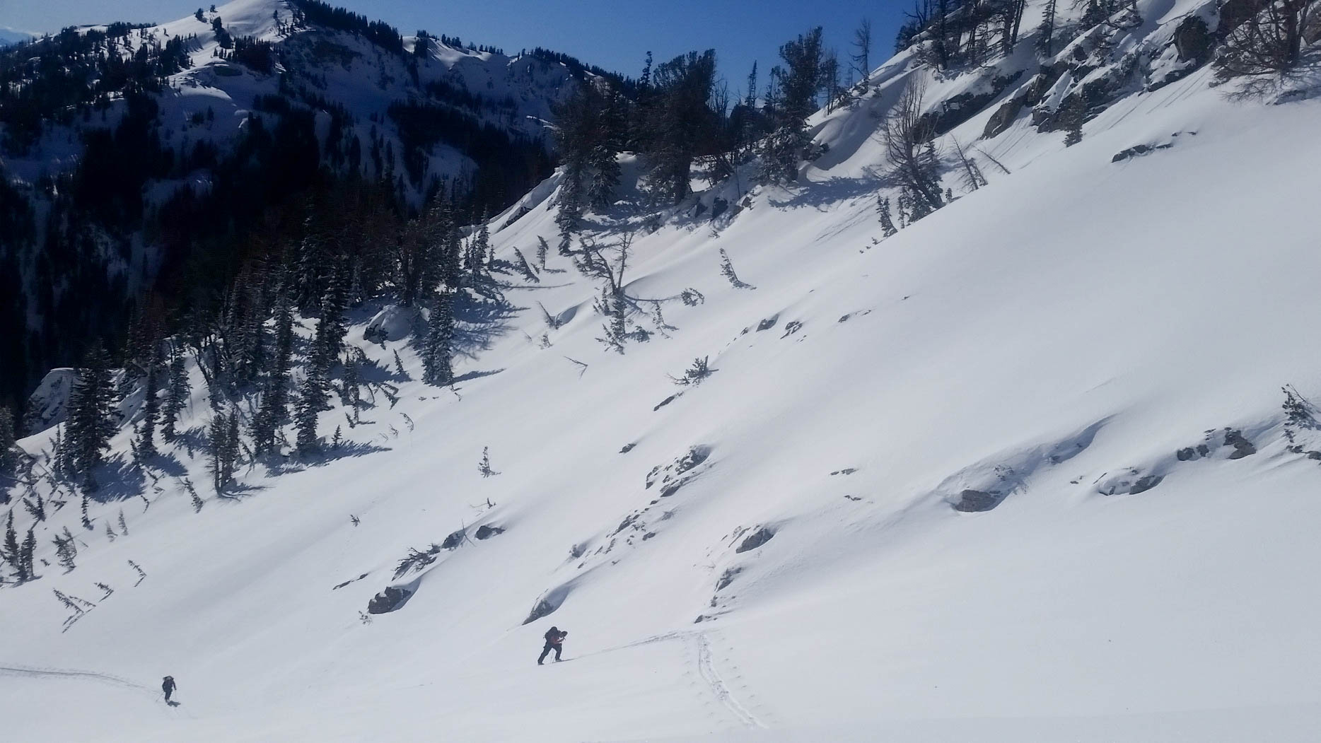
We worked our way up on the track, eventually breaking trail left at 8,600′.  We knew that the “V-Couloir Gully” was pretty nasty and wanted to be below that.  It worked out perfectly and we made our way across that gully and then into the east ridge of the Banana.

Looking down the "V-Couloir Gully"
Looking down the “V-Couloir Gully”

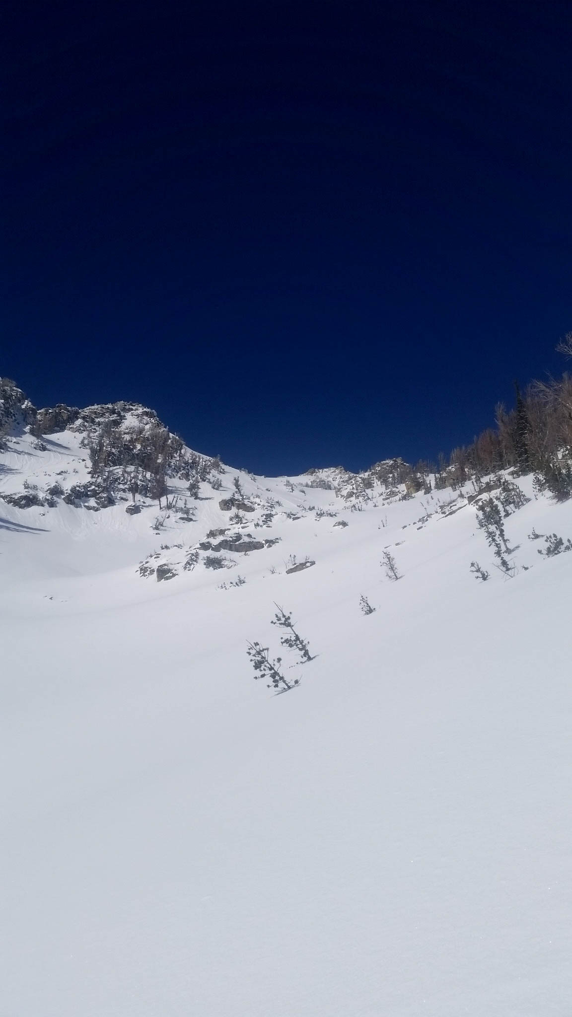
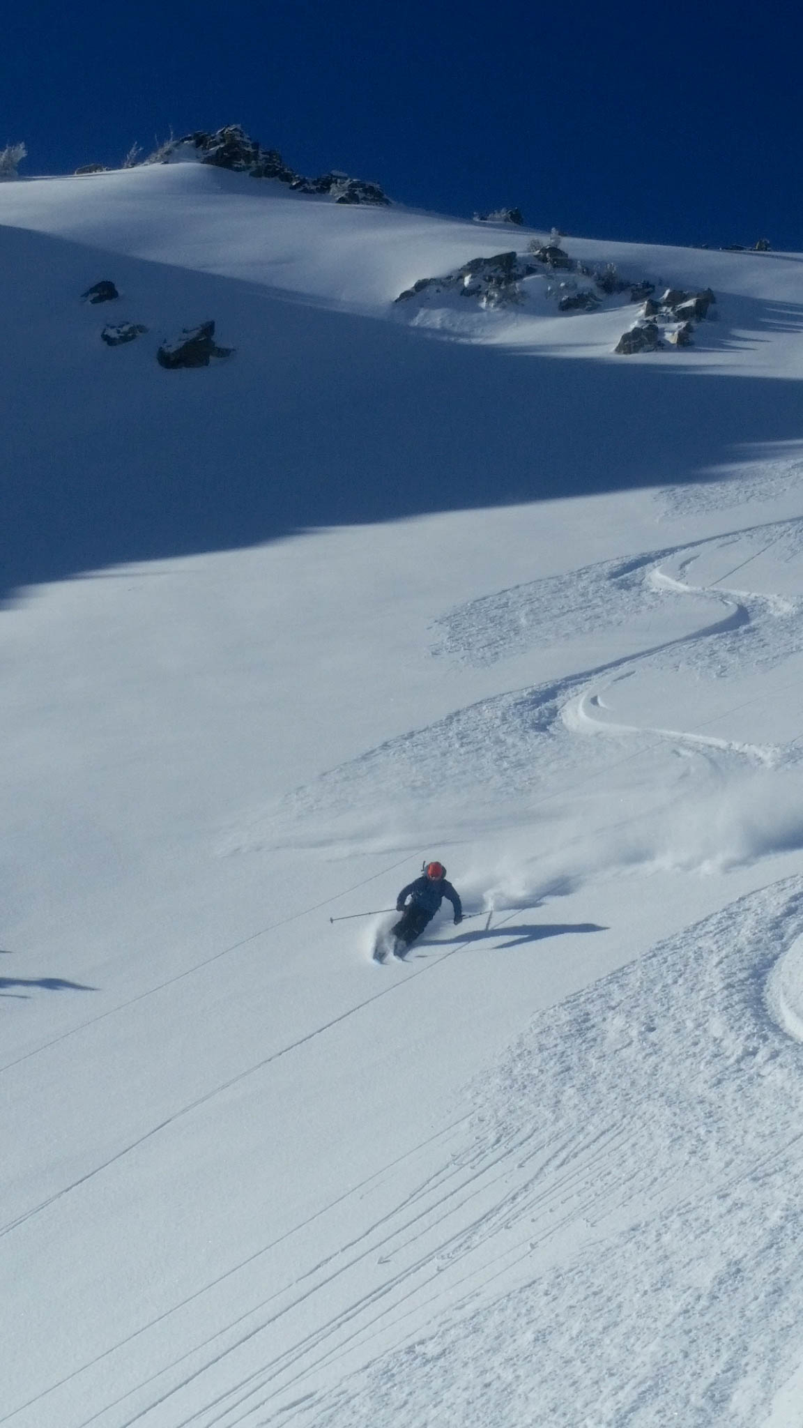
We cruised up the ridge, slipping at times on a sun crust/faceted snow, but making good time.  Towards the top, we bootpacked a steep section-then continued skinning to the upper bowl.  At the bowl, we bootpacked up-eventually reaching a spot near the top, but not actually on the summit (It is part of the Winter Wildlife Closure in the Mt. Hunt area).  We topped out at 5hrs, which was almost 2hrs faster than the last time I skied this line.

IMG_2156 IMG_2162 IMG_2163

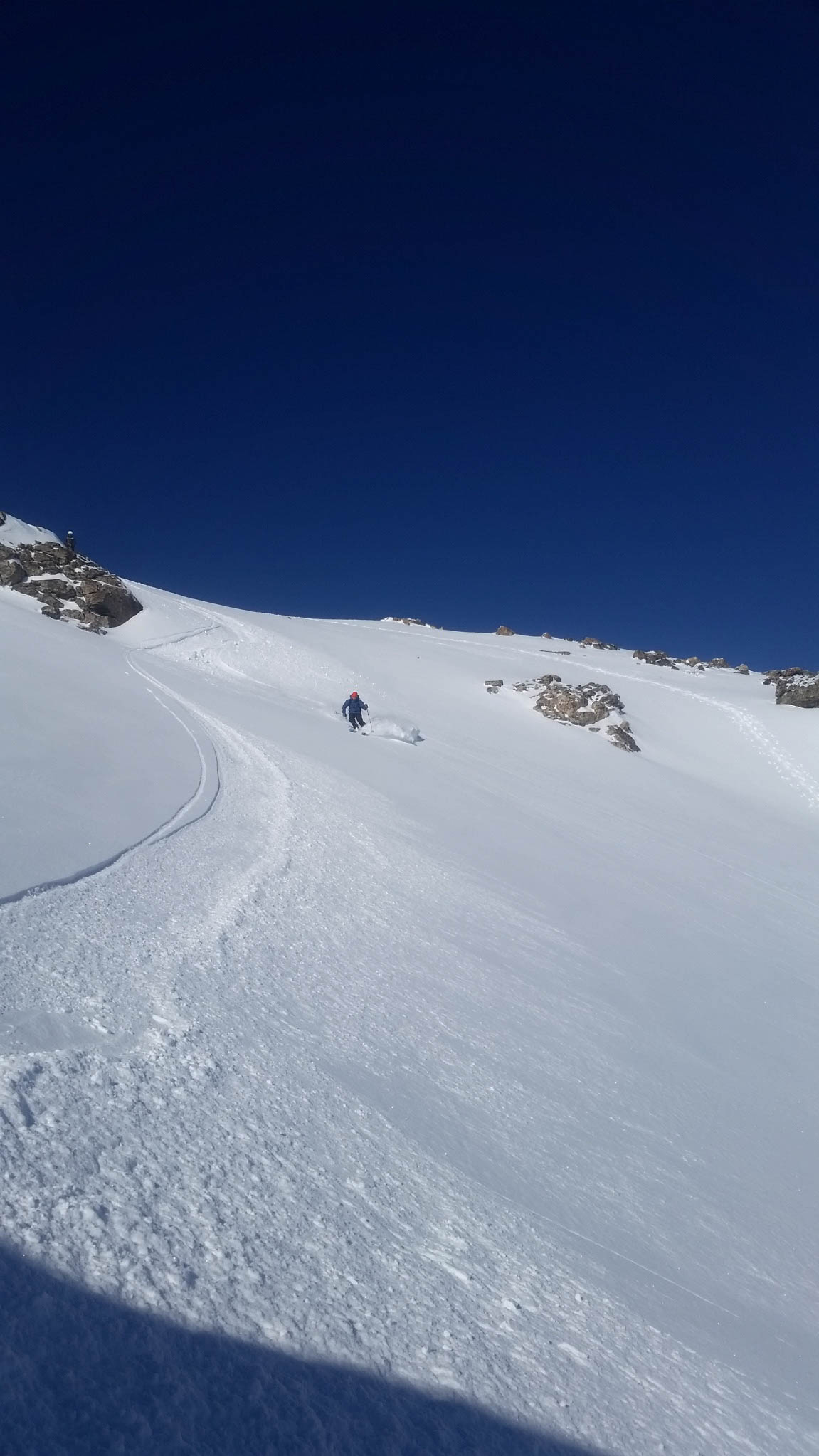
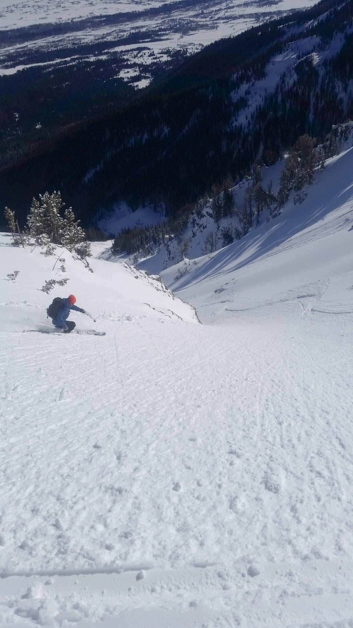
After quickly gearing up, we decided on a plan of attack for the upper portion of the run and gave it a go.  The top 400′ was wind affected and a bit grabby.  It was a little slow going, but still fun snow.  Once off the upper bowl, the snow became consolidated and very fun.  Some people call it “cream cheese snow” and whatever your name is for it, the snow was fun!  We skied down in a few pushes, not wanting to waste the big open run with numerous stops.  The snow near the bottom was a little isothermal in spots, but it was still fun and we made it down to the canyon floor in no time.

IMG_2165

IMG_2169

IMG_2171

IMG_2176

IMG_2178

IMG_2180

IMG_2185

IMG_2201

IMG_2213

IMG_2225

IMG_2227

IMG_2553

IMG_2569

IMG_2235

IMG_2237

IMG_2252

IMG_2258

After making it down to the bottom, we worked our way down canyon until we caught the track back to Olive Oil.  It was a very easy out and we were soon skating back to the truck on Moose-Wilson Rd.  We made it to the trailhead in 6hrs 30min, pleased with the day and conditions.  Once again–another fun day in GTNP schussing around.

FullSizeRender

Keep on Adventuring!

Banana Couloir


Location: GTNP, Prospector Mountain, Open Canyon, Granite Canyon Trailhead
Elevation, Gain/Loss: 11,163’, 5,220’ gain/loss
Distance: 12 miles RT
Difficulty: 4 stars
Time:  7-9 hours

Trip Report:

Date: 1/21/2015
Snow Condition: 10″ of Consolidated Powder with areas of faceted snow and some small pockets of unstable snow at lower elevation.

The Banana Couloir is a ski mountaineering run that many have stared at during the winter months, wondering what it would be like to ski such an aesthetically pleasing line.  I have been guilty of looking up at this East/Southeast facing couloir off Prospector Mountain for years, always wanting to ski it, but not sure how, or when the right time would be.  Well, after some thought the other night, I rallied my brother Dane and friend Close to head up Open Canyon and give it a try.

We left Granite Canyon Trailhead at 7am as the first flicker of daylight began to light up the sky.  We had a pretty solid plan for how to navigate the approach to the base of the couloir, but were unsure if it would translate into success.  After pouring over google earth, I found an old road 1.2 miles down Moose-Wilson Rd. that would take us close to the beginning of Open Canyon without much bushwhacking.  It veers off to the left, before Moose-Wilson Rd. makes a hard right and the pavement begins.  This proved to work, with a skin track taking us into the often overgrown and seldom traveled area to the south of Phelps Lake.

Our first glimpse of Banana Couloir.

With a visual of our objective, we took a left and started breaking trail towards Open Canyon.  The snow was solid because of the low elevation rain event from a few days before, so we cruised up canyon with relative ease.  We came to a ravine at some point and not thinking, dropped into it and crossed the stream.  In hindsight, we should have just stayed on the right side of this gully, because it was the drainage from Open Canyon and we needed to be on the right side of it to start our climb.

Dane crossing a nice snow bridge.

Despite that minor setback, we made it to what we thought was the base of the couloir in just over 2hrs.  Here we stopped for a few minutes to eat and decided how to tackle the initial steep face.

Base of the Banana Couloir. Looks like it would be a waterfall in the summer.

We decided to begin our climb to the lookers left of the “waterfall”, but I think the easiest and safest line up is to the right, through the trees and cliffs.  Upon starting up, we heard numerous whomps as the snow collapsed on a weak layer at about 7600′ in elevation.  This was very concerning to us and we discussed proceeding or not, but decided that the weak layer was only a low elevation (surface hoar) issue.  We continued up cautiously for around 500′, making quick switchbacks on relatively exposed face, maintaining a policy of only one person on the slope at a time.  After a stress filled, painfully slow initial hour of climbing, we seemed to be out of danger, having not heard a whomp for 200′ or so.  The slope got pretty steep and crusted here, so we took off our skis and shouldered them for another 500′ until we reached the top of the steep initial face.  We quickly got back into skin mode and tried to make up some of our lost time as we worked our way up and to the right.  We got our first look at the Banana Couloir from up close not long after and were a little concerned at its size and the distance we still had to cover before reaching the top.  We worked our way up the left side of the massive couloir for around 500′, before crossing the couloir to the safer, less exposed right ridge.

Working our way up and across the Banana Couloir.
Looking up the couloir, about 2000' from the top.
Looking up the couloir, about 2000′ from the top.
Working our way up the ridge.

After gaining the ridge, we proceeded up at a frustrating slow pace due to the slick snow conditions and a few points where we had to take off our skis to get over some rock outcroppings.  We struggled up, eventually coming to a steep, exposed section that we had to quickly bootpack through.  After making it through this pinch in the couloir, we could see the summit, but we a little unsure if we would get to the top.  The sun was warming the snow a little faster then we would have liked and none of us felt like going for a 3500′ ride down the couloir in an avalanche.  We set a turn around time of 1:30pm and decided to push for the top at full speed.  We skinned our way up the mellow upper “bowl” for a bit, but had to switch over to bootpacking about 800′ from the top.  The snow was surprisingly stable, but after our experience down low, we were all a little nervous to be on the upper face, exposed to avalanches.

Bootpacking up the final face.

We made great time up the face, making it to the summit just past 1pm, but were all aware that now we had to make it down this large avalanche path safely.  We took a few pictures, admired the entry into the “V Notch Couloir” and quickly geared up for the ski.

View to the North.
View to the North.
Scary entry into the "V Couloir"
Scary entry into the “V Notch Couloir”…it doesn’t ski through

I made two big ski cuts on the rollover with Dane and Close watching, but when nothing budged we cautiously skied the upper section – gaining confidence in the snow with each turn.  The skiing was unreal – fun/bouncy/playful powder with areas of deeper snow on the northeast facing right wall.  We worked our way all the way down in several sections, having a blast and hooting all the way to the last pitch.

First turns from the top.
Dane, harvesting the Banana.
Close making turns towards the top.
Fun turns down the huge couloir.
More powder!
More powder!
Dane, entering the steep middle section.
A look up the Banana Couloir from around 9500'.
A look up the Banana Couloir from around 9500′.
Dane, milking the turns
Close, skiing the lower gut.
A view up from above the last pitch.  What an amazing run.
A view up from above the last pitch. What an amazing run.

We approached the lower face from skiers left of the waterfall and cautiously made our way down, all to aware of the potential instability the snowpack displayed earlier.  We made it down to a cliffband about 200′ from the bottom of the canyon.  There were two possible ski throughs and I chose a less exposed ski to the left.  I made it down and gave a hoot, signally the next skier should come down to me.  All of a sudden, Dane yelled, “Avalanche!”.  I moved behind a tree and as I did, looked up and could see snow beginning to flow over the cliff.  It didn’t look huge, but saw large blocks of snow from what appeared to be a hard slab rolling over the cliff for what seemed like minutes.  When the snow stopped, I could hear someone yelling from below the cliff (to my left) and nothing from above where Dane and Close had just been.  I called for Dane again and thankfully heard him yell, “I’m safe, but Close got taken down below!”.  I raced down to the debris pile at the bottom of the cliff band and as I approached, saw Close’s pole.  My mind was racing, but was going for my transceiver to search for Close when I heard something from above.  It was Brian, he had been pulled over a small cliff and thankfully found some way to stop himself from being dragged over the much larger cliff edge a few feet in front of him.  He said he was missing his ski and pole, but he was ok.  I looked around in the debris pile for a bit and luckily found his ski half buried, but intact.

Brian making his way down to his ski, very luck to be safe.

Dane gingerly made his way down after Close had retrieved his ski and we collectively let out a sigh of relief.  We knew the snowpack at the lower elevation had some weaknesses, but thought we could mitigate them.  We were wrong, but thankfully we all made it out safe.

The crown of the pocket that ripped out about 50' from where Close made a turn (He was the third one to come down).
The crown of the pocket that ripped out about 50′ from where Close made a turn (He was the third one to come down).

We traversed around to the right (south), keeping high and trying to make it around the lower flanks of Olive Oil and find a skin track out.  Eventually we found a fast one all the way out to Moose-Wilson Rd. and pushed our way back to the truck in 8hrs.  It was a great day, but very easily could have been a tragic one.