Tag Archives: Death Canyon

Apocalypse Couloir

Location: GTNP, Death Canyon, Prospector Mountain
Elevation: 10,104′, 5,049′ gain/loss
Distance: 13 miles RT
Difficulty: 4 stars
Time: 6-8 hours

Trip Report:

Date: 12/31/2015
Snow Conditions: Packed powder, caulk, breakable crust, loose sluff

After being told I could either have New Years Eve off or I could come in and shovel snow off a metal roof in sub degree temperatures I decided for the former and a ski tour. Zach Simon was quick to get back to my text with some ‘solid beta’ on Apocalypse and after thinking about it for a while I was in. Apocalypse is a very committing ski line and it is not something to take lightly. With the current state of these persistent weak layers lingering throughout our snow pack, I am cautiously deciding on the next ski line. But with the information that Zach had received and the knowledge of the area I felt the snow was safe in there and we would be able to manage the terrain. Zach had already had Tanner on board and with the call from me that afternoon the plan was set.

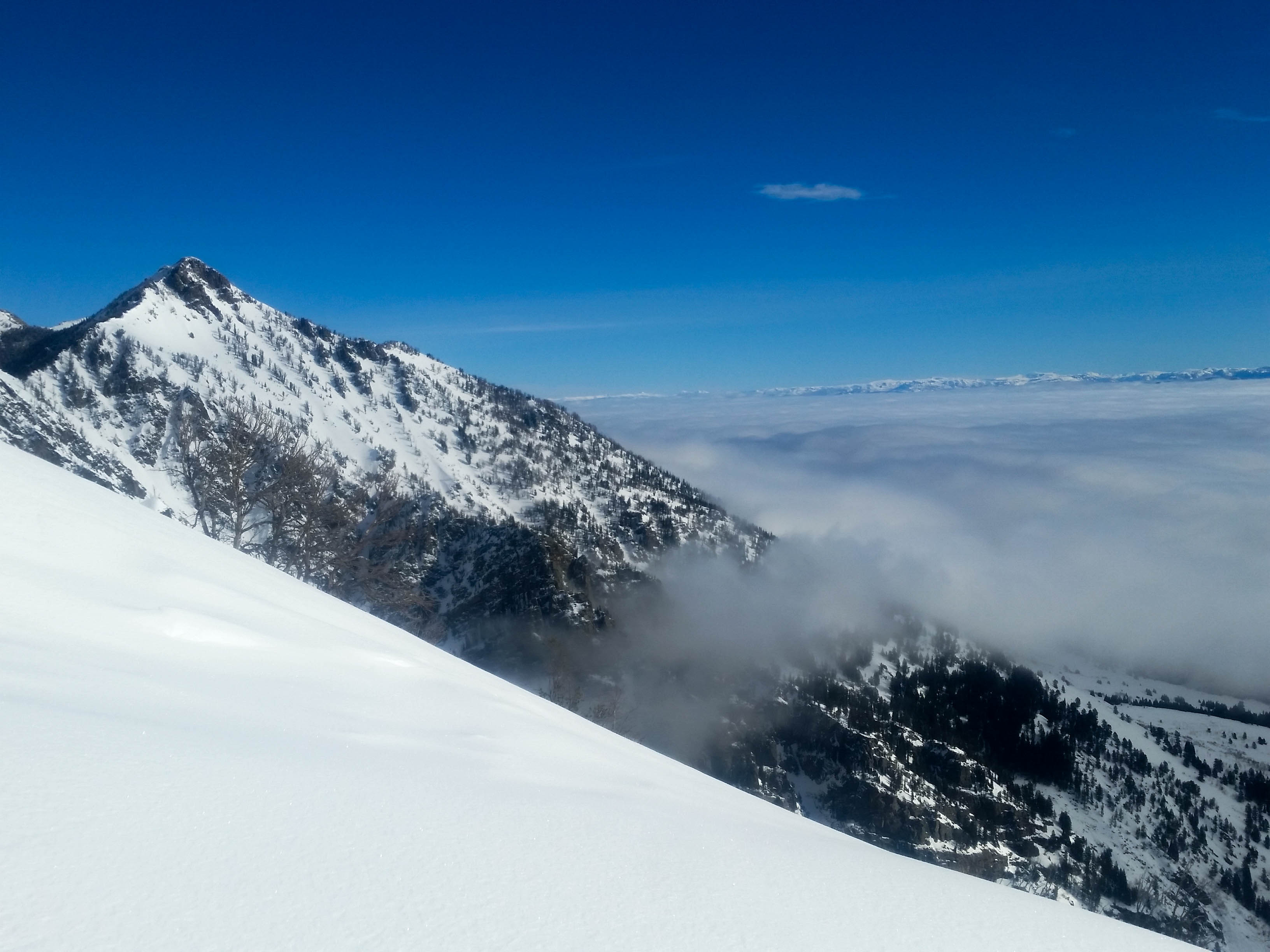
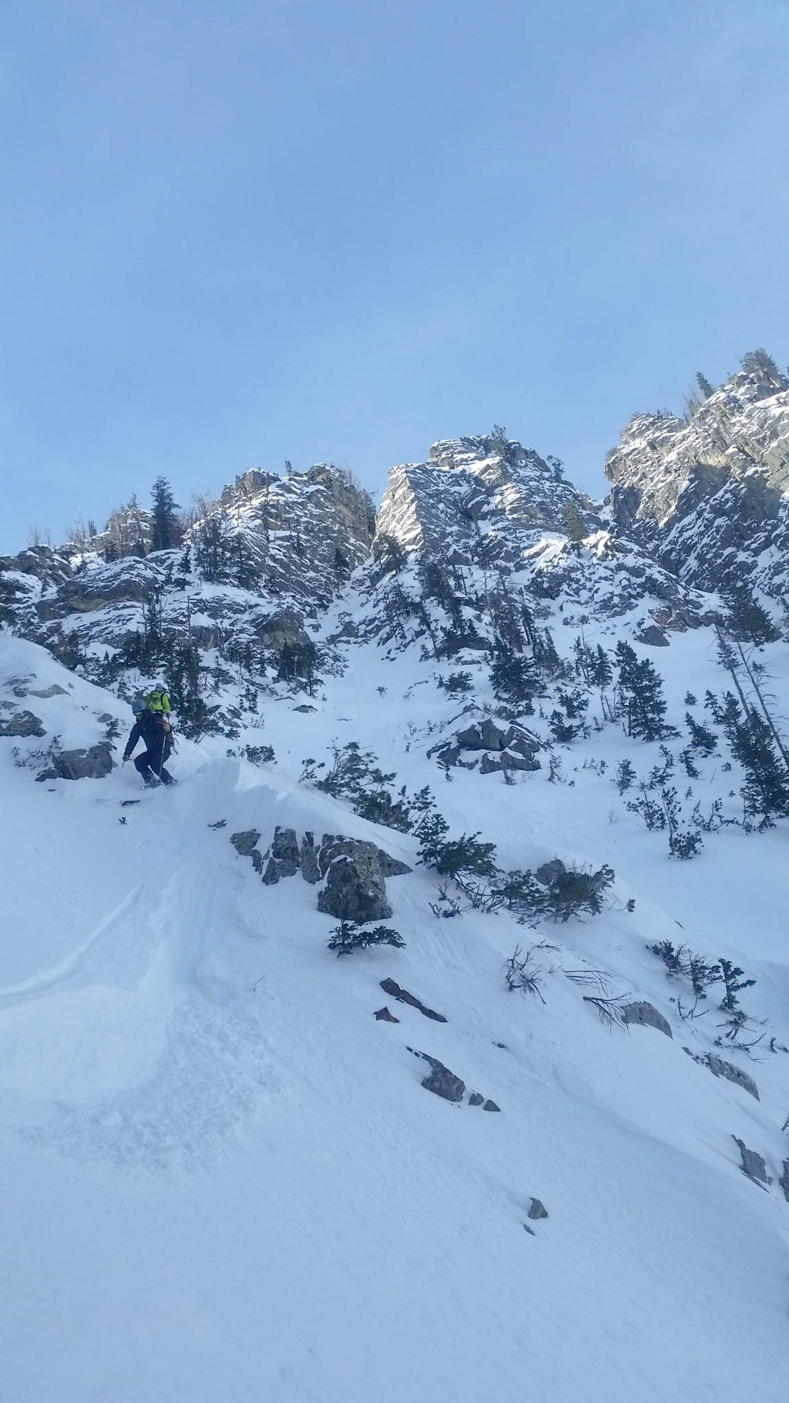
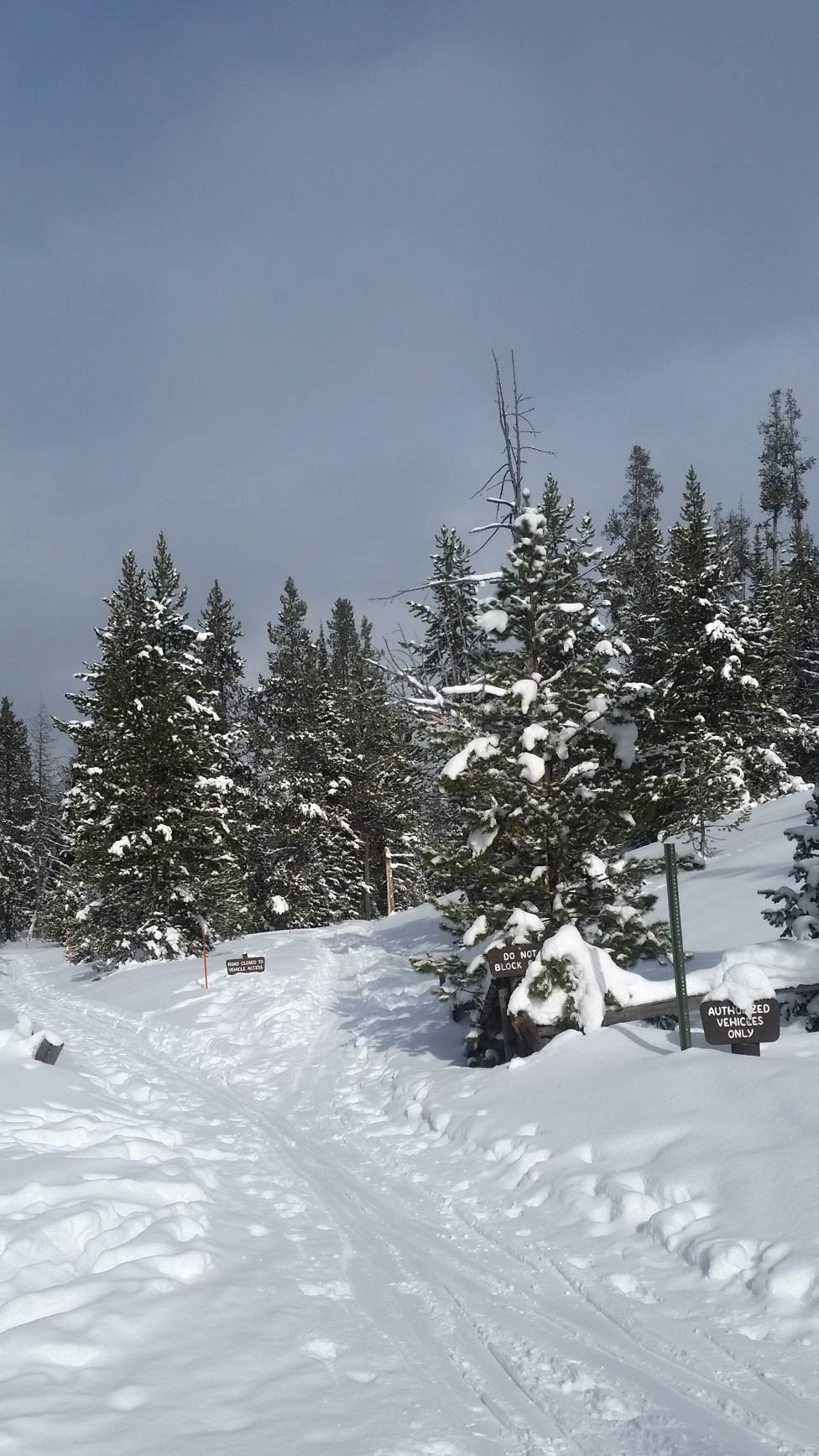
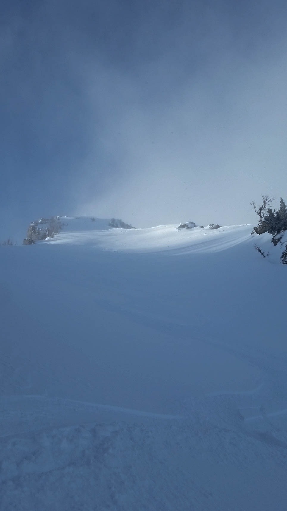
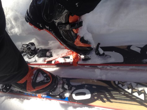
We got to Death Canyon parking lot an hour before sunrise and the temperature read -21 degrees. Cold! After leaving at 7 am, we were soon warm enough and cruising up towards the Phelps Lake overlook. Took the skins off and after a quick ski we were down at the base of the canyon and back into the arctic cold. By the time we put our skins back on, Zach and mine had lost their stick and we were struggling with them the rest of the skin up! A recommendation: put your skins in your jacket to keep them warm when transitioning!

IMG_9569
First light on the Four Horsemen and Death Canyon
IMG_9573
Sunshine!
IMG_9577
Ski strap under the boot worked out alright!

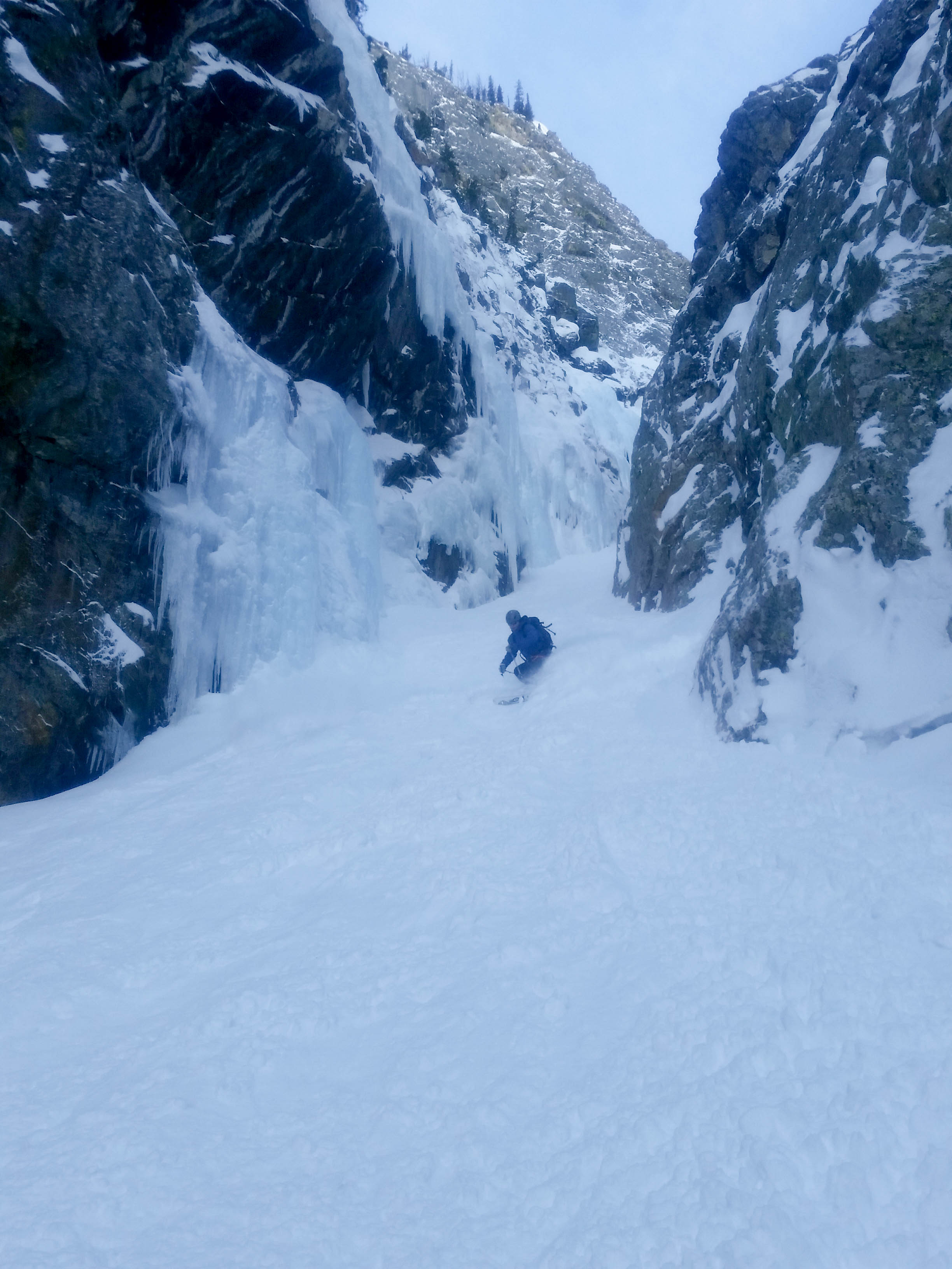
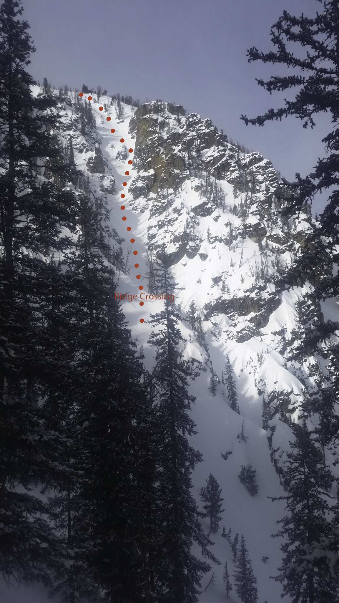
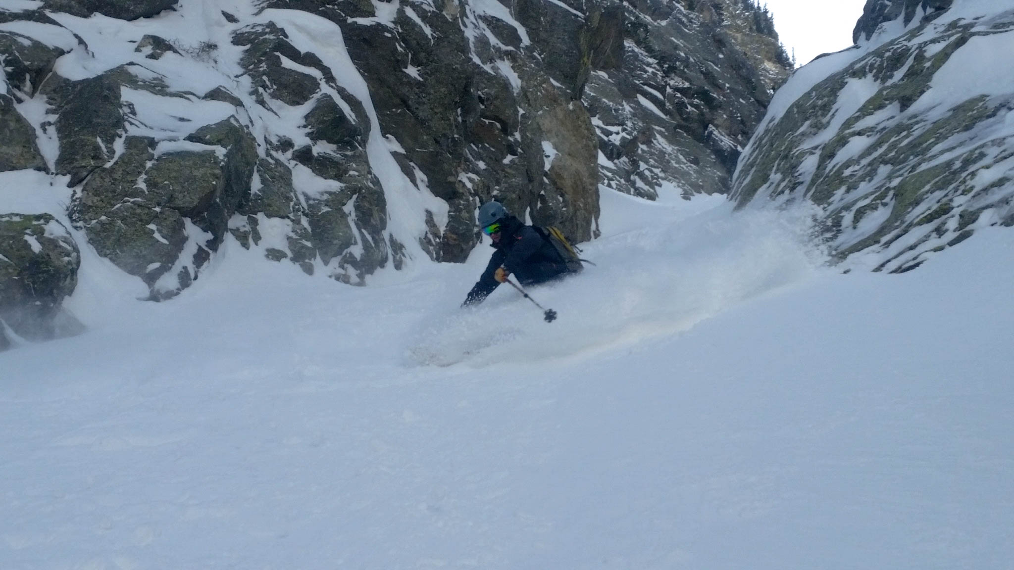
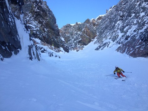
It took us four hours from the truck to reach the top of the couloir. The air was crisp and the sun was warm. It was nice to have a skin track already set which made all the extra weight a little more bearable. With a slow transition into rappel mode we geared up and were soon dropping into the cold and ominous Apocalypse Couloir. We brought up two ropes, one 60m, one 70m, both 8mm Dry Coat. It really helped expedite the rappels and made for two double raps up high and one on the exit through the ice bulge area.

Zach dropping in!
Zach dropping in!
Tanner making his way down
V-Notch looking pretty nice!
Tanner on the second rap
Zach starting us off

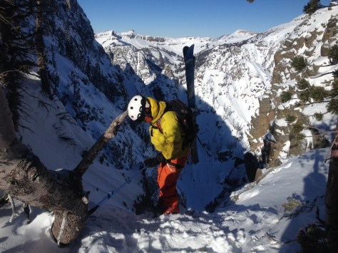
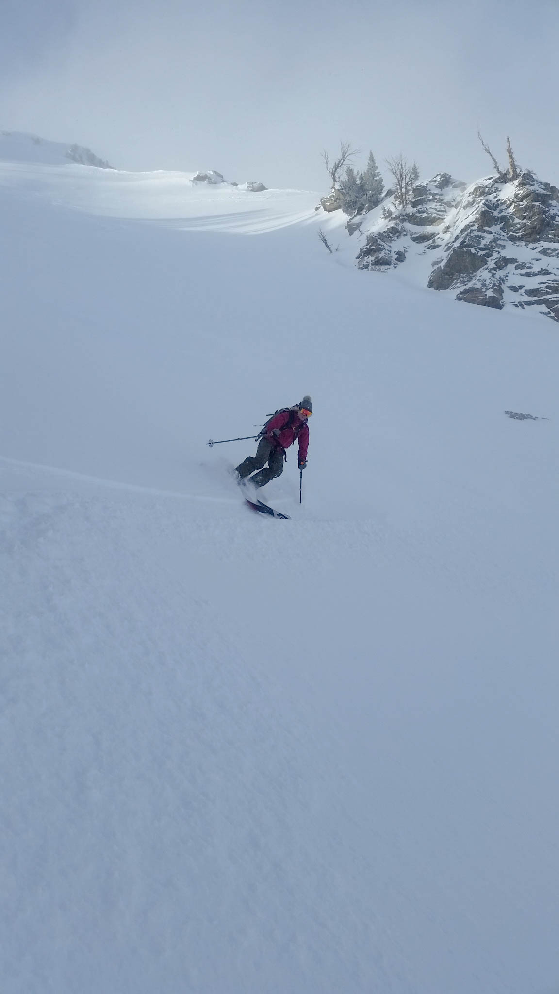
The snow was pretty good in there. There was a variety of snow: some hard packed caulk, mostly old bed surfaces where it had flushed out on, there was some soft newly deposited cold smoke and there was some wind packed breakable crust that made things interesting. All in all it was skiable, but somewhat slowly caution skiing was in store. With the early season snow, everything felt tight, compacted and the skiing was steep!

Top portion
Top portion
Into the rabbit hole we go
IMG_9669
Zach making his way down the elevator shaft
IMG_9685
Tanner at the end of the elevator
Rappelling through the ice

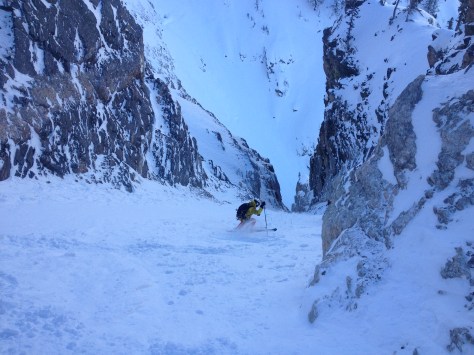
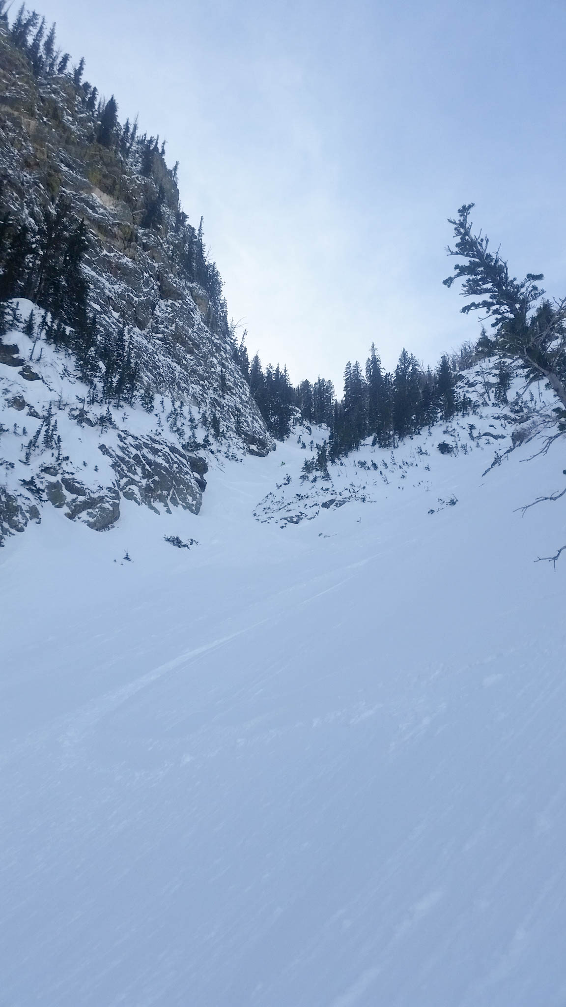
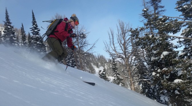
We opted for a double 60m rap on the exit to speed things up a bit. It worked out great and we’re back skiing in no time. There was a v-thread about 30m down if you opted for a two rap out. The skiing on the exit was great and the apron opened up with some solid powder turns all the way down to the steam.

All in all, it took us 8 hours from car to car. I think we could have done it faster without the frozen skins, but it was a solid day out skiing one to the more enjoyable and exciting lines the park has to offer.

Mayan Apocalypse

Location: GTNP, Death Canyon, Prospector Mountain, Mayan Apocalypse
Elevation, Gain/Loss: 10,491’, 5,351’ gain/loss
Distance: 12 miles RT
Difficulty: 4 stars
Time:  7-9 hours

Trip Report:

Date: 02/24/2015
Snow Conditions: Packed powder, powder, sun crust, wind crust.  A strong northerly wind over the past few days created variable conditions on this north facing slope.

After a great day skiing off the South Teton Monday, Dane and I decided to head back to the park Tuesday and tackle a couloir we had heard a lot about this year.  The “Mayan Apocalypse” is a north facing shot up Death Canyon a little past the patrol cabin.  With northerly aspects skiing great the day before, we decided it was a worthy objective for the day.  We left the Death Canyon trailhead around 8:30am and worked our way along the track at a brisk pace.  After skiing down from Phelps Lake Overlook, we were quickly back skinning below the apron of the Apocalypse Couloir and into Death Canyon.  We got to the patrol cabin in around 2hrs and took a little break to take in the views.  Death Canyon offers enough ski runs for an entire season and we were pretty excited about the potential the zone offered.  After the break, we worked our way up canyon (to the left) and found ourselves staring at the access to Rimrock Lake.  There, directly to the left is the “Mayan Apocalypse”.  It is hidden by a steep treed slope and a rocky chute that is in effect the couloirs drainage.  We worked our way up around the impassable bulge of rock and eventually were looking at a tight gully above the rocky chute.  We transferred over to boot pack mode and made our way into a large opening directly below the couloir proper.  We worked our way up the steep couloir, noticing some soft avalanche debris in spots and firm crust where the slide had washed the snow out of the couloir.  We came to the middle of the couloir, initially thinking this was the end, only to find that a much steeper portion of the couloir was still waiting for us.  We worked our way up and to the right, finding some very firm, steep sections of climbing along the way.  We eventually came to the end of the climbing on a very steep (50 degree) slope, just below a few cornices.  We gently kicked out a step for our skis and got geared up.  The top portion was very fun on the left side, where the wind had deposited a good amount of snow.  Once into the upper middle section, the snow became firm and each turn was pretty spicy, but we made it through some rocks and into the lower section without issue.  Here, the slide had washed out half the couloir, but the half with soft snow remaining was very fun.  We also found the debris piles to be very soft and fun to surf on for a turn or two.  We made it out of the couloir proper and found some fun turns on the upper apron before the couloir pinched into the gully leading to the rocky chute.  We made a few turns in the gully, then exited to our left and found some soft powder turns to the traverse out of Death Canyon.  We quickly worked our way back to the truck in just over 7hrs 30min and were pleased with the adventure and the gnarly couloir we had just skied.

Apocalypse Couloir

Location: GTNP, Death Canyon, Prospector Mountain
Tags: Backcountry Skiing, Skiing, Ski Mountaineering
Elevation: 10,104′, 5,049′ gain/loss
Distance: 9 miles RT
Difficulty: 4 stars
Time: 6-8 hours

Trip Report:

Date: 2/11/2015
Snow Conditions: 7″ of dense powder, stable with pockets of deeper snow.  Fast moving sluff, but no area of concern.

After a decent storm dropped around 2 feet of snow in the mountains a week ago, we decided it was time to get out and do some exploring.  With warm temperatures and sunny days following the storm, the northern aspects were the only areas holding some quality snow.  After some discussion, we decided on the Apocalypse Couloir.  I skied this last year in awful conditions, so was hopeful that we would find some couloir powder.  Dane, Tristan, Darren and I met at 6am in town and made our way out to the Death Canyon Trailhead.  We left the car a little before 7am and worked our way along the track.

Working our way to the Prospectors Mountain.
Working our way to Prospector Mountain.

We followed the same route up to Apocalypse Couloir that you do to Son of Apocalypse, only you proceed another 700 vertical feet or so up along the southern ridge.  Just to the left of the termination of the ridge is the entrance to the Apocalypse.

Dane working his way up the ridge.  Slightly left of the high point is the entry point to Apocalypse.
Dane working his way up the ridge above Son of Apocalypse. Slightly left of the high point is the entry point to the Apocalypse Couloir.
A cloud layer enveloping the valley, with Albright Peak to the left.

There is one large tree to the left of the entrance that the cordelette is to tied around.  The two times I have skied this line, I had to dig around for it in the snow, but it is there.  It is purple and does not show any sign of wear.  As always, I would recommend bringing along some extra webbing, cordelette and a few nuts for this adventure.  We geared up in our harnesses and soaked in the last of the sunshine before descending into the dark gully.

The "V Notch Couloir".
The “V Notch Couloir” to the South.
Getting ready in the sun.
Looking into the upper section of Apocalypse.  A few rappels are necessary to get into the skiable park of the couloir.
Looking into the upper section of Apocalypse. A few rappels are necessary to get into the skiable portion of the couloir.

We rappelled off the top anchor and found a decent anchor about 20m down on the lookers right.  It consisted of 4 nuts with some webbing.  We had to make some adjustments to the anchor to balance it, but felt good about it after and worked our way down from there.  After the second rappel, we were 6m short of some purple anchors down on the lookers left (we used a 60m rope).  Here, we all should have just downclimbed in the steep snow to the last anchor, but instead everyone but myself put their skis on and sideslipped over some rocks to the anchor.

Darren rappelling off the top anchor.
Dane rappelling off the second anchor, working his way over a bulge.
Tristen, stoked for the adventure.
Tristan, stoked for the adventure.

Last year, you could just slip your way down into the skiable portion of the couloir from here, but this year there was a 6ft drop with a small rock ledge below preventing that.  It was very tight at this point, barely a ski length and getting the skis straight to make the jump seemed a bit risky to me.  Tristan and Darren decided that they felt comfortable with the risk and gave the drop a go, each landing in soft snow and making a hard right turn to get in a safe spot.  Dane and I rappelled the section, quickly coiling the rope and getting ready for the skiing.  We encountered what I call “rope time” during our rappels.  When time seems to slow because of your focus, but in reality everything is taking an exorbitant amount of time.  We were all getting pretty cold standing around in the shade and were pumped to get moving.  We skied the large, mellow first pitch tentatively, checking the stability of the snow before it drops into the “elevator shaft”.  The snow was stable, soft and fun to our surprise and delight!

Dane making some powder turns in the upper portion of the couloir.

Before the steep rollover, we regrouped and quickly made our way down the 50 degree slope.

Tristen, working his way down the steepest portion of the run.
Tristan, working his way down the steepest portion of the run.
Steep and Deep.
Steep and Deep.

From here, we skied across the “main” gully of the couloir, below the Four Horsemen and took a look down into the narrows.  We couldn’t see the ice bulge (pinch) of the run from this vantage point, but were all hopeful we had had the correct beta that it was filled in and skiable.  We skied down to the pinch to inspect the ice bulge.

Working our way down to the crux of the run.

Standing above the bulge, we could see that it was indeed skiable.  It was at most a ski length at its tightest point, but with a little side slip we could make it through.  I “skied” down through it first, marveling at the beauty of this special spot in the park, but aware that we needed to move fast.  A runnel had formed from all our sluff, which made it even more difficult to navigate the crux, but with some careful work, I made it through, into the tight lower section of the couloir.

Trist, making his way into the crux.
Tristen slashing the couloir powder as he exits the crux.
Slashing couloir powder is fun!
What a couloir!
Icicles for day.!
The fun lower section of the run.

Everyone made it through the ice bulge safely and quickly.  The difficult part of the run was over, so we skied the lower section out to the apron of the couloir.  We did this “Canadian Style” and were sitting at the base of the couloir a few minutes later, elated to have skied such a great run.

Apocalypse Couloir apron.

We quickly made our way out of Death Canyon and enjoyed a few snacks and laughs in the sun before skinning up the Phelps Lake Overlook.  We made a fast exit to the truck, arriving in just over 7hrs.  It was a great day and even more special because our good friend Darren Johnson had come down from Big Sky, MT to join us on the adventure.  Hopefully he sees the light soon and makes the move to Jackson.

Darren, aka @yellowstoneclubturd

Son of Apocalypse

2015-01-17 13.37.39

Location: GTNP, Death Canyon, Prospector Mountain
Tags: Backcountry Skiing, Skiing, Ski Mountaineering
Elevation: 9,413′, 4,262′ gain/loss
Distance: 8 miles RT
Difficulty: 4 stars
Time: 5-6 hours

Trip Report:

Date: 1/17/2015
Snow Conditions: 10″ of consolidated powder, stable with pockets of deeper snow

With around 10″ of snow and more on the way: Chase, Tim and I decided to venture into GTNP during a weather window to try and tackle Son of Apocalypse.  It is one of many north facing couloirs off Prospector Mountain that end up in Death Canyon.  We left town around 8:15am, delighted by the amazing weather and great visibility.  We were moving from the Death Canyon parking area at 9am and made some good time up to Phelps Overlook.  Here, we took off our skins and traversed right (south), following the summer trail until we crossed onto the large field to the west of Phelps Lake.

Field to the west of Phelps Lake.

We made a few fun turns down the field and then straight-lined it for the far end of the field and the snow covered bridge towards the south west of the field.  We transitioned back to skin mode and started moving up and to the right – onto a flank of Prospector Mountain.  In the past, I have gone across the south west corner of Phelps Lake and started skinning up the obvious avalanche path, but we decided to try a different path considering we were going to be breaking trail regardless.

The far avalanche path is the "normal" starting point of the skin.
The far avalanche path is the “normal” starting point of the skin.

We worked our way up, through some tight growth and eventually found ourselves lookers right of the avalanche path and the “normal” skin up.  We crossed the path and continued up the ridge, finding a faint skin track from a few days earlier.  The up was fairly easy and we soon found ourselves on the ridge that eventually leads to the Son of Apocalypse.  We found the little depression in the ridge we were looking for around 4hrs from leaving the truck.  While waiting for the group, I scoped out an alternative entry to the couloir that would provide a lot more spice, but looked doable if the conditions were right.

Alternative entry couloir into Son of Apocalypse.

We changed over to ski mode and made some quick assessments of the snowpack.  It seemed stable, with no areas of concern and we decided on a few ski cuts to test our theory.  This provided no movement, so we proceeded on with cautious optimism.

Tim skiing pow down the first pitch.

The snow proved to be very fun and deep, with minimal sluff or crust.  We cruised down the first pitch and then got into the heart of the couloir, with large rock walls and numerous hanging snow fields rising from each side.

Tim, skiing down the second pitch.
Tim, skiing in the distance down the second pitch.
More couloir powder turns please.

We made our way down the massive couloir, each having a blast and amazed at the amount of snow in the couloir.  We were unsure if the rock band in the middle of the couloir had filled in, but were confident that we could either air/down climb it if necessary.  So with a little trepidation, we reached the crux and found that it has filled in enough to pick our way through it.

Chase and Tim above the crux of the ski.

From here, the couloir eventually pinched into a fairly tight choke toward the bottom of the run, before opening up to the exit apron.  We skied down to the pinch and passed through without incident.

Looking down to the pinch.
Chase, looking nothing like a Colorado skier.
Chase, looking nothing like a Colorado skier coming out of the pinch.

We skied the apron down for a bit and had a look up to Apocalypse Couloir to see if the ice bulge was filled in.  We couldn’t determine if it was, but could tell that if it was skiable, it must be about a ski length wide at most.

Exit of Apocalypse Couloir.

From here, we crossed the stream and found the summer trail out of Death Canyon, which proved to be quite fast (up on the north side of the canyon).  We eventually put our skins back on and made our way across the field from earlier and up to Phelps Overlook.  We took one last look at Prospector Mountain and Death Canyon before turning our backs on the zone and making our way back to the truck.

Son of Apocalypse.
Son of Apocalypse.

The traverse/ski back was fairly fast, with us arriving at the truck in 5hrs 40min.  We felt pretty lucky to have skied a couloir like that in deep snow and even more fortunate that the snow was completely stable.  We knew that days like this were few and far between in the Tetons and soaked in the joy as we made the drive back to town.

Albright Peak

2015-01-03 15.25.06-30

Location: GTNP, Death Canyon, Albright Peak
Tags: Backcountry Skiing, Skiing
Elevation: 10,236′, 4,065′ gain/loss
Distance: 7 miles RT
Difficulty: 3 stars
Time: 4-5 hours

Trip Report:

Date: 1/3/2015
Snow Conditions: 8″ of bouncy powder with a playful sun/wind crust underneath (barely noticeable).  North facing pockets of deep powder.

After recovering from the holiday season, Zelie and I decided to venture into the park for a mellow skin up Albright Peak to see what the conditions were like in the park.  We made it to Death Canyon parking area at around 10:30am and were moving shortly after.  We made our way up the road until the fork for Death Canyon/Mavericks and made our way left to our destination.

The fork: Death Canyon (Whimpy's, Albright, Stewarts Draw) left, Mavericks right.
The fork: Death Canyon (Whimpy’s, Albright, Stewarts Draw) far left (out of frame), Mavericks far right.

We continued past the summer trailhead and made our way onto the Valley Trail until the skin track forked right and into the open field below Wimpy’s Knob that signals the start of the climb. For some reason, this is one of my least favorite skin tracks in GTNP.  It seems to always be set in the most asinine manner; usually steep with numerous switchbacks – but most importantly, it gets a good amount of sun and is always a bit slick.  So, with this in the back of my mind, we worked our way through the field and began our climb.  It was not as bad as usual, but it was not ideal.  We worked our way up for around 1.5hrs and eventually came to the final slope that leads to the top of Wimpy’s Knob.  Here, we began left about 300′ from the summit of Wimpy’s.  We crossed through some trees and above some rock outcroppings, eventually coming to the ridge that connects Wimpy’s to Albright.  We continued along the ridge until the East face of Albright was above us to our right and we needed to cross the slope to get to the south ridge and the normal boot pack up the 300′ top portion of the face.  Here, the wind had created a thick crust, which made the skinning tough, but we made it across to the south ridge and had a decision to make.  The face looked like it had slid during the past storm cycle and was riddled with wind whales.  It looked like the skiing from the top would be mediocre at best, so we opted to just ski from the ridge, about 300′ below the summit.  We geared up and ripped the gut of Albright Peak, working our way down and to the right below some large rocks.

Zelie, making some powder turns down the first section of Albright's East face.
Zelie, making some powder turns down the first section of Albright’s East face.
The upper portion of Albright.

We worked our way down and to the right below a rock band, finding some amazing snow on north facing aspects, until we had to ski hard right to avoid the choke towards the bottom of the face.  Here, we found ourselves with an untouched canvas of powder on the lower faces of Albright.

Powder time, excellent!

We milked the powder all the way to the bottom, linking some fun turns together on the mellow lower face.  At the bottom, we worked our way left – eventually finding the Valley Trail and our ticket home.  The track was pretty quick on the way out (one of the bonuses of skiing in this zone), making our way to the truck in around 15minutes.  In total, the whole ski took 4hrs 30min, at a very leisurely pace.  It was another great day in the park (we have been spoiled this winter) and left us looking forward to the next ski.