Tag Archives: Bradley/Taggart

Sliver Couloir – Nez Perce

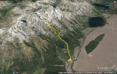
Location: GTNP, Shadow Peak, Bradley/Taggart Trailhead
Elevation, gain/loss: 11198, 5690’ gain/loss
Distance: 14.5 miles RT
Difficulty: 3+ stars
Time:  6-8hrs

Trip Report:

Date: 12/27/2015
Snow Conditions: Powder, Consolidated Powder, Mild Wind Crust @ 10500′ and some sun affect snow around 10700′

The storm that rolled through Jackson over Christmas was once again a present from Mr. Santa.  Around 100″ fell over a 15 day period and in an instant the winter began.  Over the past couple of weeks, I was able to have some great days in and around JHMR and Teton Pass, but I was yearning to get into the park to poke around a bit.

IMG_1772
Skiing the POW around JHMR

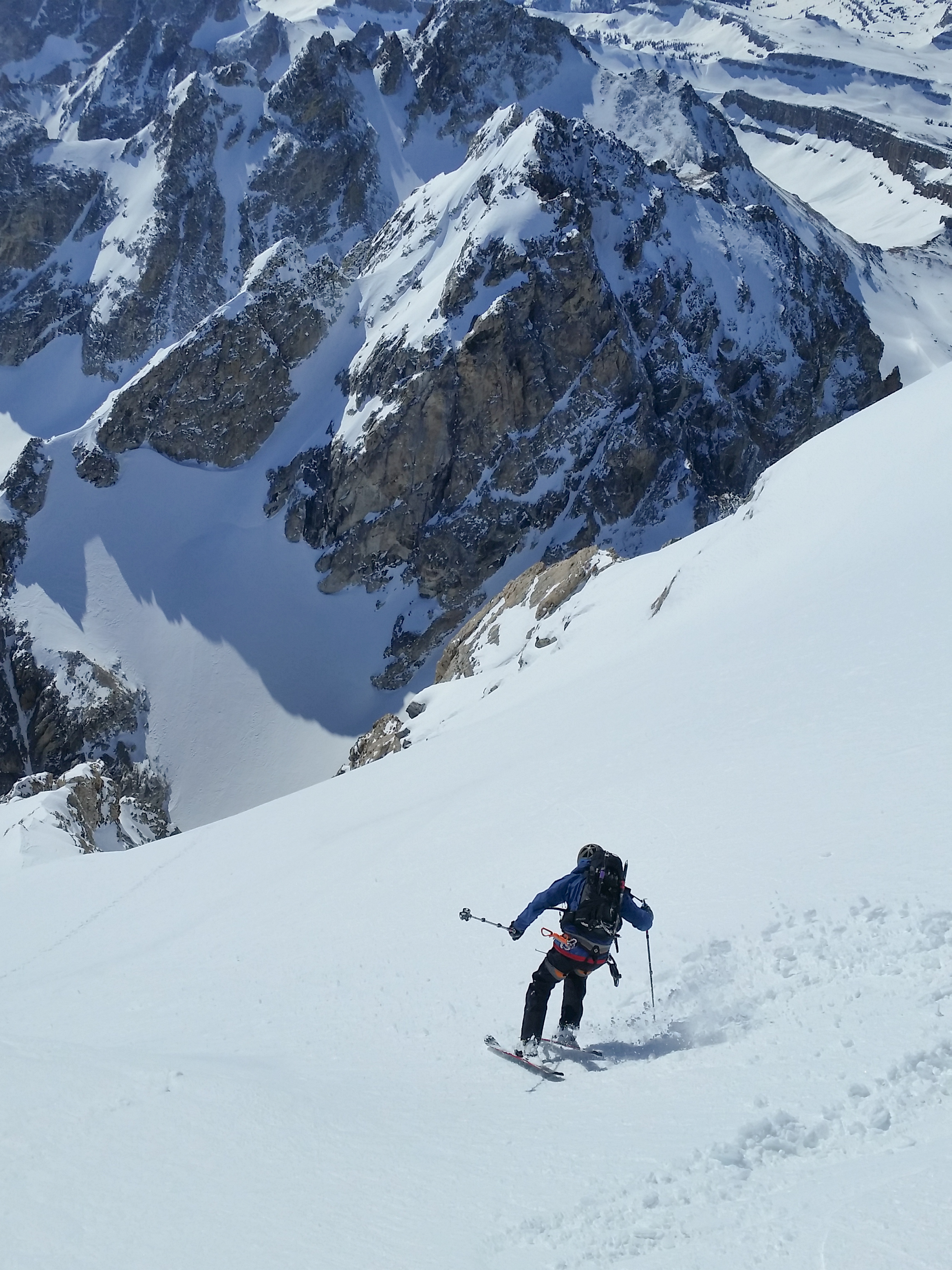
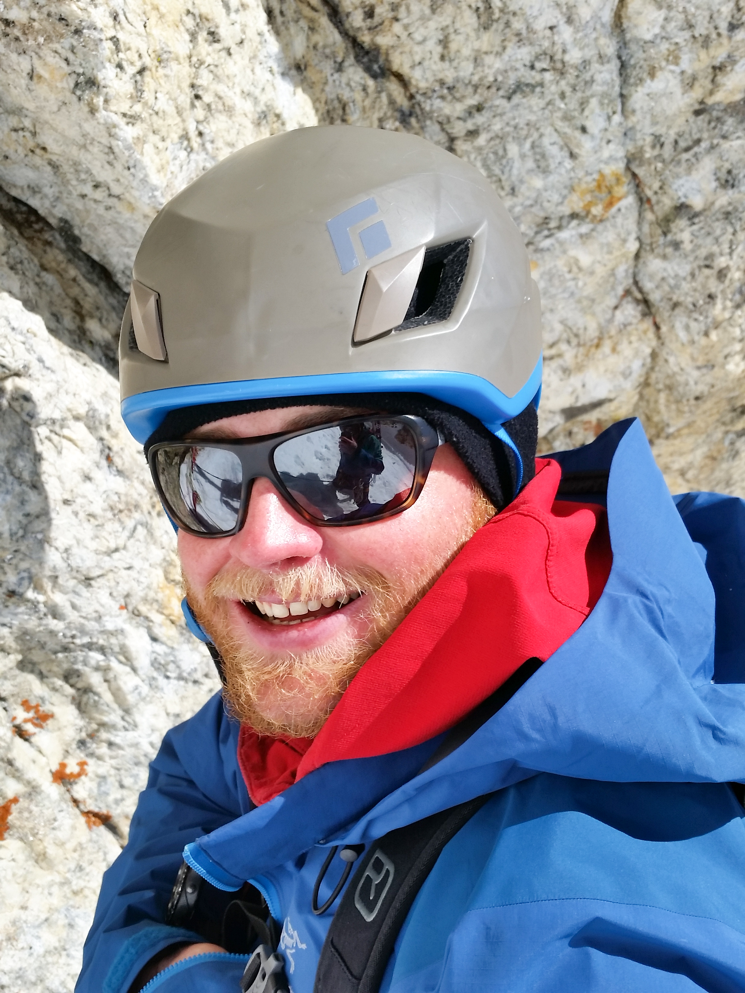
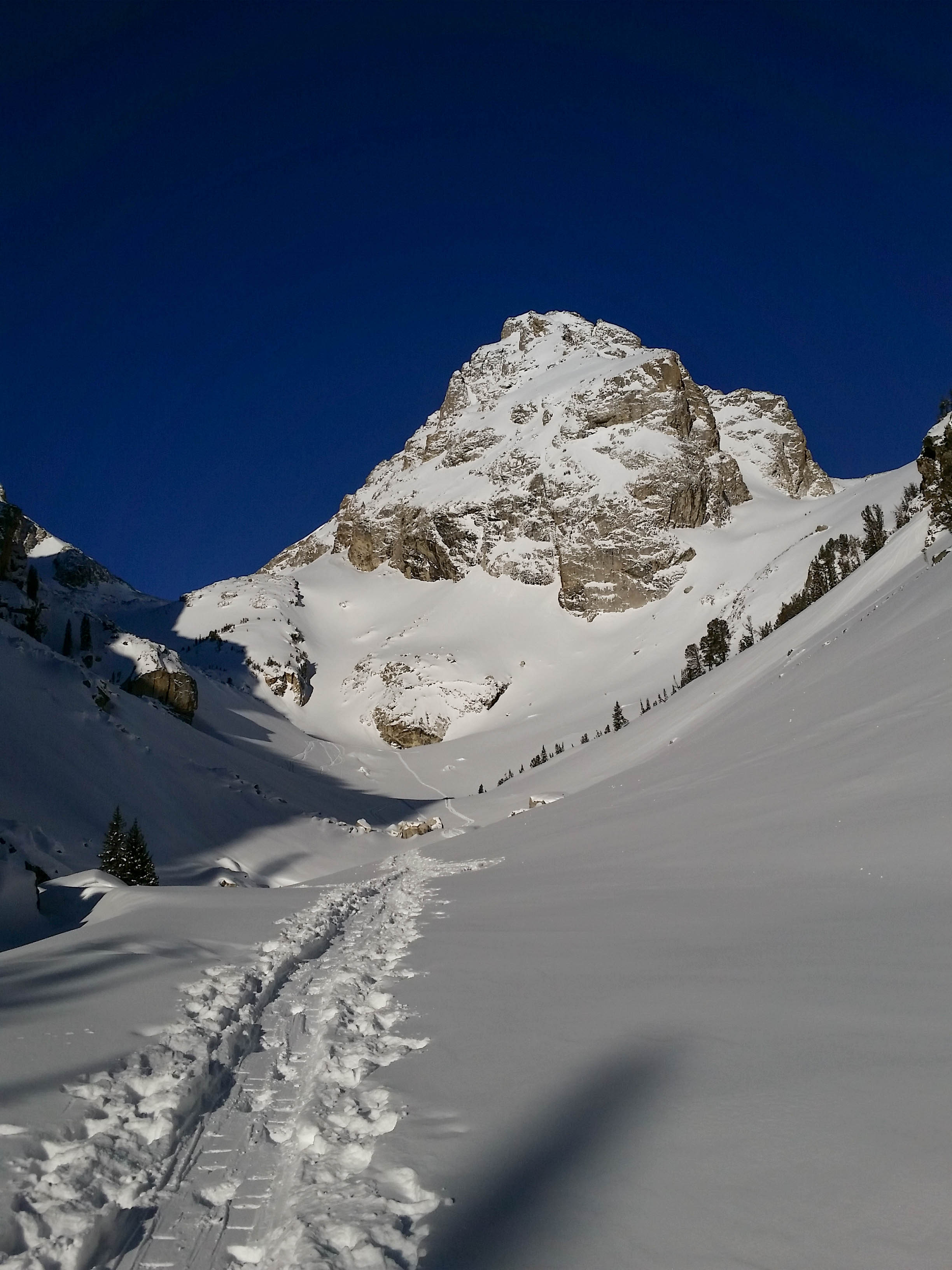
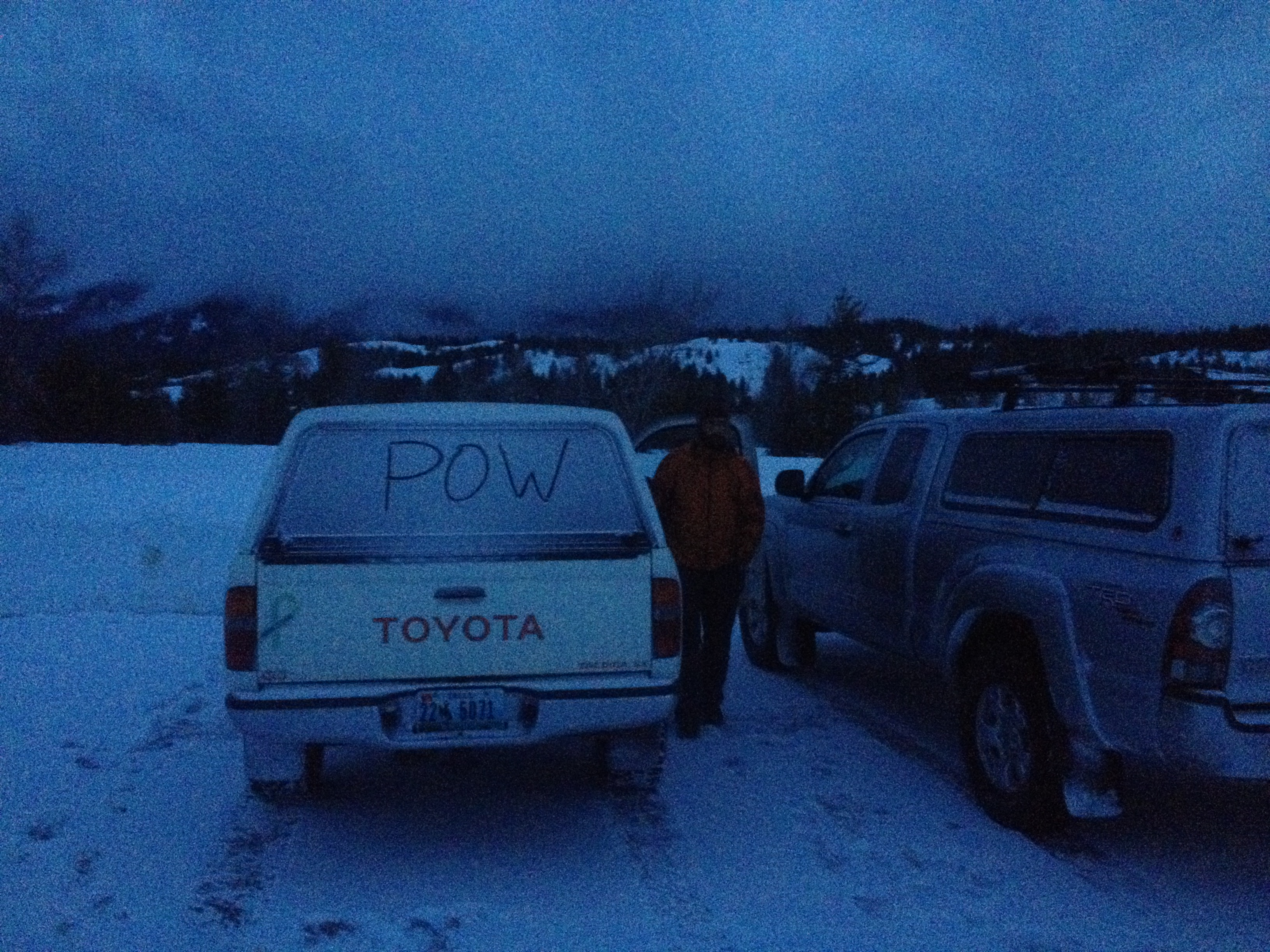
The Bridger-Teton National Forest Avalanche Center has been calling for Considerable to High avalanche danger over much of the past two weeks and yesterday was no different.  With this in mind: Dane, Tristan, Stu and myself set out for Shadow Peak at 8am from Bradley/Taggart trailhead. Our ideal objective was skiing the Sliver Couloir off Nez Perce, then heading down the 4 Hour Couloir to Avalanche Canyon, but we were not sure what we would find.

IMG_9456

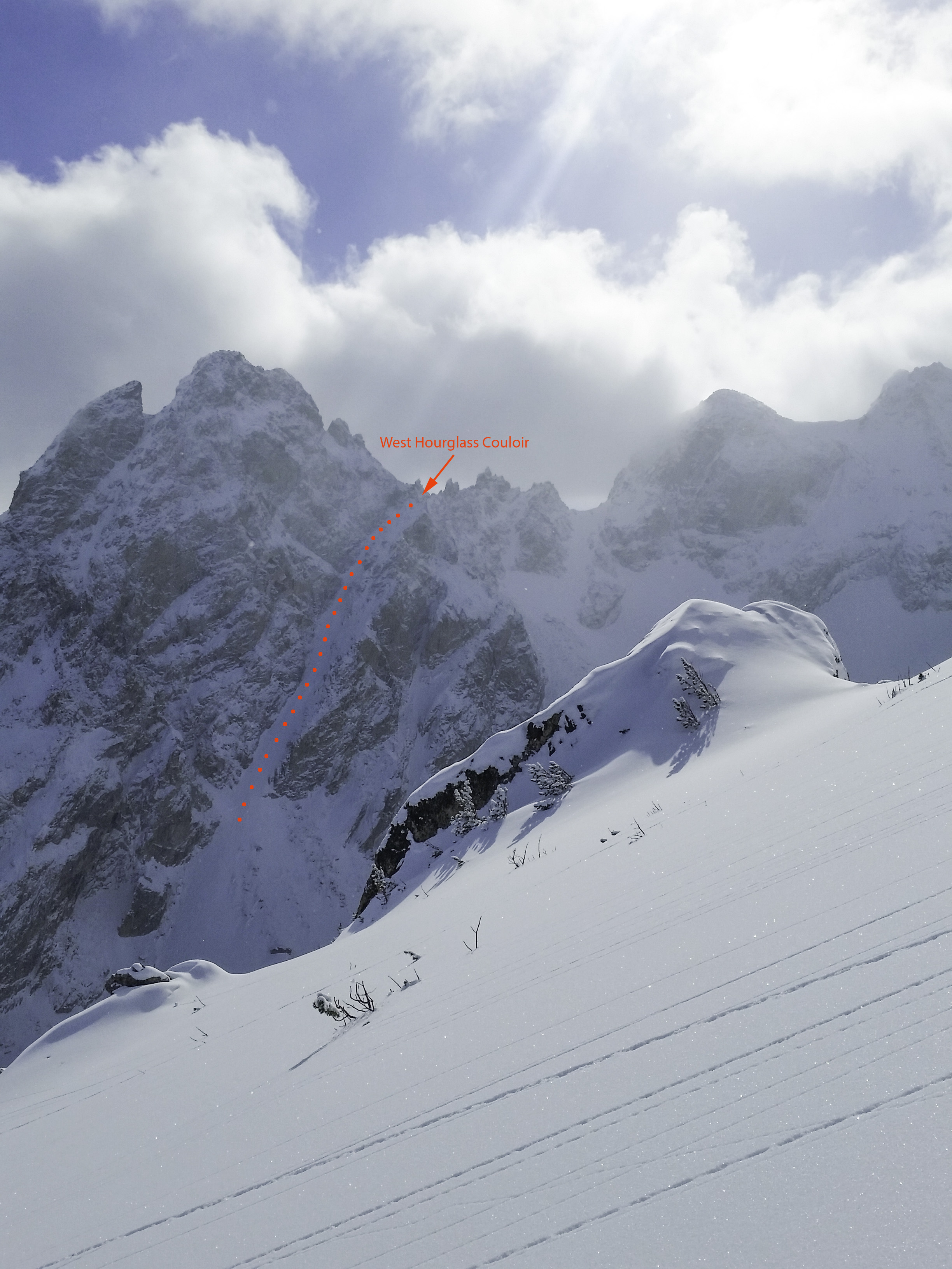
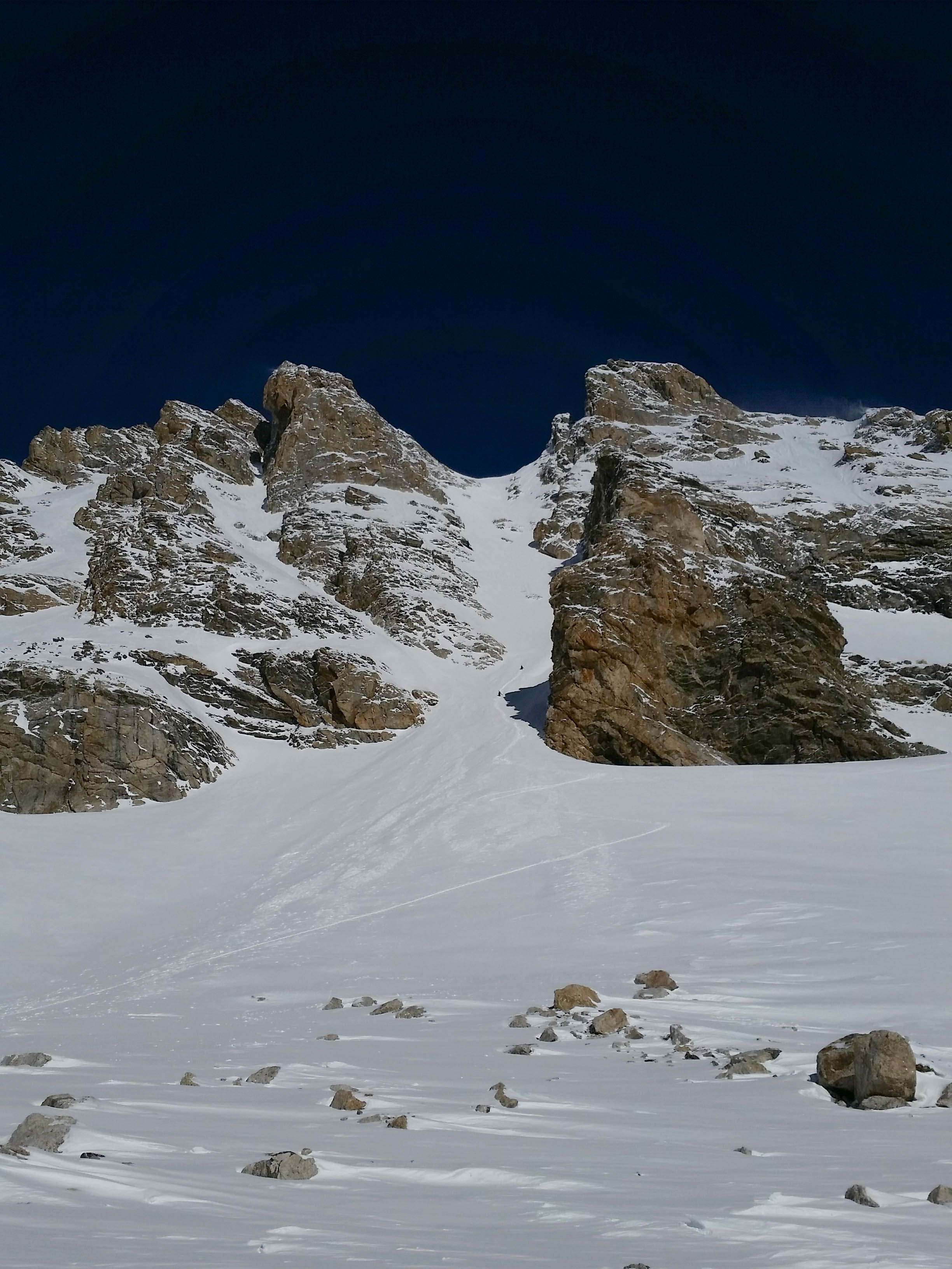
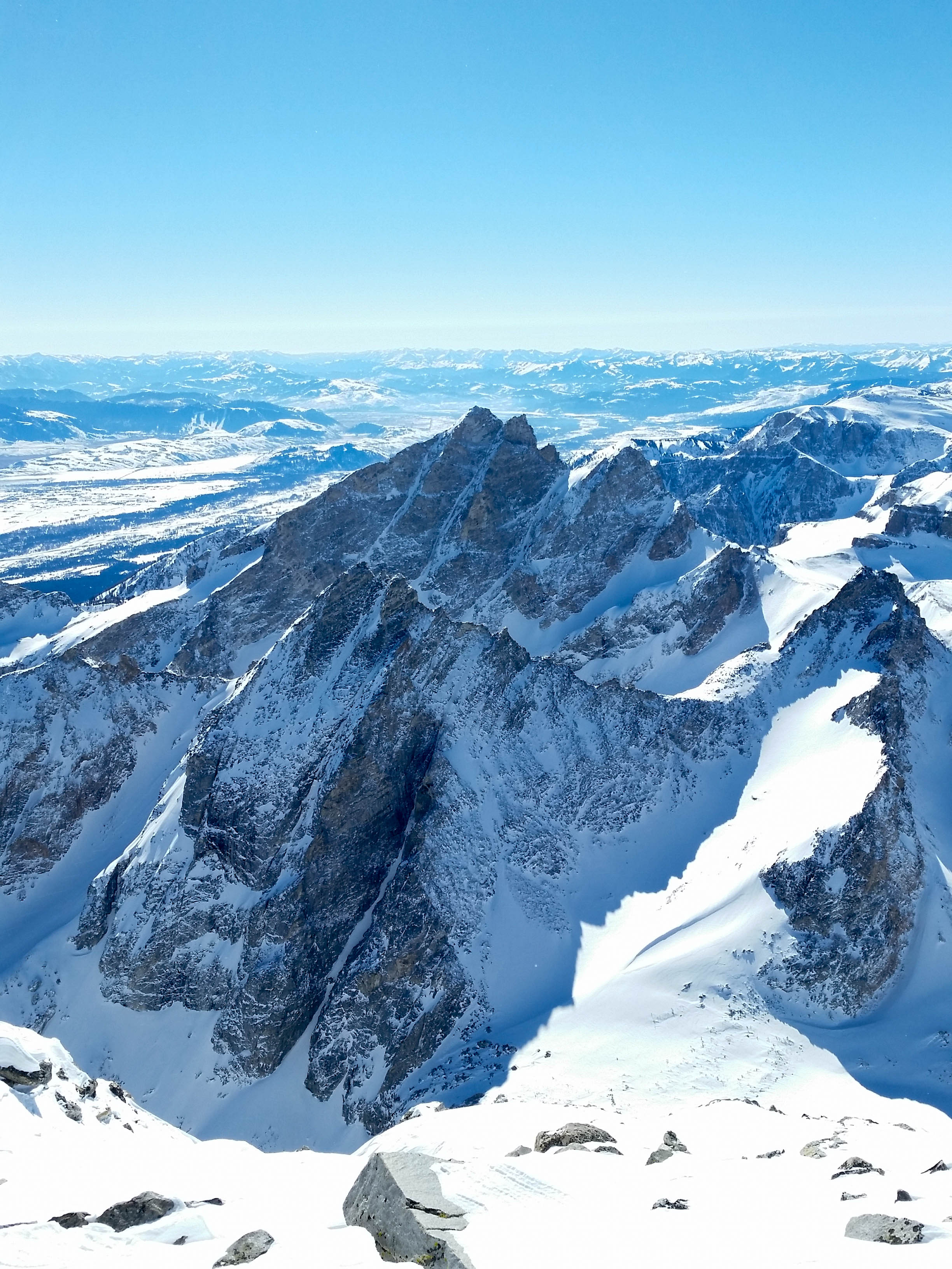
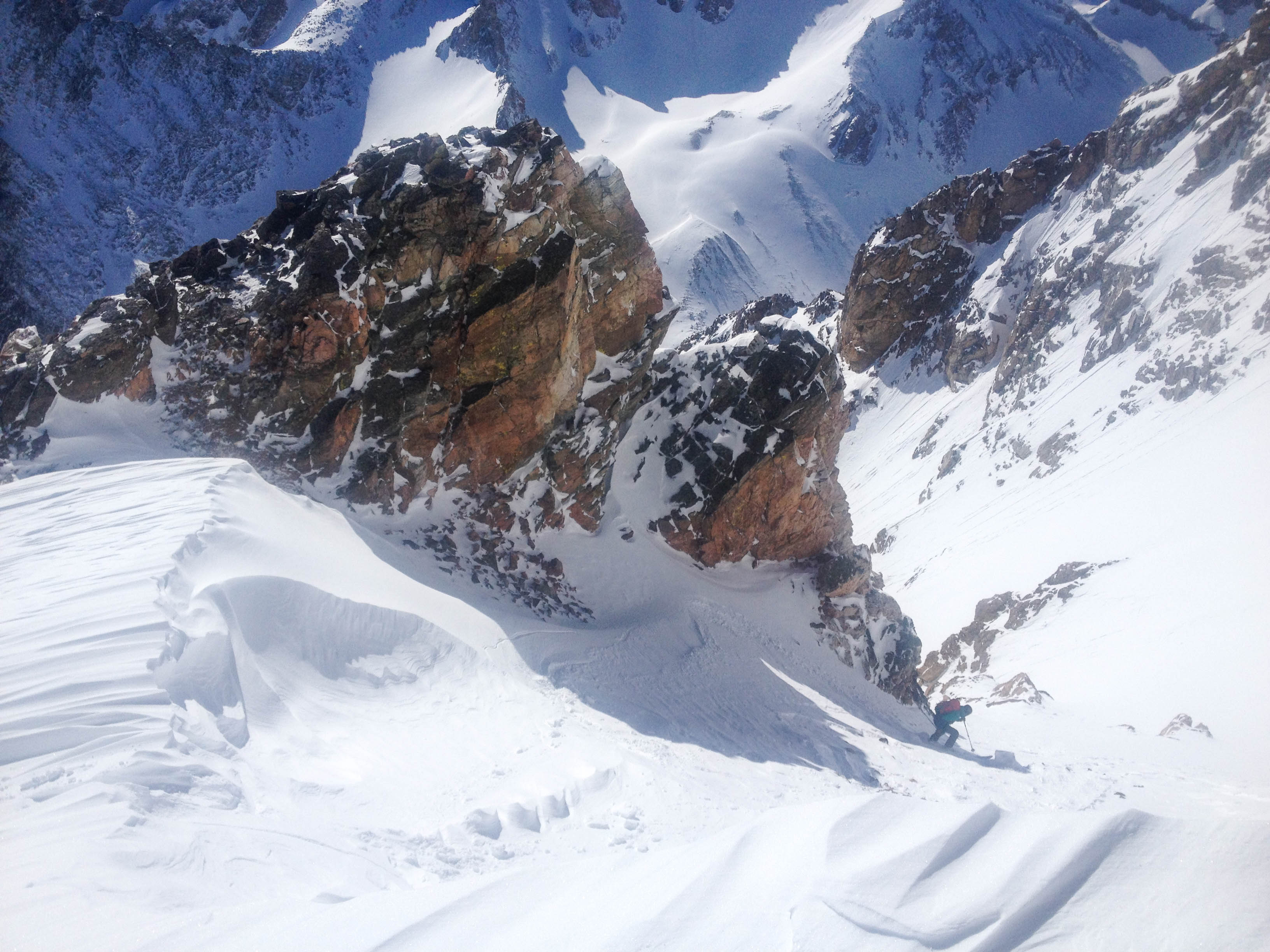
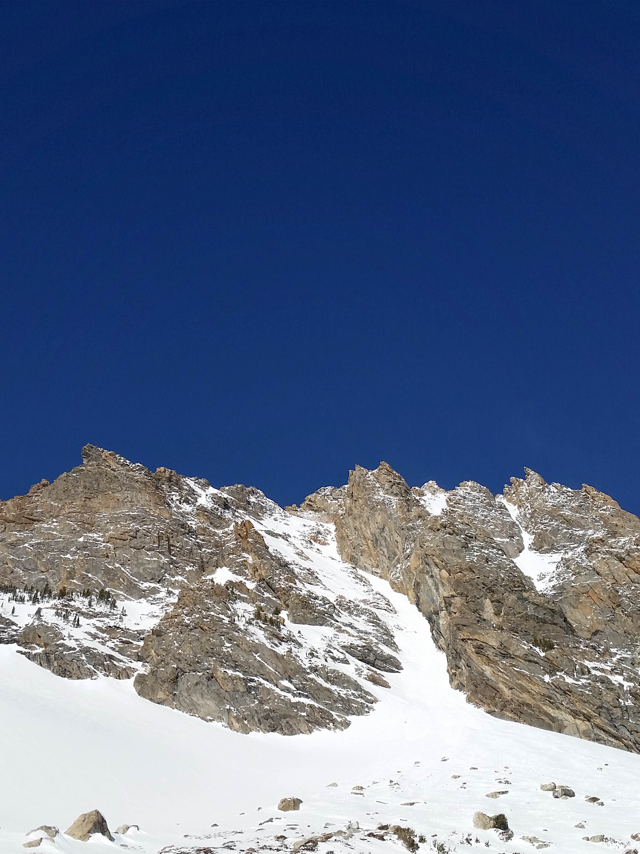
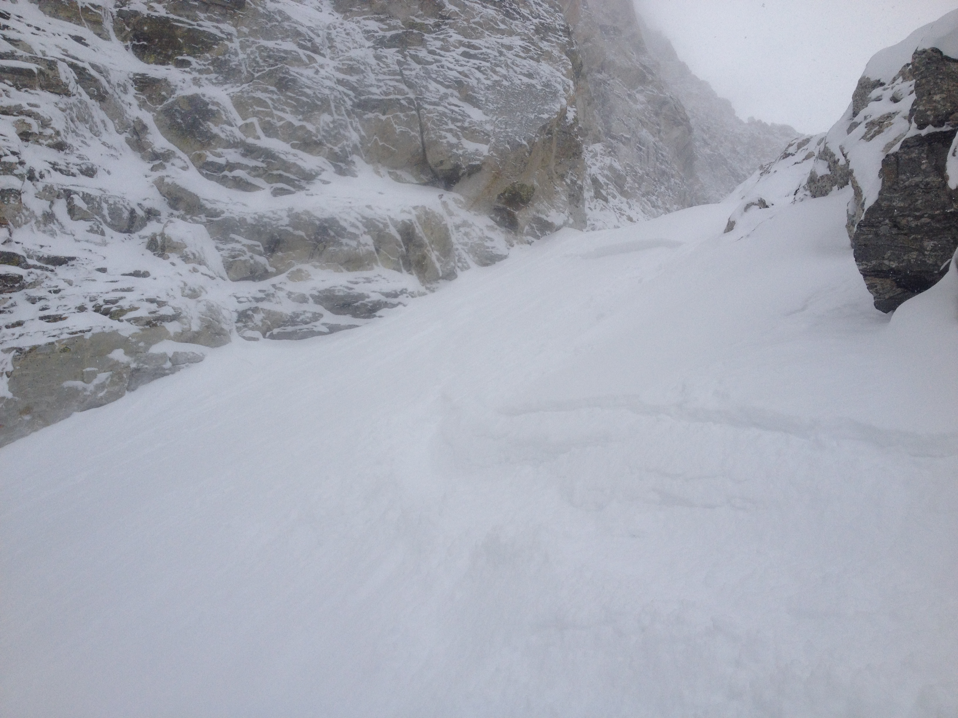
We made good time up to the 4 Hour Couloir entrance (see former post for details) and continued on to the top of the “skiers summit” of Shadow Peak.  Here we had our first good look at the Sliver and we liked what we saw.

IMG_1781

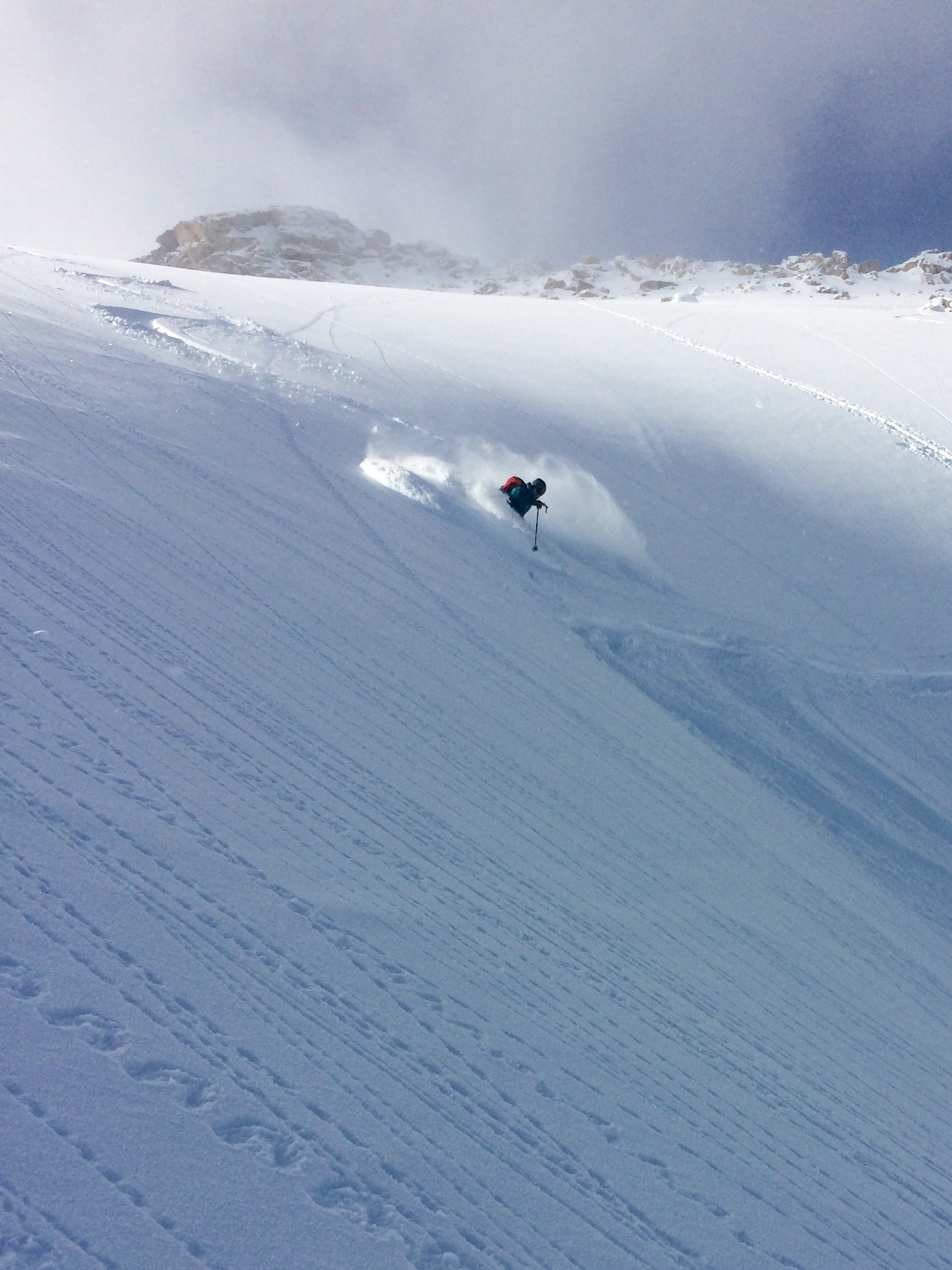
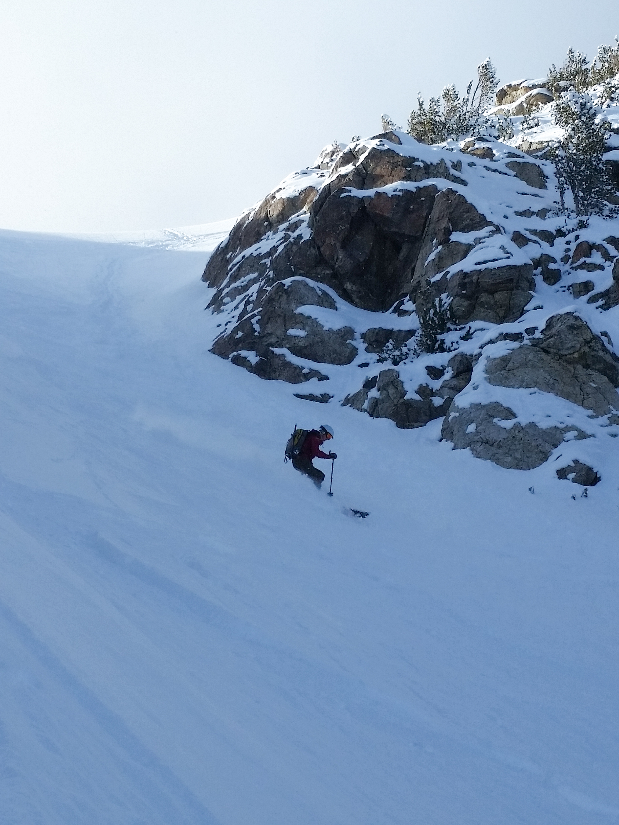
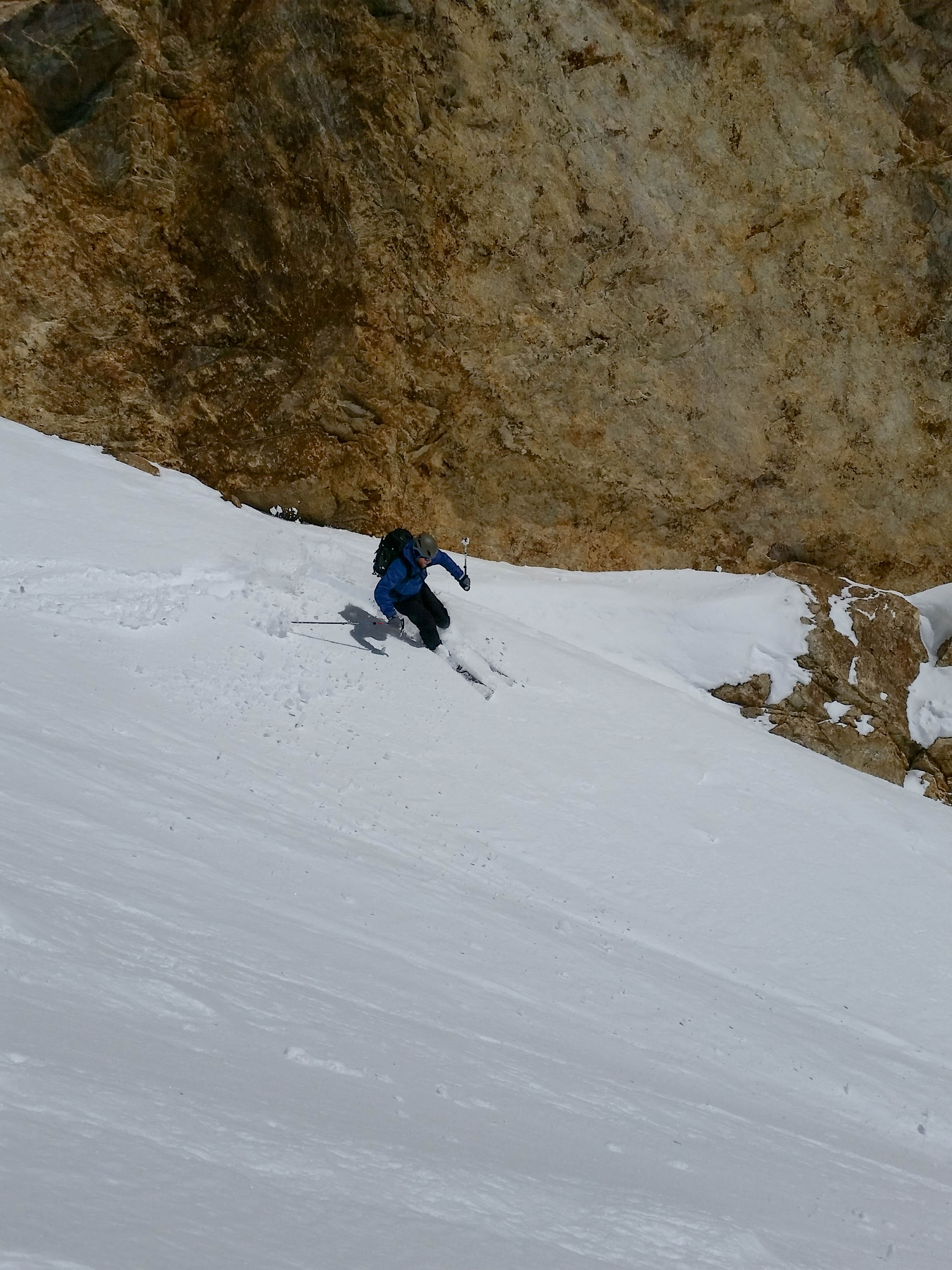
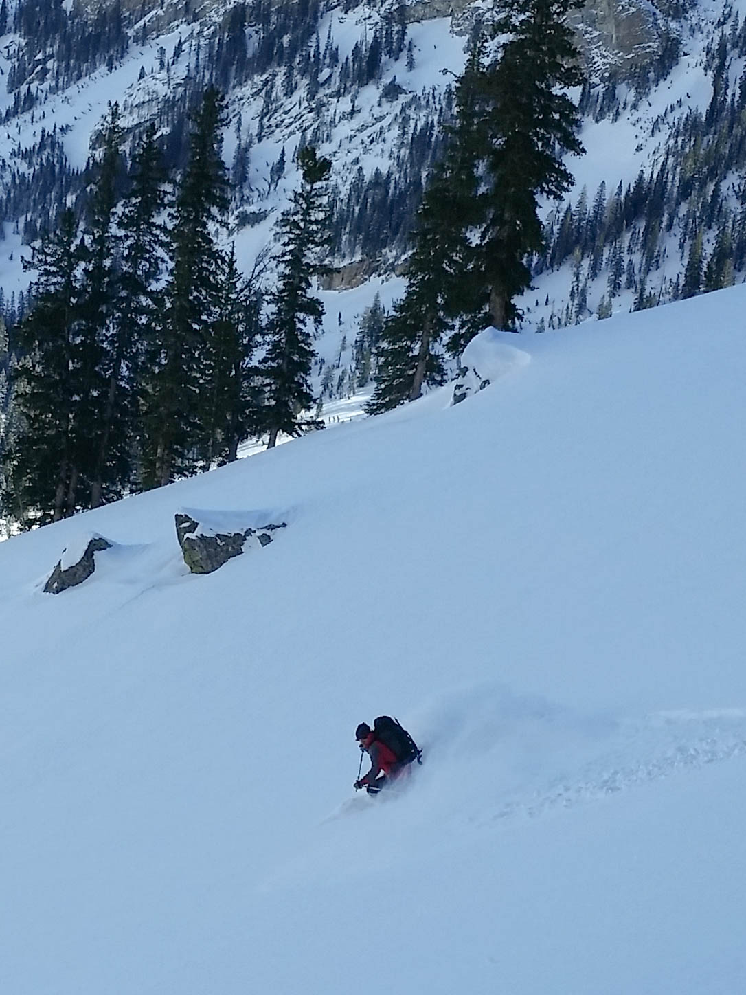
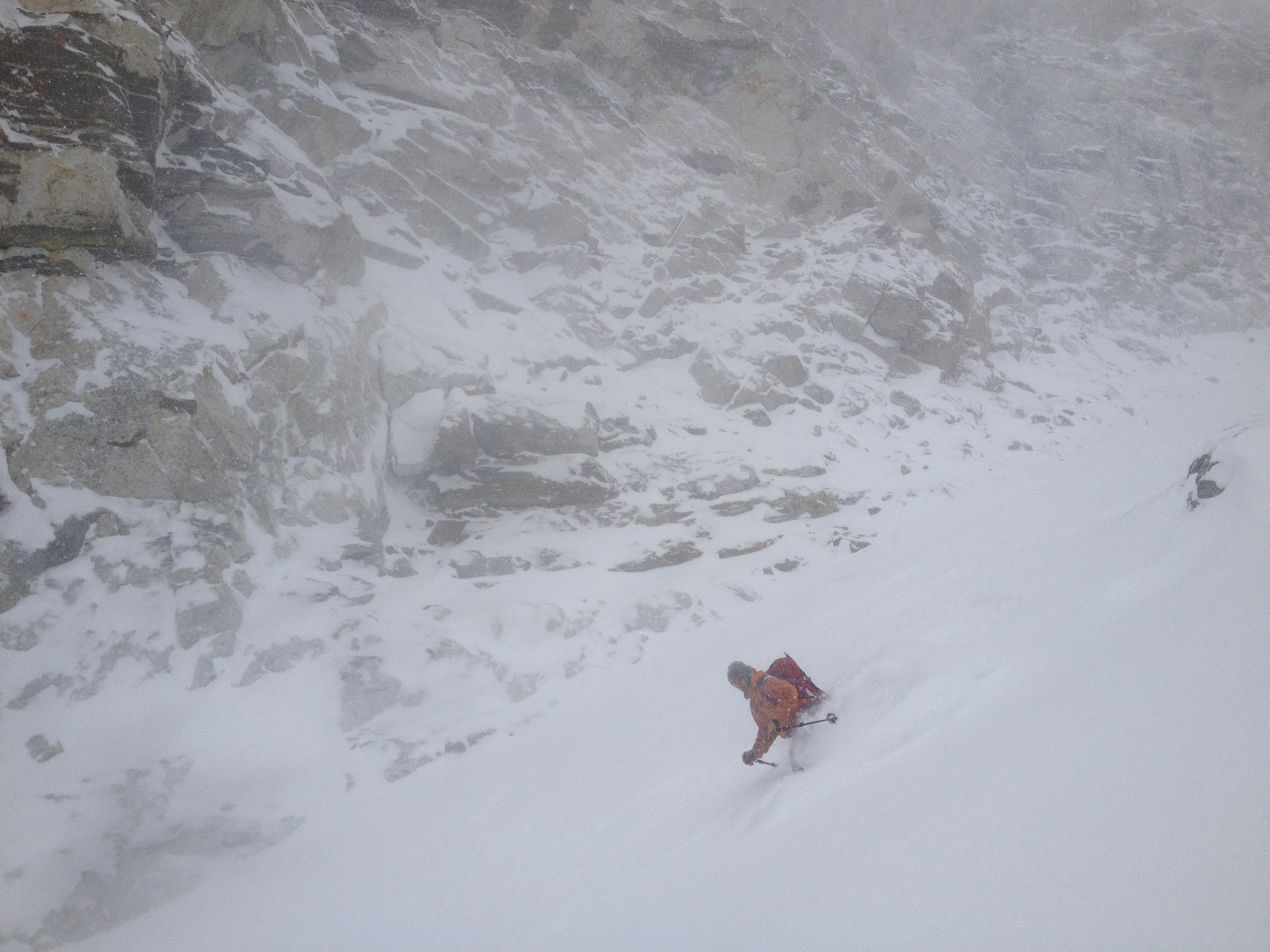
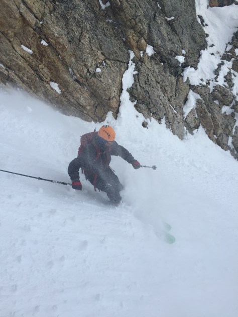
For starters, the couloir looked as if it had flushed a few times during the storm cycle.  Also, we could make out a couple minor crowns on the two larger “snow fields” on the left of the Sliver.  These two signs, along with our observations over the past few weeks lead us to believe it could be skied safely, but we would only know once we got into the line.  We made our way down to the col between the skier summit and true summit of Shadow and got ready to ski the west facing slope that drops down in the cirque of Nez Perce.  Here we dug a few hand pits and found a few areas of concern around 24″ down, but after a couple ski cuts–we decided to rip it.

IMG_1783
West Facing slope, leading to the Nez Perce cirque

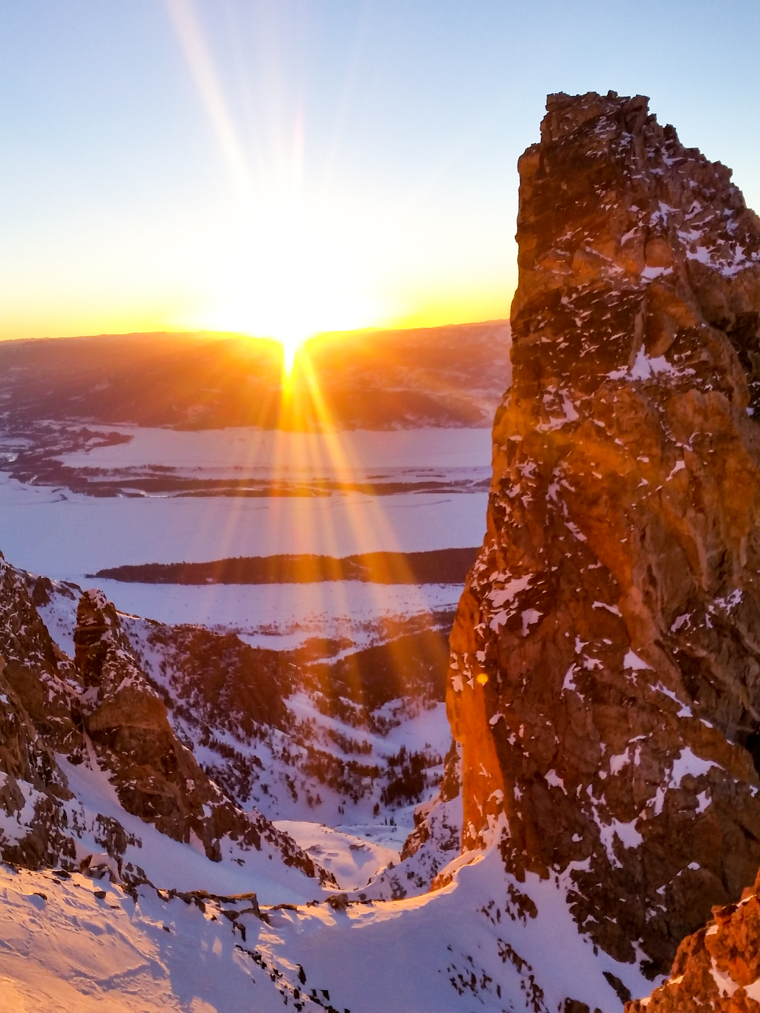
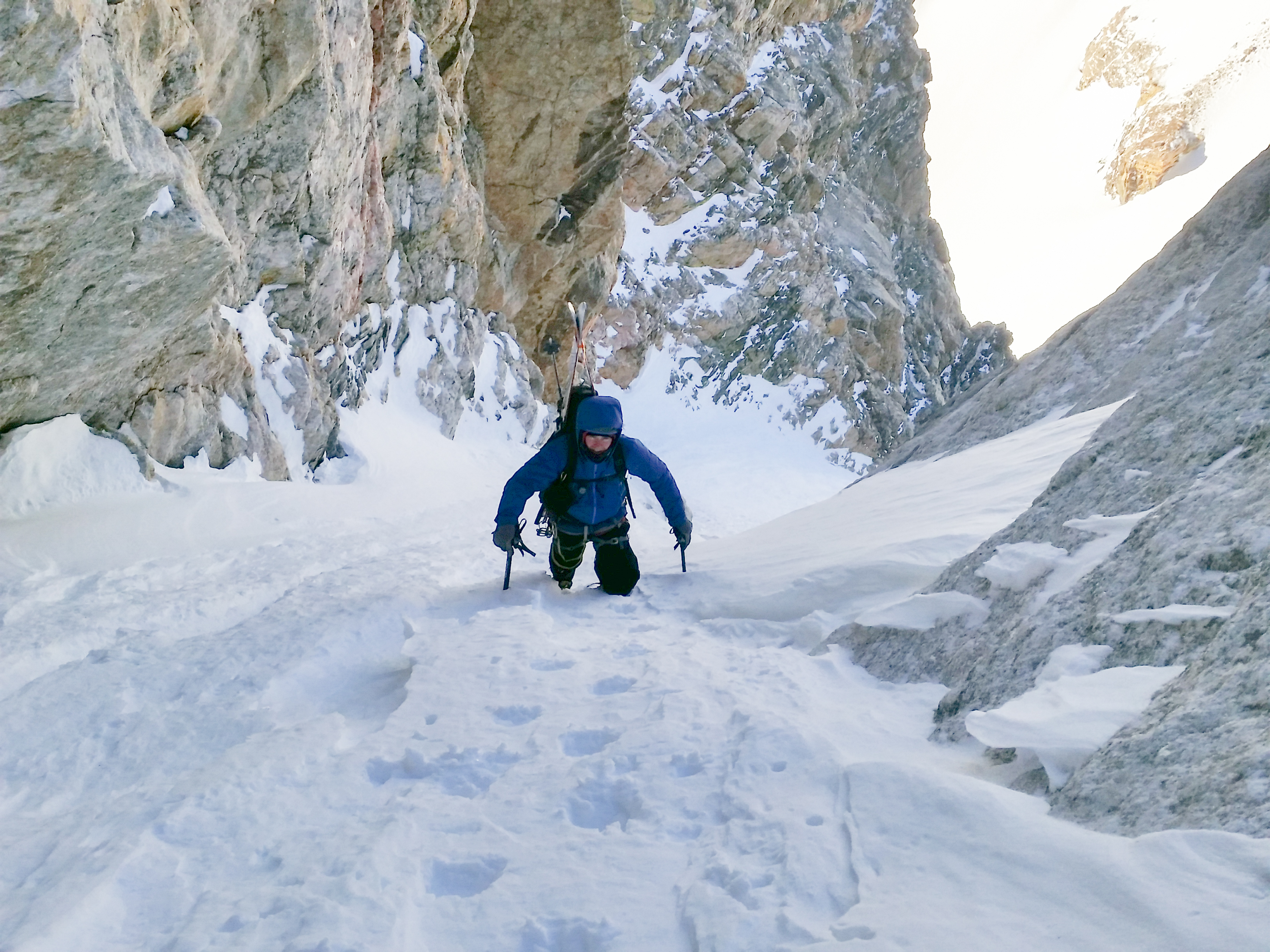
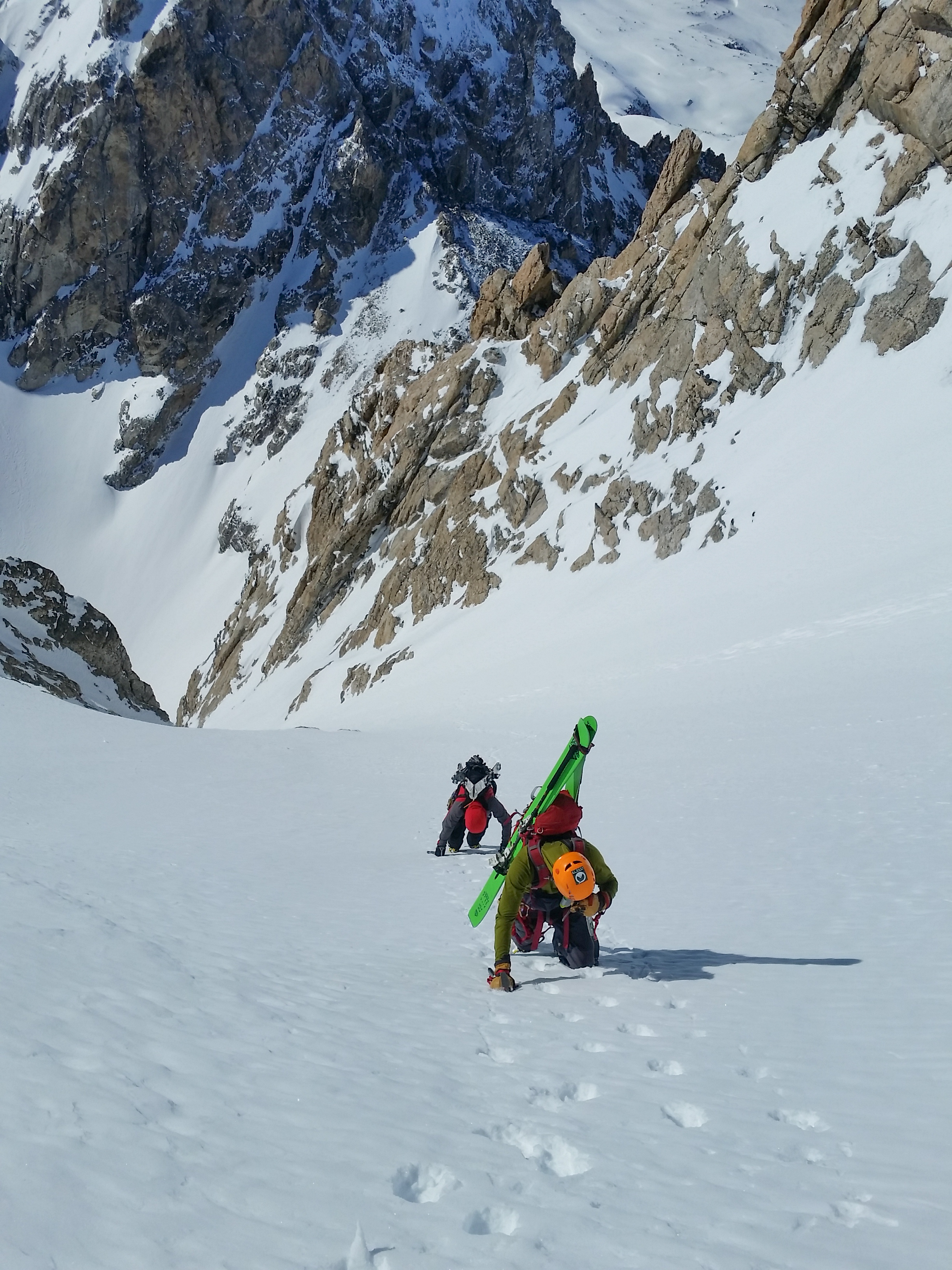
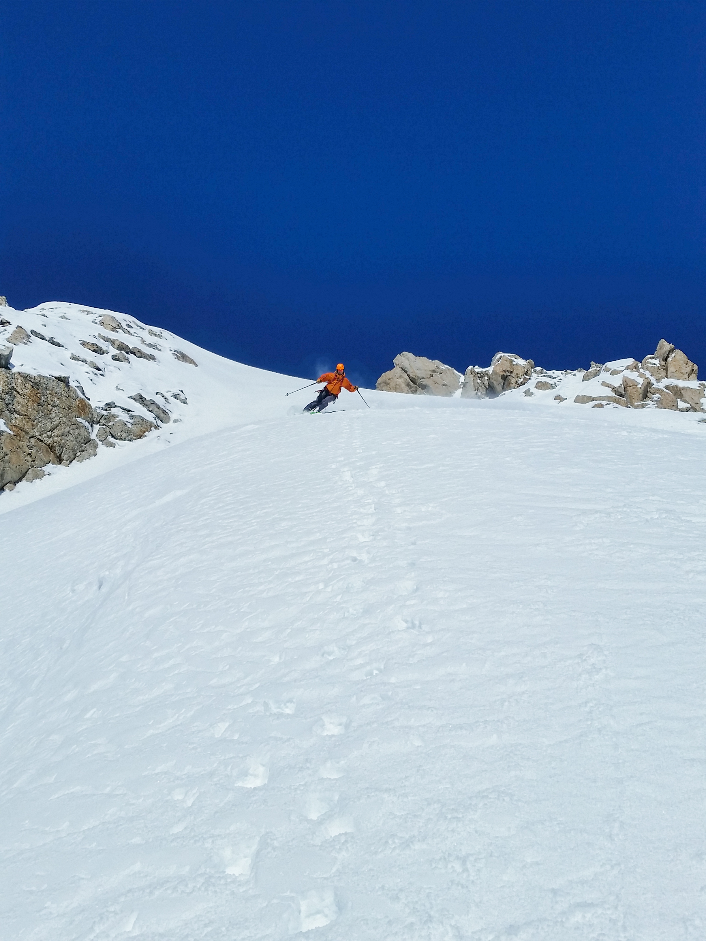
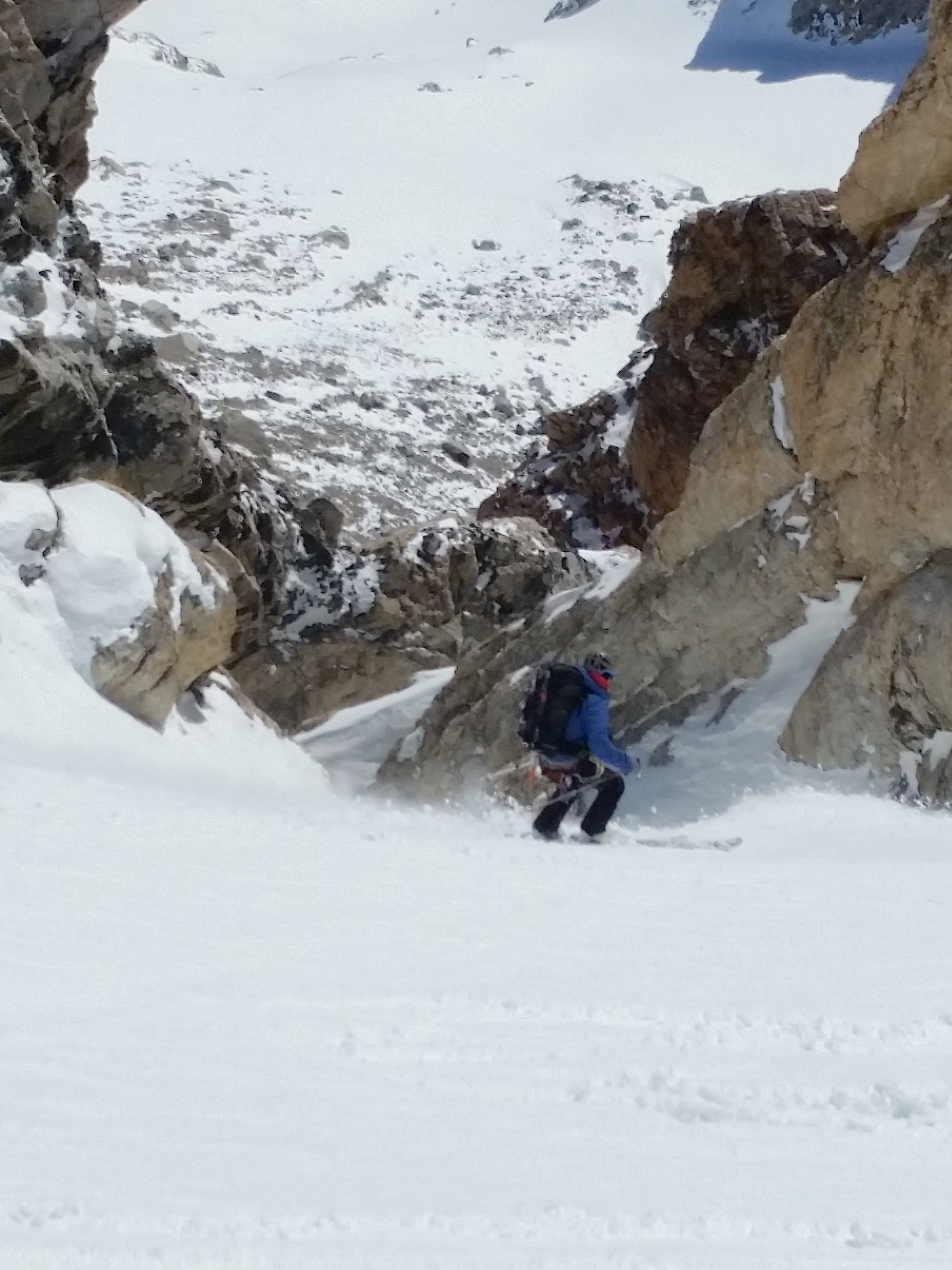
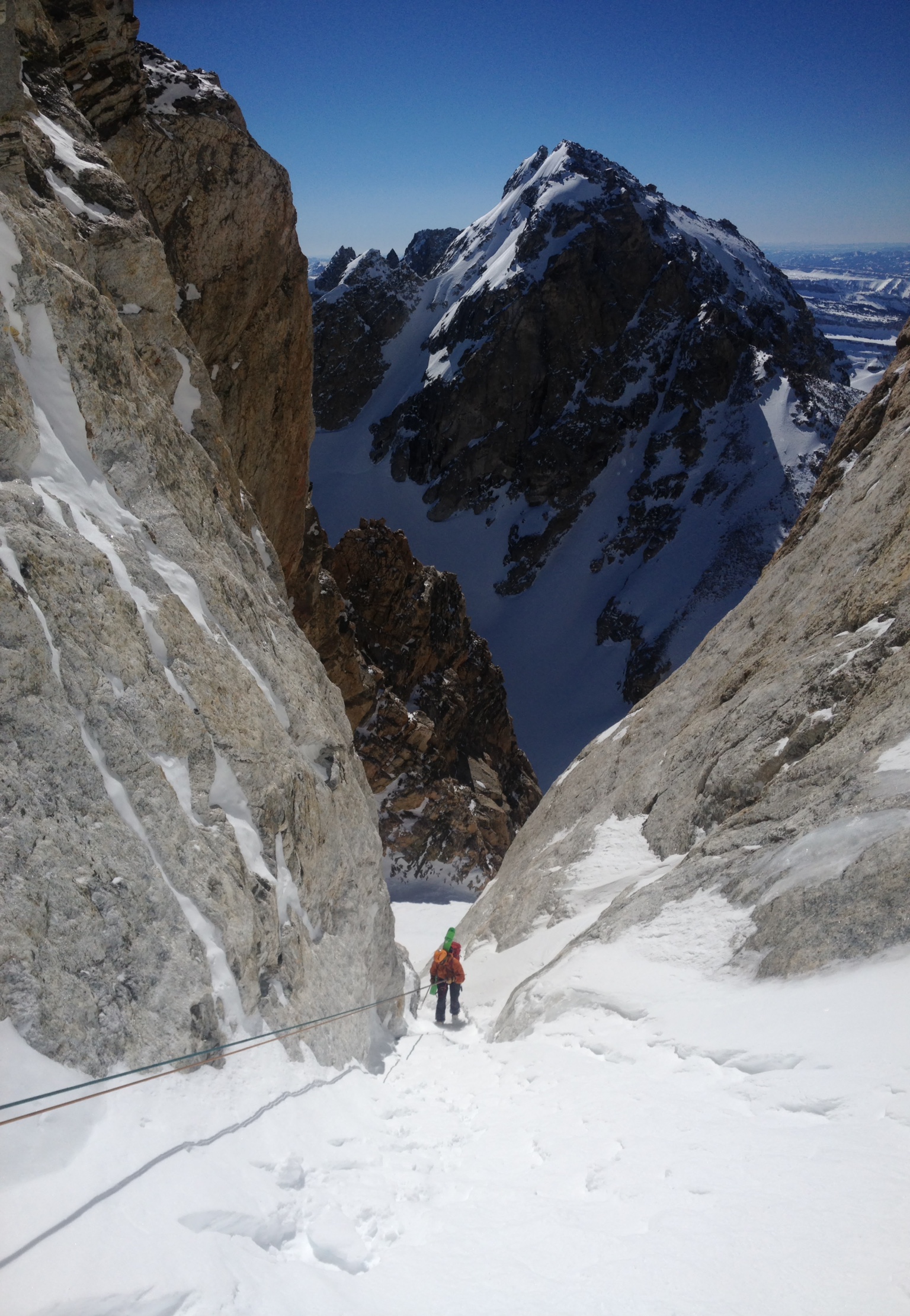
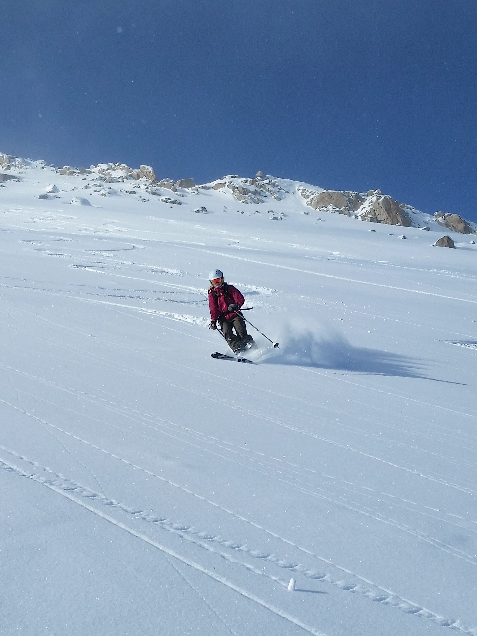
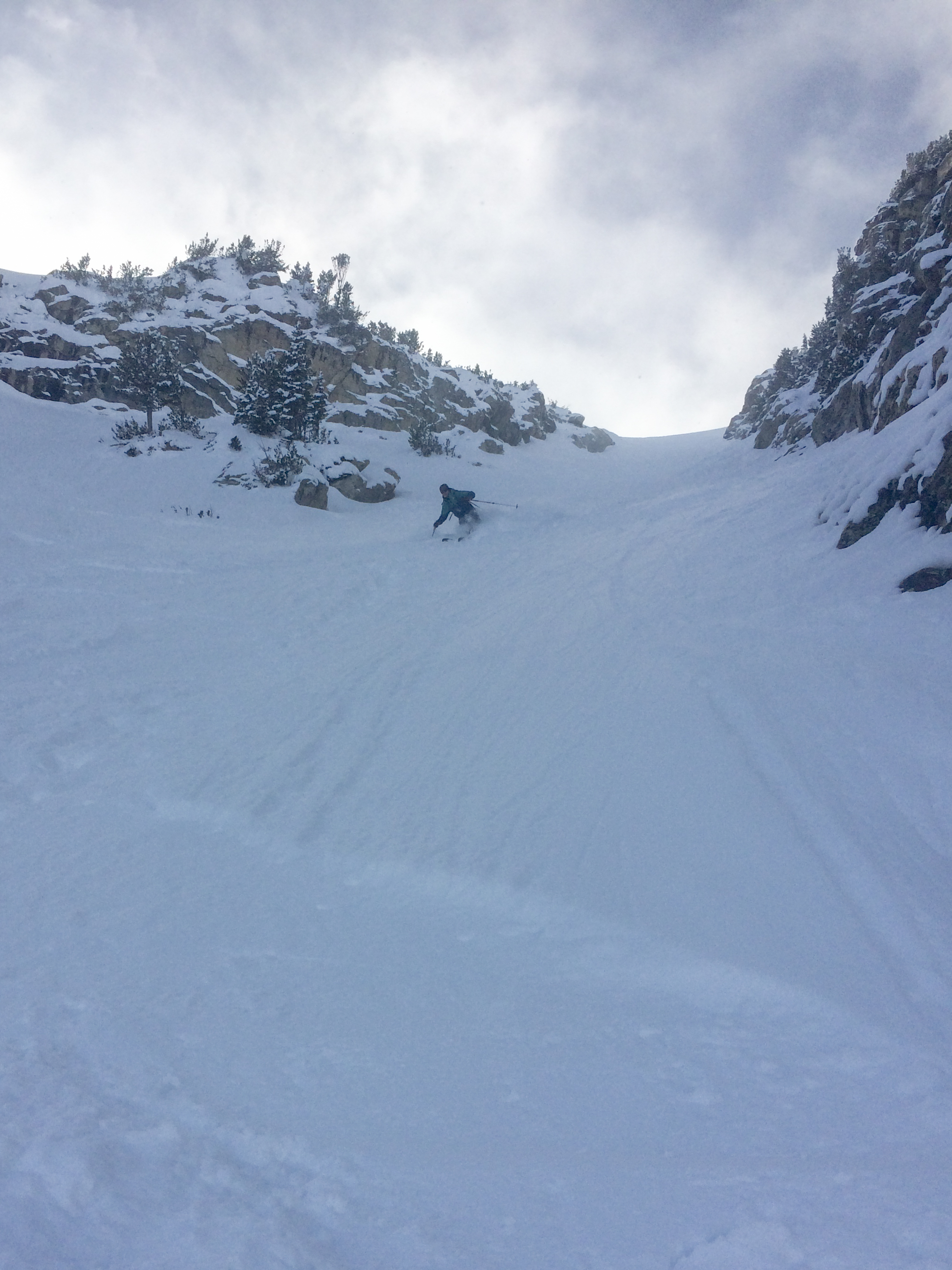
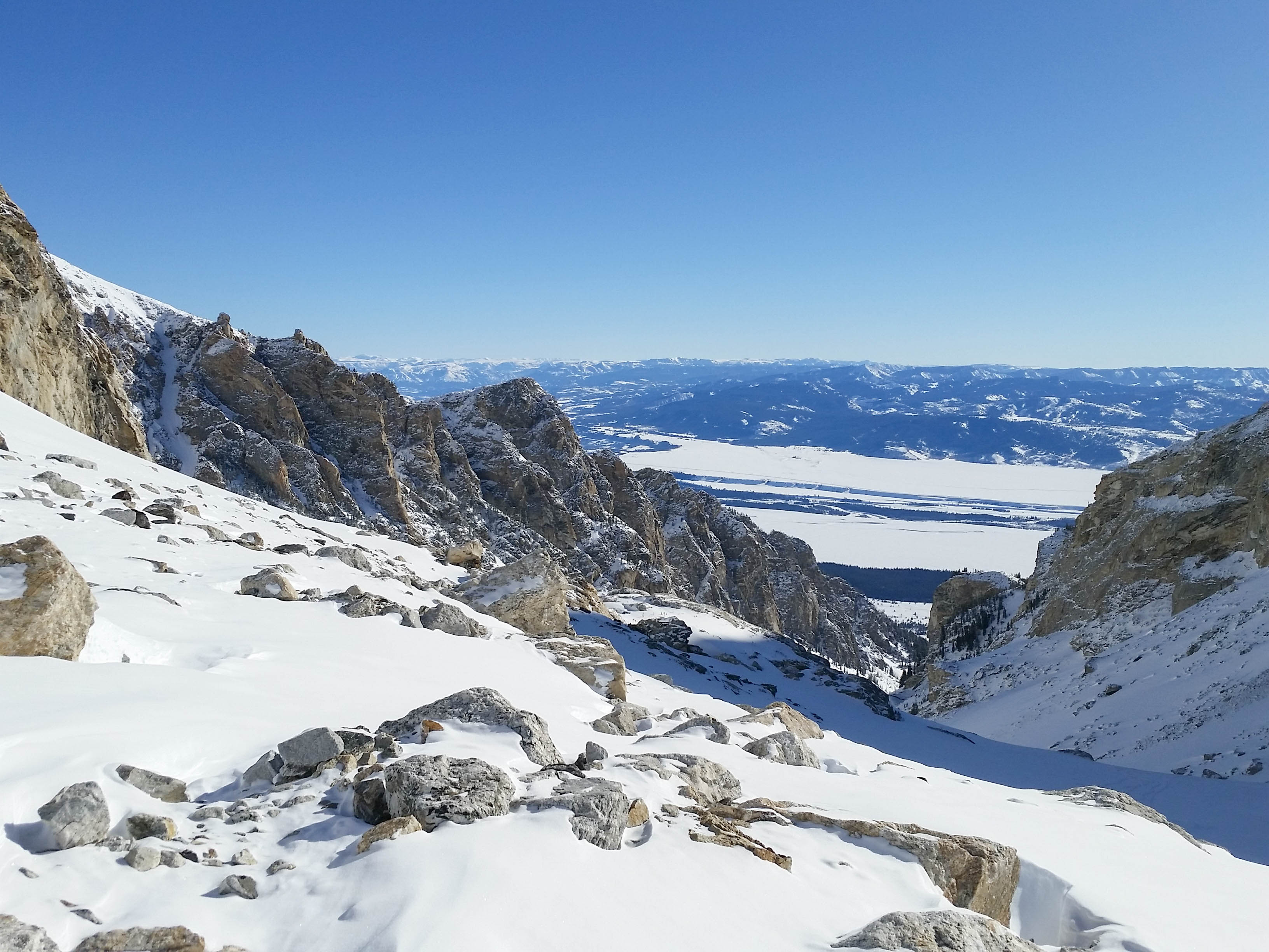
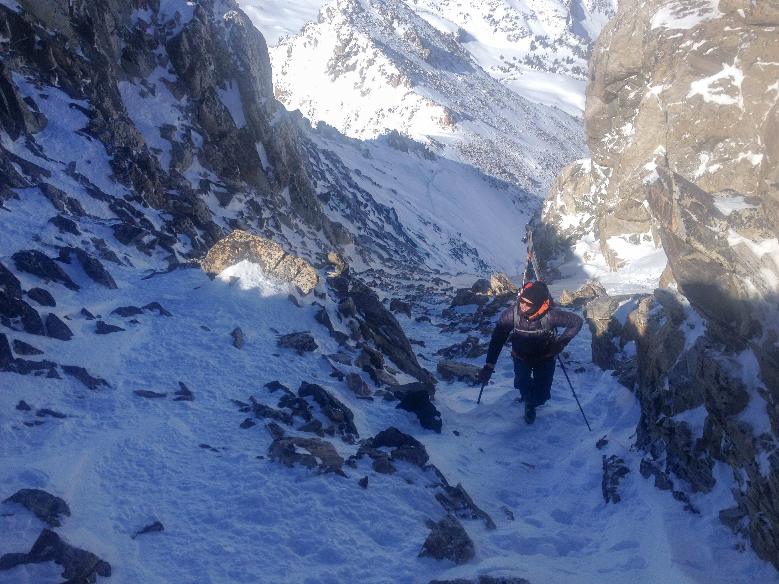
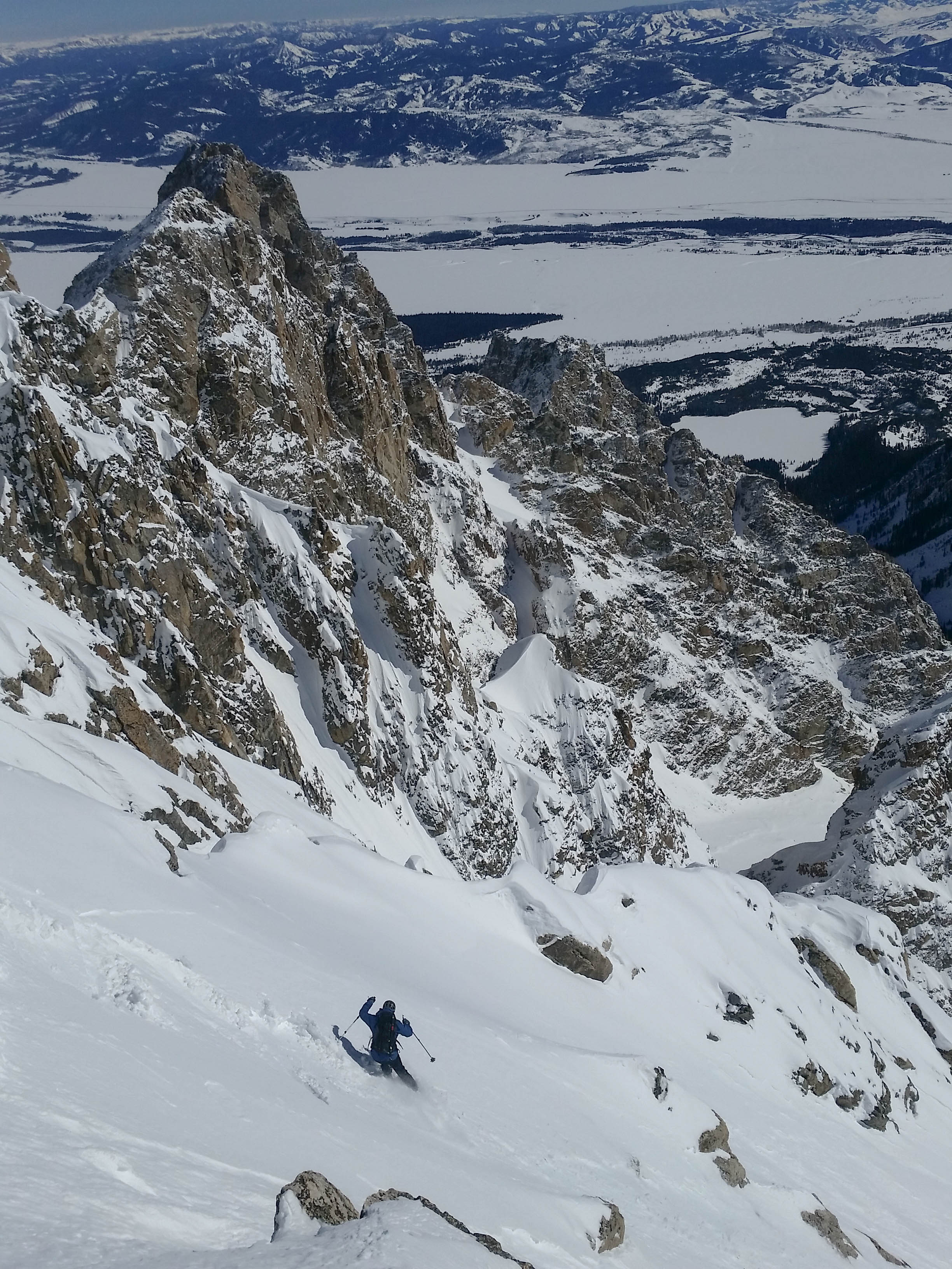
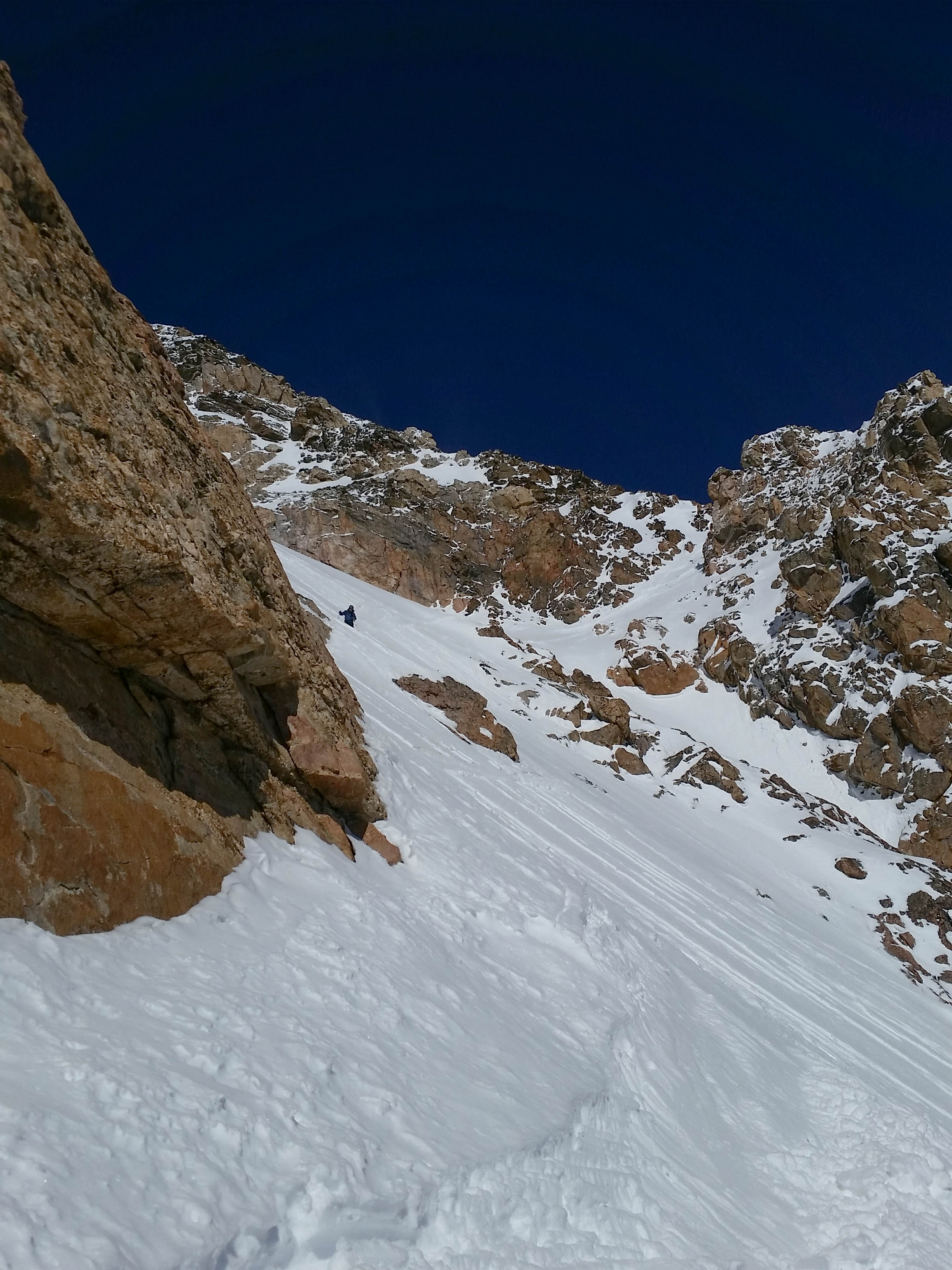
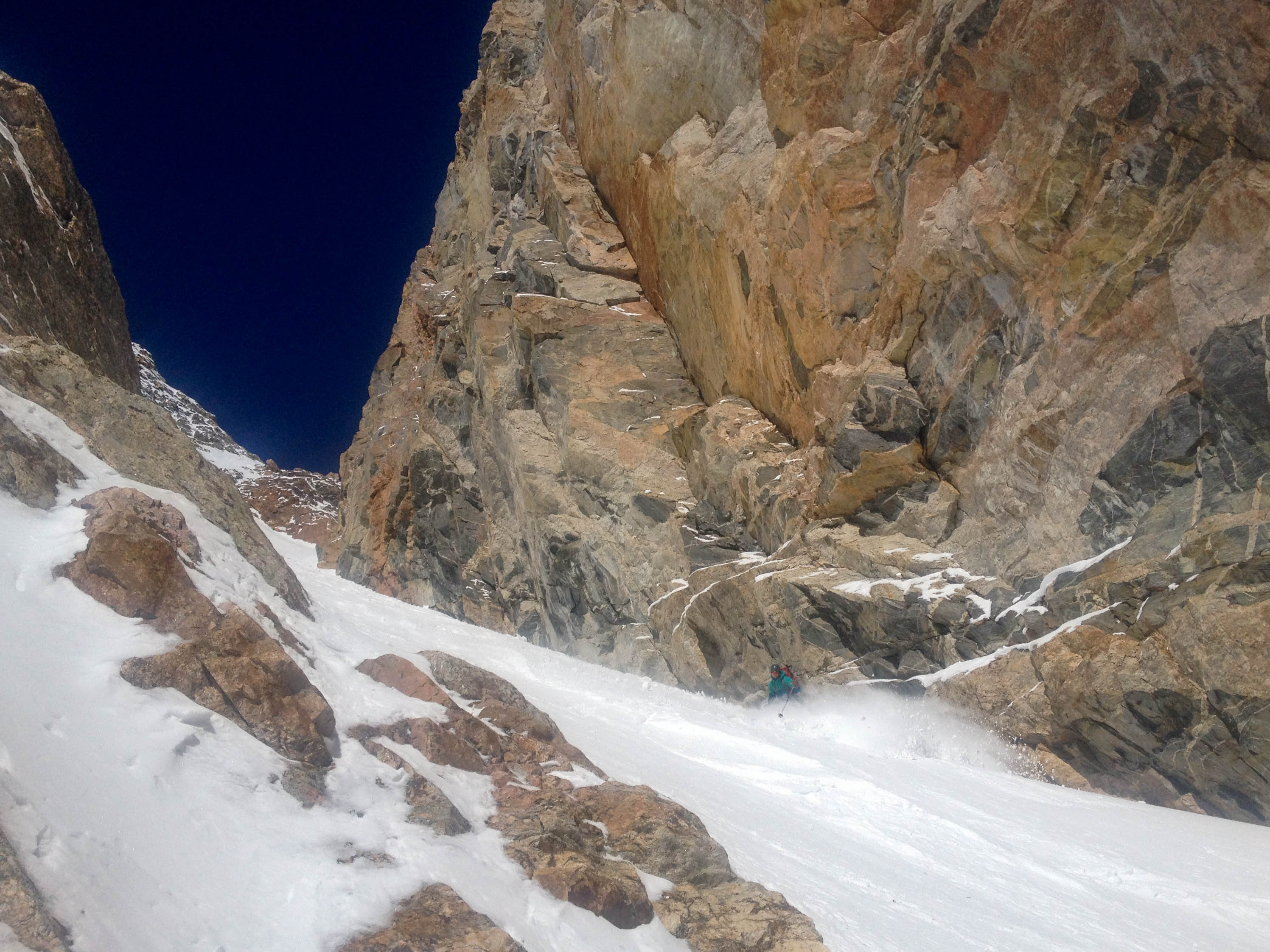
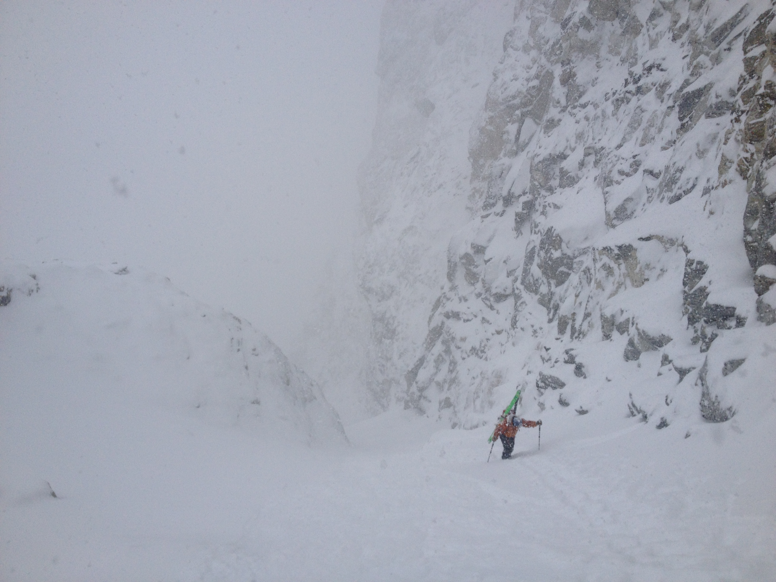
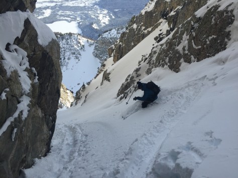
The snow in this zone was deep, stable and very supportive.  We made our way across the cirque and then transitioned to skin mode to make our way to the entrance of the couloir.  We worked our way up to the rock bulge below the Sliver and dropped our skins and some unneeded layers and began our way into the couloir.  We noticed the temperature was rising a bit at this elevation, but the snow didn’t seem to be affect too much at this point.  We worked our way up the couloir for about 500 feet, stopping on occasion to dip a few hand pits and discuss the situation.

IMG_9496
Nearing the top.

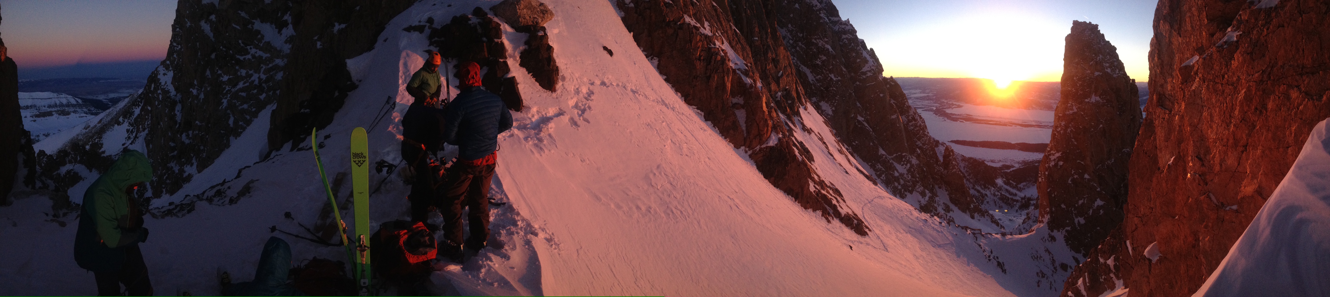
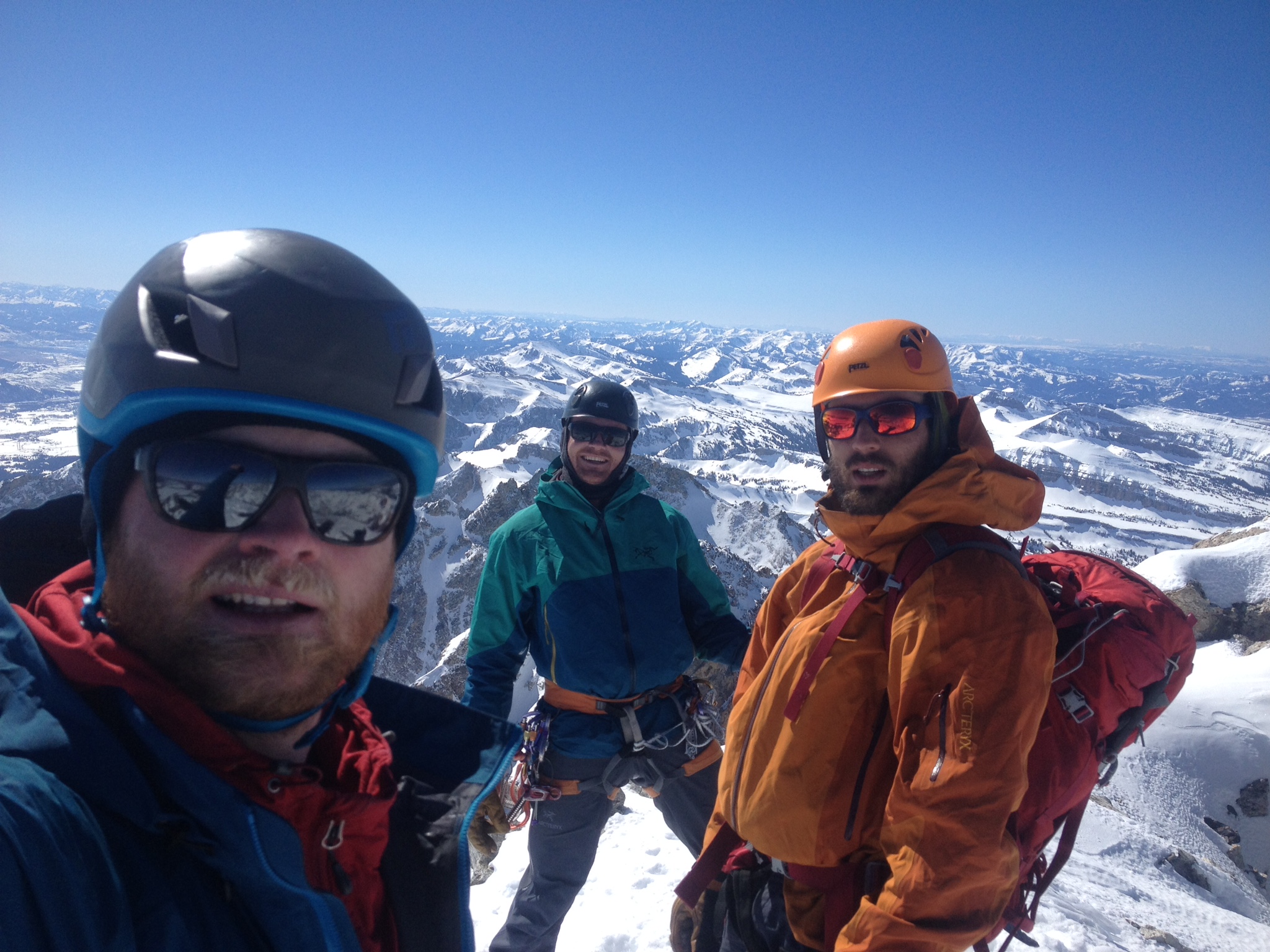
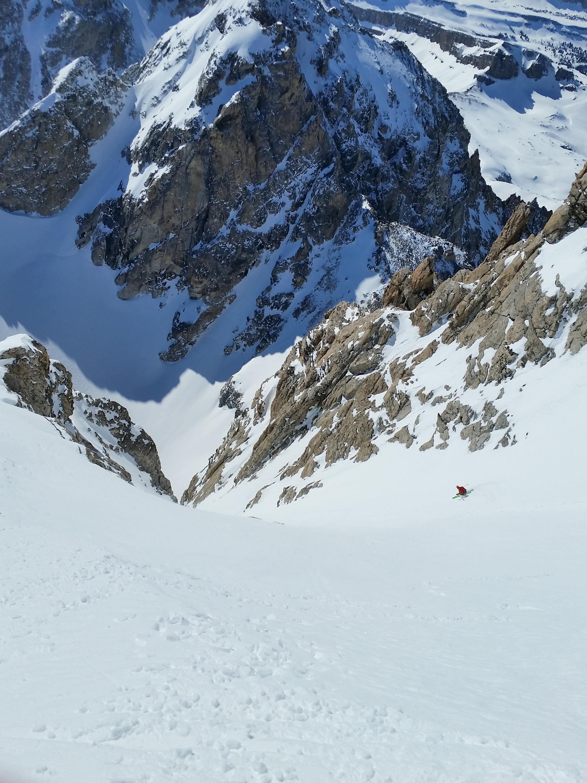
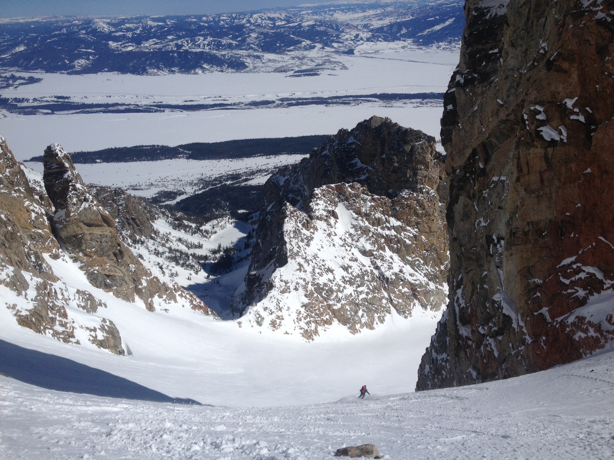
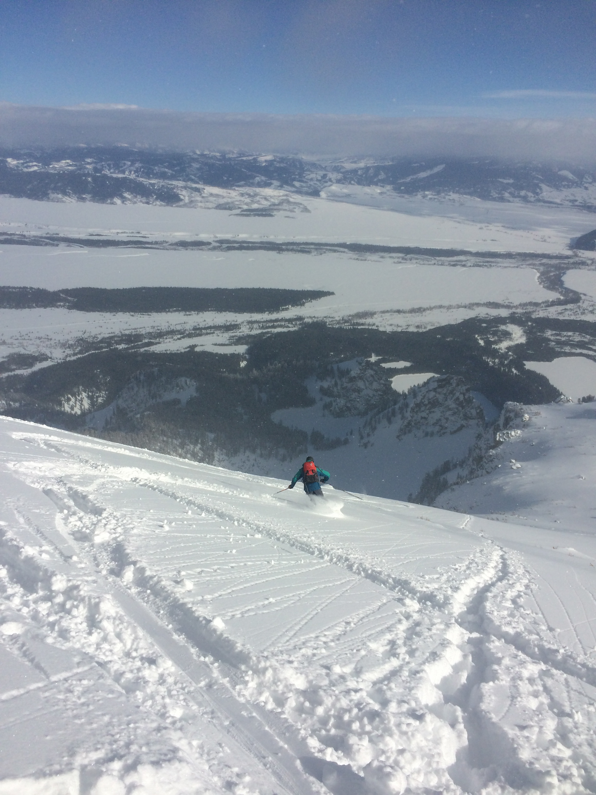
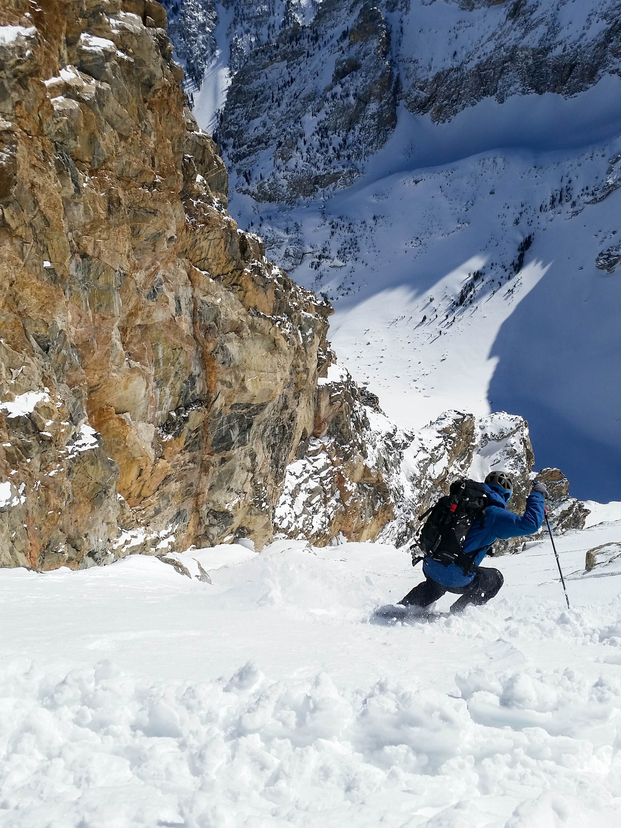
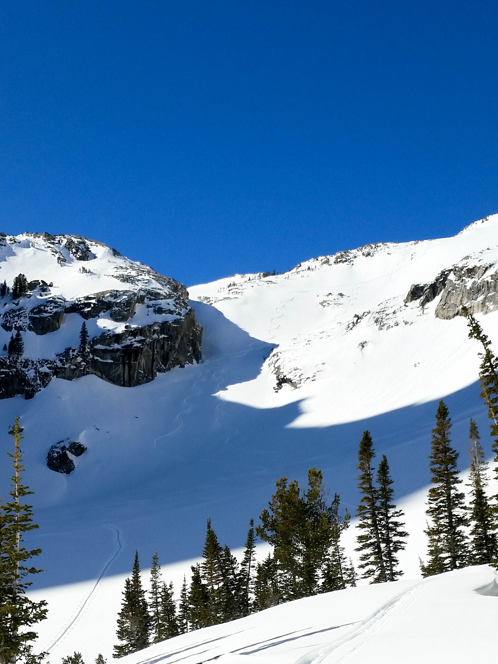
At around 10700 feet, we noticed the snow warming–with the first 2″ noticeably sun affected.  This was a little concerning, but we thought that it was not a major concern, just something to be conscious of on the way down.  The last third of the couloir was waist deep powder with some faceted/surgery snow towards the bottom.  This made the bootpacking difficult, but with four of us, we were able to take turns slogging through the snow until finally we were at the top!  We geared up and talked a little about how we wanted to tackle the line.  We thought that the best move was to be extra cautious and make numerous stops along the way down.  With everyone in agreement, we had ourselves some fun all the way down to the bottom….

IMG_1792IMG_1793IMG_1794

IMG_1796IMG_1800IMG_1803IMG_1804IMG_9528IMG_9515IMG_1815

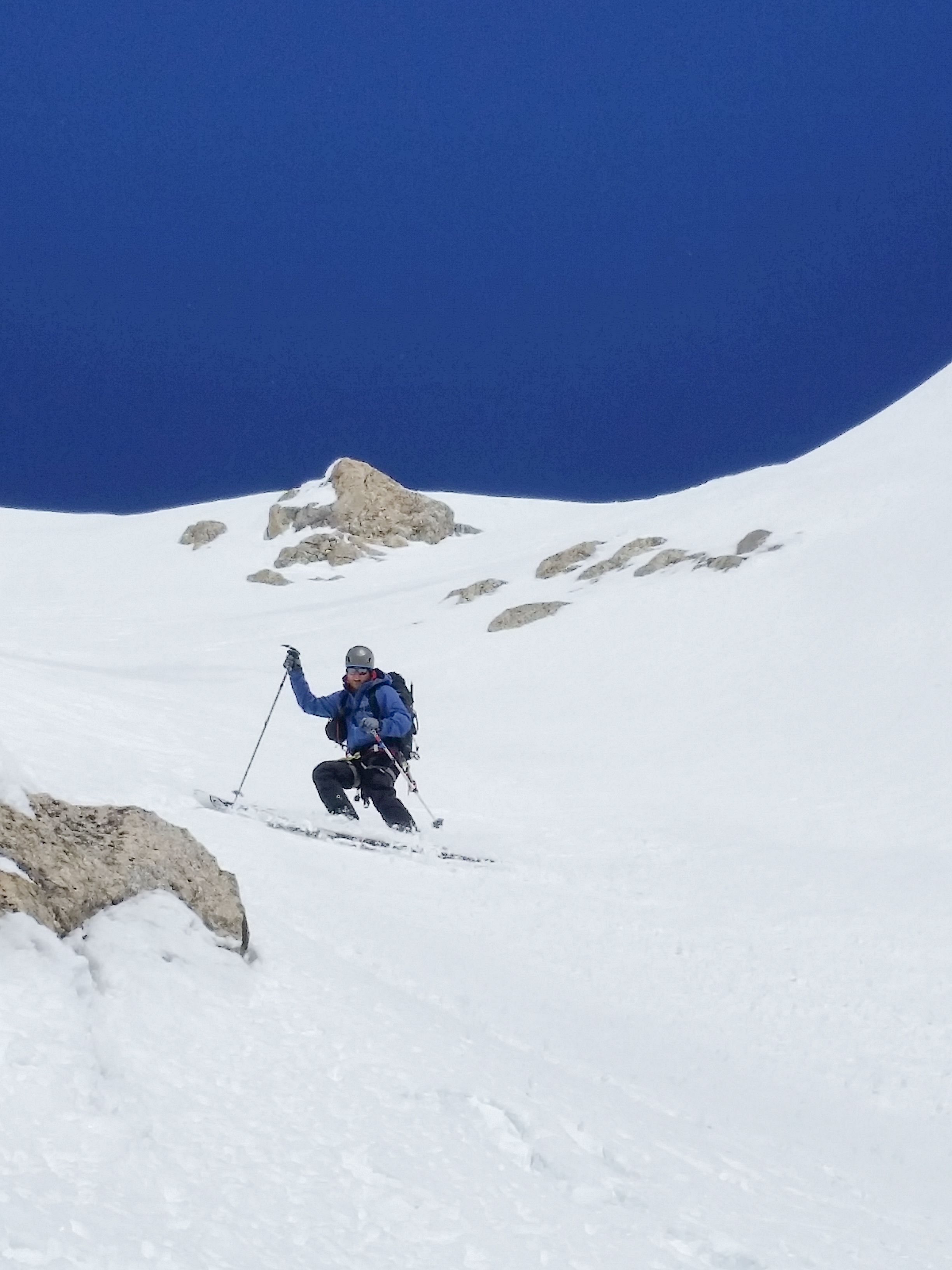
After making it down, we gathered our stashed gear and skied the apron down to the west facing slope we had skied down from earlier.  From here, our plan was to skin up to Shadow and then have a look at the 4 Hour Couloir and possibly ski that.

IMG_1819
Skiing the Apron.
IMG_9547
Skinning up to Shadow col.

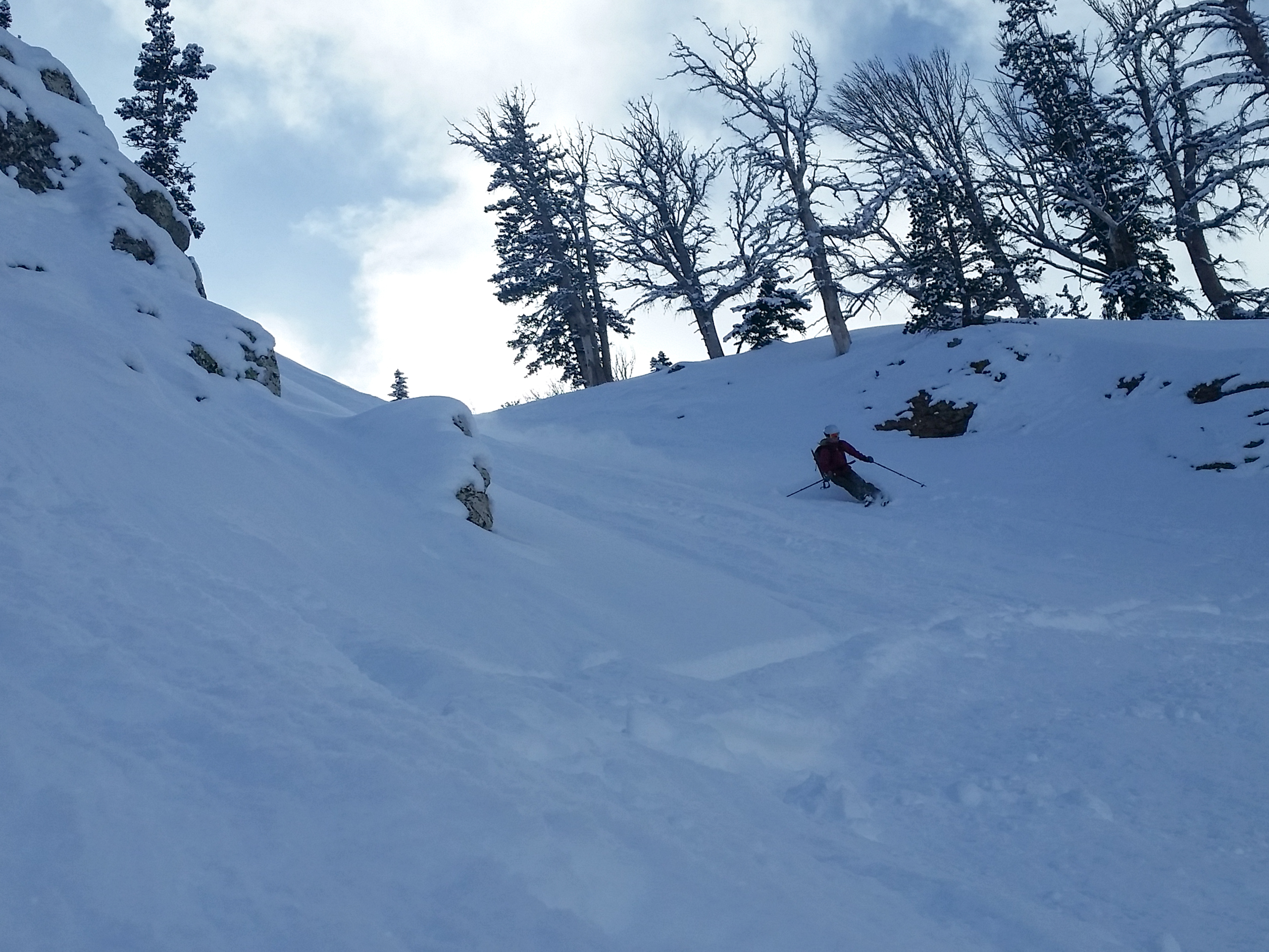
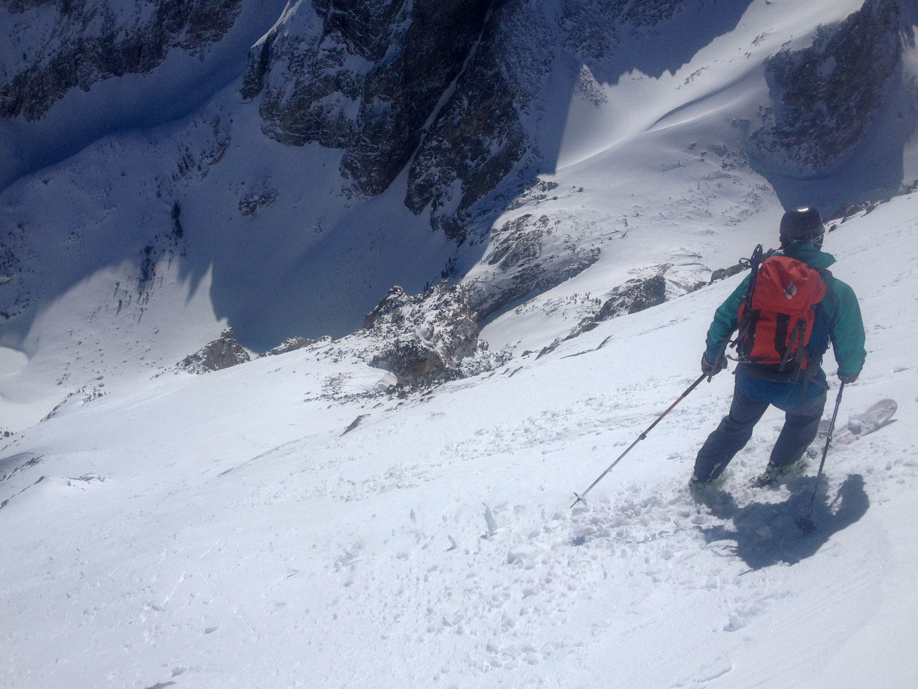
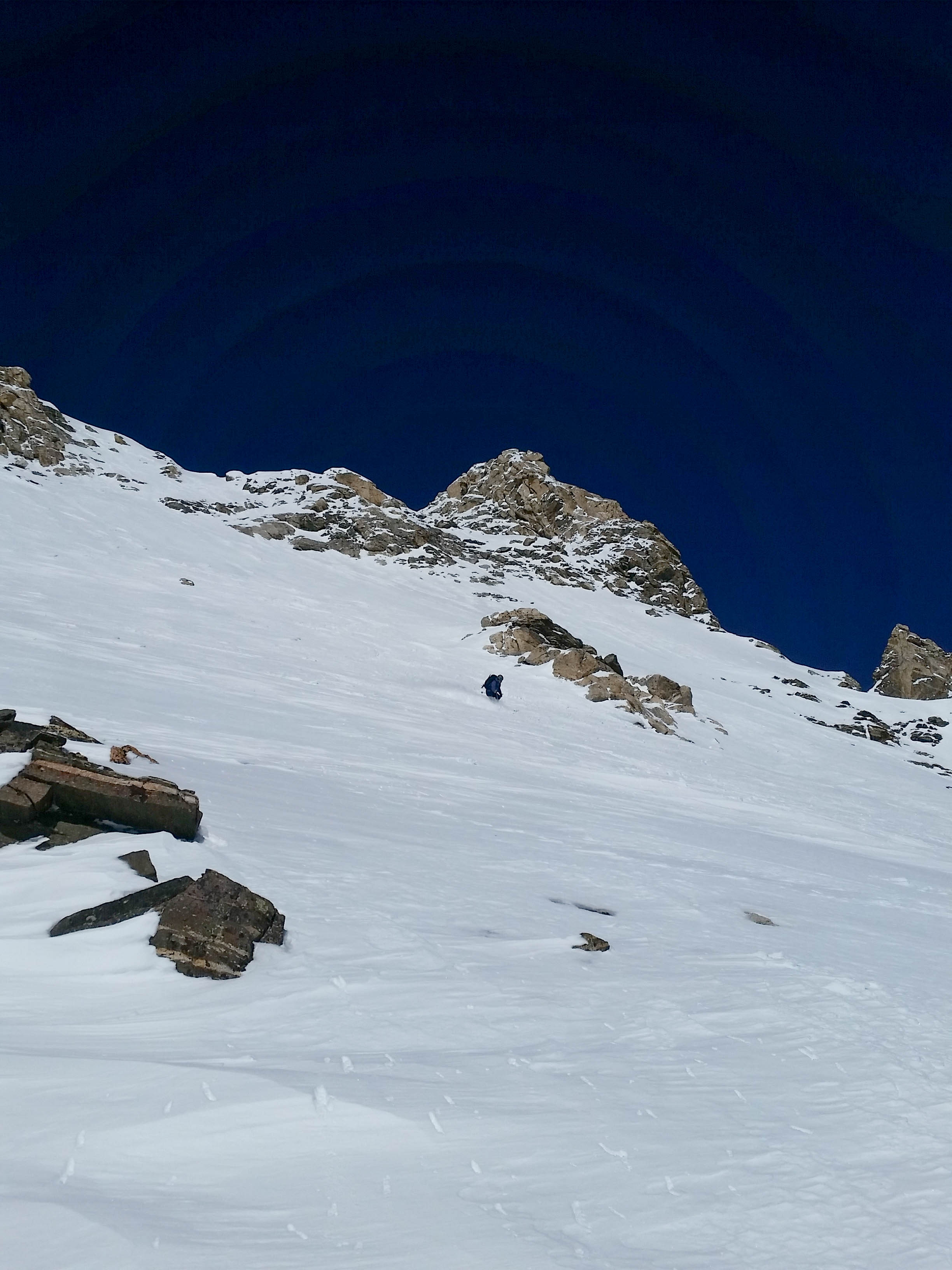
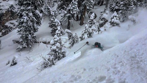
We made quick work of the up and had a break in the sun at the “skiers summit” of Shadow to eat some much needed food and transition to ski mode.  After about 15 minutes, we skied down the fun upper face of Shadow and made our way into the 4 Hour Couloir.  We were a little concerned with the south facing aspect, considering all the warming we had witnessed in the Sliver.  We dug around for a bit, finding numerous areas of concern within the snowpack and after some discussion, decided to bail and ski the north facing trees of Shadow down to the bench.  There were too many concerns for us to feel like we could safely ski the line and figured, the season is just beginning….

IMG_1822

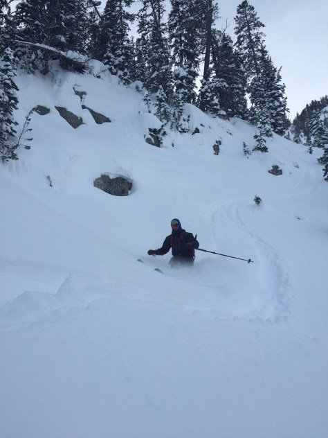
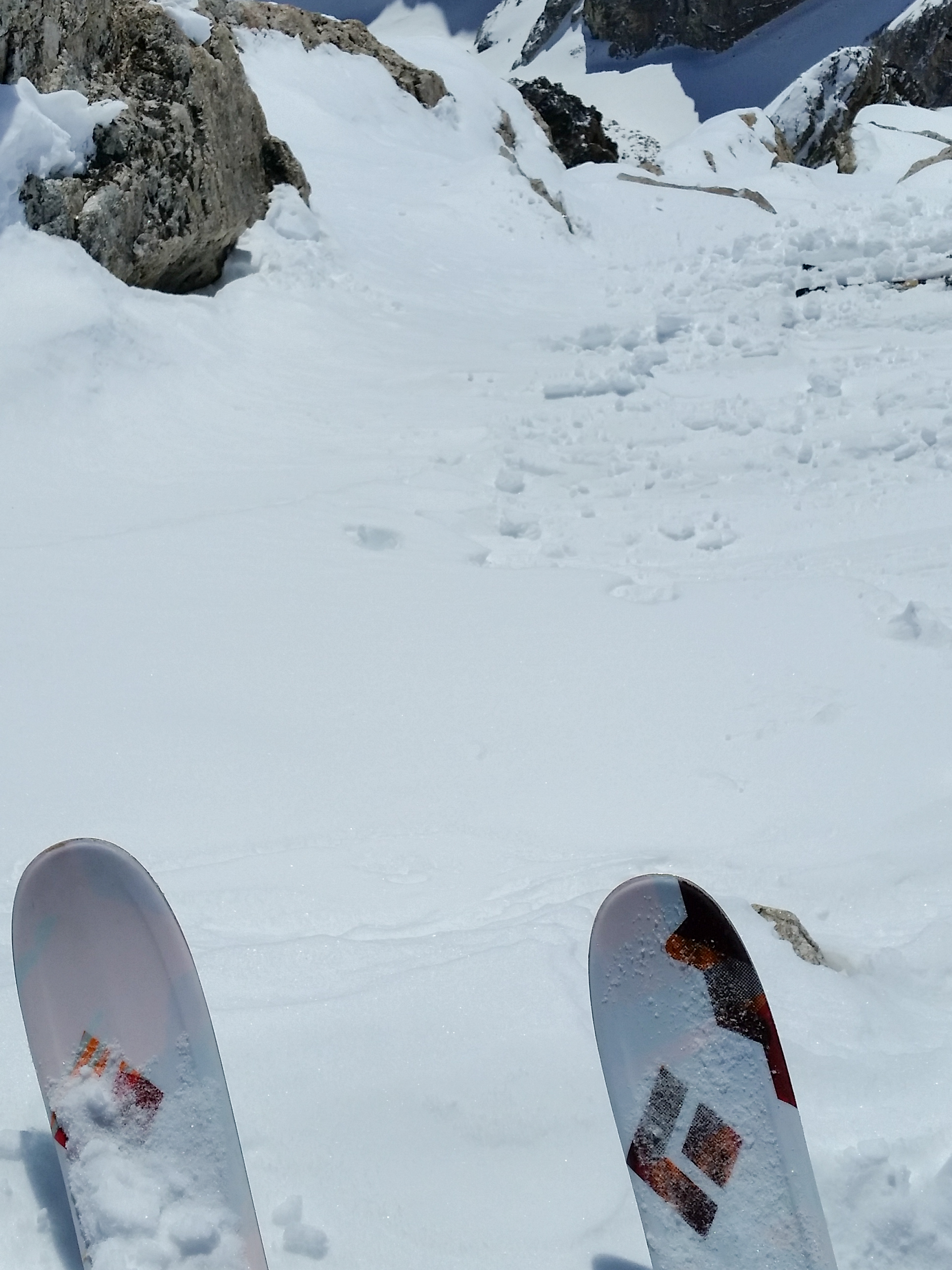
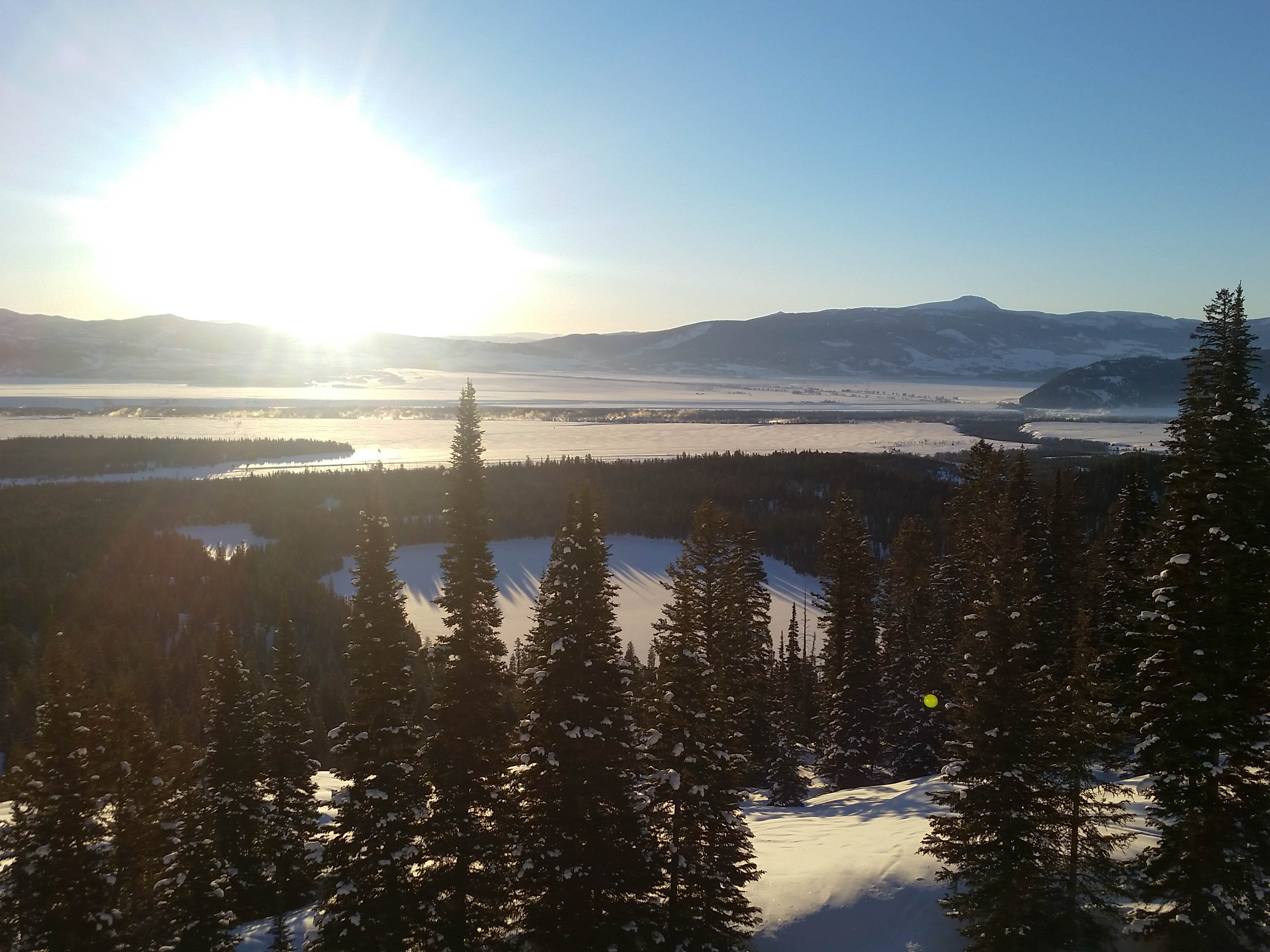
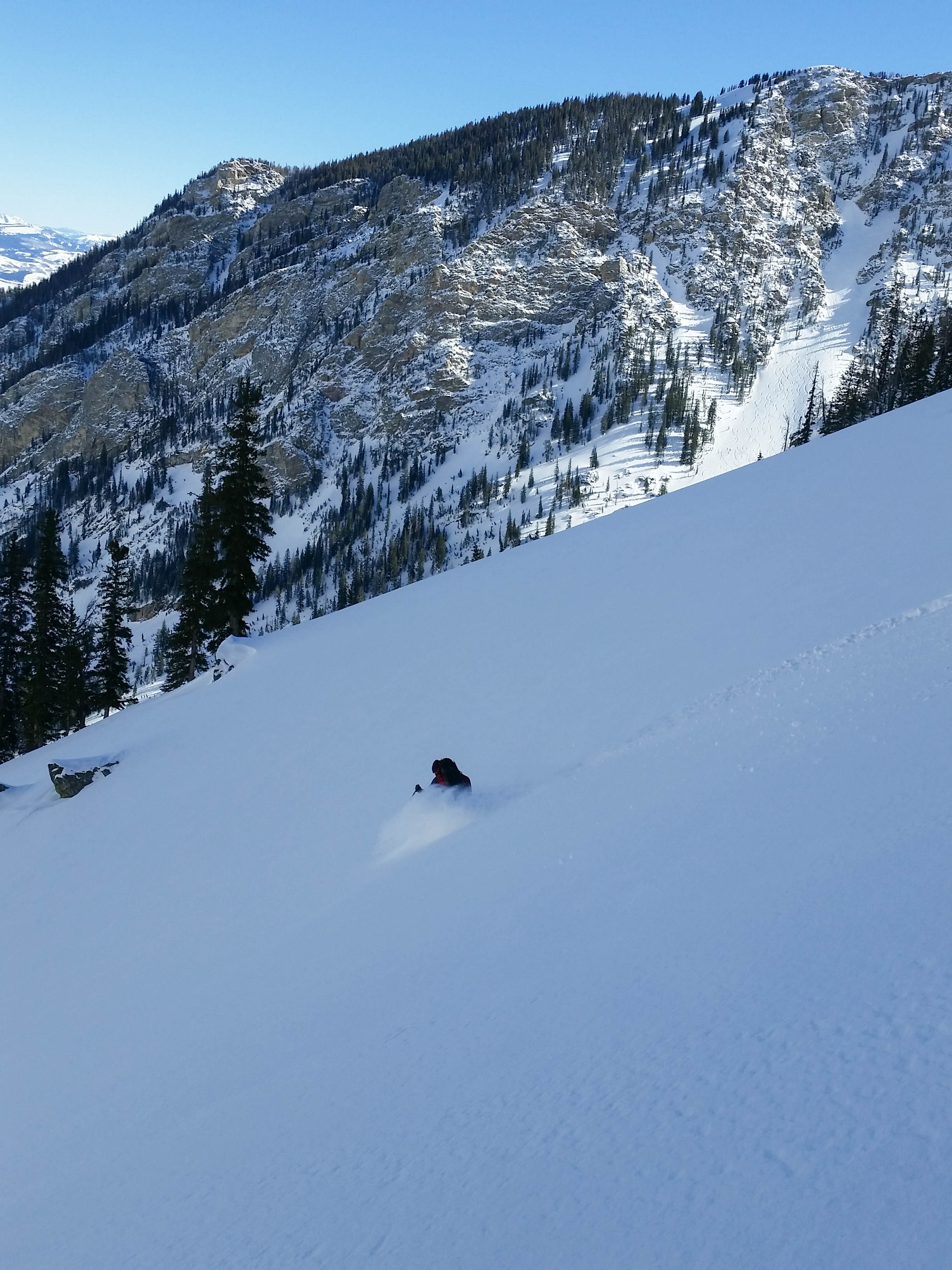
The snow was great throughout this zone and we milked the turns for as long as possible until traversing right (South) to the skin track up Shadow.  We cruised back after gaining the skin track and pulled into the parking lot at 7hr 36min.  For all our poking around, we felt good about the day and great about our ability to ski a fun couloir safely.  More to come very soon!

Google Earth Sliver - Nez Perce
GPS


Grand Teton-Ford/Stettner Couloir

Location: GTNP, Garnet Canyon, Grand Teton, Ford-Stettner Couloir, Teepee Glacier
Elevation, gain/loss: 13,770’, 7,487’ gain/loss
Distance: 16 miles RT
Difficulty: 5 stars
Time:  5 hours (Seriously!) – 18 hours

Trip Report:

Date: 3/10/2015
Snow Conditions: Sun affected powder, mild sun/wind crust, “corn” snow down low.

Ever since Bill Briggs became the first person to ski The Grand Teton over 40 years ago, it has been an achievement for any aspiring ski mountaineer.  My brother Dane and I have climbed it a handful of times, a couple in winter conditions, but never felt comfortable with the ice climbing needed to tackle the ski.  With the weather around Jackson continuing to be seasonally warm and the snowpack well bonded after last weeks small storm, we were motivated by Tristan to get out and tackle the “standard” route off the Grand, the Ford/Stettner Couloir.  Tristan reasoned that despite our limited ice skills, all you had to do was, “climb up and ski down”.  This proved to be the push needed and we settled on Tuesday for the attempt.

The weather for the day called for temps around 30 degrees in the mountains, with sunshine and mild wind, so we decided an alpine start was needed.  We were skinning from Bradley/Taggart under moonlight at 1:20am in mild temperatures.  The conditions were firm on the up into Garnet Canyon and once again I was swearing that I have yet to buy ski crampons.  After 2 hours, we were in the Meadows and staring into an eerie canyon dimly lit by the moon.  We decided to boot pack to the left of Spaulding Falls instead of following the “summer trail”, because I think it is faster (but could be wrong).  After climbing above the steep face, we put our skis back on and skinned up, into Teepee Glacier.

Early morning walk.
Early morning walk.
Teepee Glacier in the early morning.
Teepee Glacier in the moonlight.

Here, we saw another party about 500′ above us working their way towards Teepee Col.  I knew the guys in the group, having chatted with them about our plan the day before and so far everything was going as discussed.  They had planned on skiing the Grand before we settled on it and we were going to let them make first turns down if we all made it to the top.  So we worked our way up the steep Teepee Glacier, eventually topping out on Teepee Col as the sun started to rise.

Climbing in the early morning.

The other group had decided to wait at Glencoe Col for some warming rays and were shouting for us to join them.  We worked our way across the Death Couloir/Couloir to Nowhere that links up Teepee and Glencoe Col and met up with the other party.  The wind was howling here and we immediately regretted not gearing up at Teepee Col as we had planned. Tristan, Dane and I started to get ready as the sun began to rise, hoping it could warm us a little.

Sunrise behind Teepee Pillar.
Tristan gearing up, with his blackcrows soaking in the sun.
Panorama from Glencoe Col. (photo: Dane Etter-Garrette)

The other group had left for the Stettner by now.  We hydrated a little and tried to give the group a head start.  Eventually, it got too cold to wait any longer and started down from Glencoe Col to the start of the Stettner Couloir.  We worked our way up the couloir and over a mild pinch/ice bulge 100 yards up the Stettner.

Dane working his way up the Stettner.
Up at the pinch in Stettner Couloir. (photo: Dane Etter-Garrette)
Working past the small bulge in the bottom of the Stettner.

After that, we waited at the start of the Chevy (darts up to the left around 200 yards up the Stettner) for the other group to climb through the two bugles.  We waited here for a bit, getting very cold, but ready to begin climbing the moment we could.  Eventually the group cleared out and we worked our way to the belay station to tackle the ice bulges.  We were all interested in taking the lead, but in the end Dane decided to take the sharp-end.  He made quick work of the climbing, placing one nut between the two ice bulges on the right and one 16cm screw in the upper ice bulge.

Dane at the upper ice bulge in the Chevy.
About to make the move up the bulge.

Feeling comfortable with the ice and wanting to make up some time, Tristen and I simul-climbed the pitch as Dane belayed us from above.  We made it up to the anchor and quickly decided to simul-climb out of the Chevy and into the Ford.

Climbing out of the Chevy, in the Ford.
Climbing out of the Chevy.
Simul.
Simul.

We found a nice spot to delayer/drop some gear near an anchor at the bottom of the Ford Couloir and got ready for the last 1000′ of boot packing.  We were a little behind schedule, so set a turnaround time of 1pm and pushed towards the top. Right after beginning the bootpack, we saw the group ahead of us down climbing the Ford.  We worked our way up to them and asked what was up.  They said they didn’t feel 100% comfortable with the conditions and were going to bail.  We were disappointed for them, but didn’t have much time to waste.  The sun was warming the snow a bit and we knew the window was closing on our day if we didn’t hurry.  We cruised up the Ford in no time and quickly found ourselves on the East Face of the Grand, working our way through warm, soft snow.  We finally reached the summit block at 12:35pm, just over 11hrs from leaving the truck.

Working our way up the Ford, near the East Face.
Almost there.
Almost there.
Summit Vibes.
Summit Vibes.
USGS Marker, Grand Teton 13775'
USGS Marker, Grand Teton 13,775′
Summit. (photo: Dane Etter-Garrette)

Not having a bunch of time at the top of the Grand is something I’m used to, but I barely had time to snap a few pictures before we were starting down towards the East Face.  We didn’t want to risk the snow warming anymore than it already had. Unlike other objectives, once done skiing, you are still in harms way until you exit the Stettner after numerous rappels.  With this in mind, we skied down from the summit and worked our way onto the East Face.  We felt good about the snow, but you never really know until you get onto the face.  Dane made a few tentative turns up high and then took it all the way down to the lower entry into the Ford.  The snow was surprisingly good on the East Face, with the sun warming the surface just enough to create some early season “corn”.  We all had a blast skiing the East Face, which is a feeling not many will ever have.

Skiing onto the East Face.
Skiing onto the East Face, looks a little intimidating.
The Black Diamond Carbon Justice skis handled the Grand with ease.
First turns off the Grand.
Tristan, waiting his turn.
Dane, in the distance at the entrance of the Ford.
Dane, in the distance at the entrance of the Ford Couloir.
Grand turns.
Grand turns.
East Face of Grand Teton. (photo: Dane Etter-Garrette)
All smiles for this turd.

The Ford proved to be as much fun as the East Face, if possible, even a little more spicy.  The 50 degree couloir ends in a 1000′ cliff, so each turn was made with care.  We found good snow on the skiers right side of the couloir, some smooth firm snow on the left and made it down safely to the spot we stored our gear earlier.

Tristan, making turns down the Ford.
Making my way down the Ford. (photo: Dane Etter-Garrette)
Dane, navigating down the middle portion of couloir.

We discussed rappelling into the Chevy from the  anchors on the skiers right, at the bottom of the Ford, but decided to ski down a little lower to the first anchors in the Chevy.  This slope was steep and very exposed, so we skied it gingerly and eventually got to the anchors, quickly getting ready for the rappels through the Chevy and Stettner.  We rappelled twice in the Chevy and dug our an anchor on the lookers right of the Stettner below the entrance of the Chevy for our final rappel (definitely could have down climbed this portion).  We were happy to have brought two 60m ropes for the day, allowing us to get out of harms way as soon as possible.

Dane, working his way into the Chevy towards the anchors on the right.
Rappel #1.
Rappel #1.
Dane was pumped.
Dane was pumped.
Rappel #2.
Rappel #2.
Rappel #3. (photo: Dane Etter-Garrette)
Tristan and Dane coiling the rope below Rappel #3 towards the bottom of the Stettner.

After making it down, we quickly made our way out of the Stettner and over to Glencoe Col.  We gathered our skins, etc and got ready for the 5000′ ski down to the truck.  We worked our way over to Teepee Col and made some fun turns down Teepee Glacier, eventually making our way down Garnet Canyon.

Skiing Teepee Glacier. (photo: Dane Etter-Garrette)
Teepee Glacier.
Teepee Glacier.

At this point we were exhausted, dehydrated and only wanted to make it down safe.  The snow was decent all the way down, but that was just icing on the cake for us.  We made quick work of the out from Bradley Lake and pulled into the Trailhead at 4:25pm, 15 hours after we had started in the moonlight.  We were tired, but all felt great about what we had just accomplished.  We rested our tired feet and had a few sodas, staring up at the Grand and the run we had just skied.  It wasn’t long after that we started hatching plans for the next adventure in the park.

The Grand Teton.
The Grand Teton.

Spoon Couloir – Disappointment Peak

Location: GTNP, Disappointment Peak, Glacier Gulch
Tags: Backcountry Skiing, Ski Mountaineering
Elevation, Gain/Loss: 11,357’, 5,075’ gain/loss
Distance: 11 miles RT
Difficulty: 3 stars
Time: 5-7 hours

Trip Report:

Date: 2/28/2015
Snow Condition: Powder, Mild breakable crust down low (below 7800′), but mainly powder with a slight bottom on SE facing slopes.

Took a little weekend trip up the Spoon Couloir with Zelie to check out the snow and get her into an area she had not skied this past Saturday.  The Spoon Couloir is a nice test piece for those looking to graduate from the smaller lower faces to more committing lines, without really scaring yourself.  It also offers some great views of the surrounding mountains and some pretty fantastic “face skiing”.  I have been up the Spoon a few different times, writing my first trip report about it, and must say I do like skiing this couloir a lot.  It is: relatively easy to get to, the East Face of Disappointment is a blast, the couloir is steep and you have numerous ski options once you get to Amphitheater Lake.  That being said…this was the best skiing I have had in the couloir to date.

We left Bradley/Taggart at a casual 9:45am and cruised over to the Disappointment Peak skin track.  Making it up to Amphitheater in a little over 3 hours (the skin track was pretty awful), we could see two groups of 2 going up the couloir.  Now, it’s always a bummer to not get first tracks, but considering the time we left and that it was the weekend, I couldn’t really be disappointed.

Morning sun from above Bradley Lake.
The Spoon from Amphitheater Lake.
The Spoon from Amphitheater Lake, with the last group of two topping out.

We slowly worked our way up to the start of the climb, hoping that the two groups would make quick work of the East Face and ski through before we got to the transition point.  Unfortunately, this did not happen.  We changed over to boot pack mode and waited 15 minutes in the shade, assuming that the skiers ahead of us would be coming down any minute.  Finally, we got cold and decided that the snow conditions did not warrant that we wait until the couloir was “open”, even if it may “taint” someones skiing zen.  As we predicted, about 2 minutes into the climb – the first group came skiing through.  We moved to the side and said hello as they skied through.  I asked if the second group was going to be coming down soon and the skier said it looked like they were about to ski.  So we worked our way up keeping an ear above for the remaining group, but didn’t see them until we hit the East Face.  They said hello and we continued to work our way up the face, wondering what had taken them so long, but not really concerned with it.

Working on the up. (Zelie really wanted to use the ice axe she brought, so she did)

It was getting a little late, so the summit of Disappointment was not in the cards for the day, but we climbed until it turned rocky and got ready for the ski.  With the temperature just right and the wind calm, we soaked in some rays and took in the views from this beautiful perch in the park.

West Hourglass Couloir.
Beautiful. (photo: Zelie)

After a short while, we decided to do what we came to do….ski some powder and took it down the East Face.

Making some turns on the East Face. (photo: Zelie)
Dreamy.
Dreamy.
Powdah.
Powdah skiing.

After skiing the face, we worked our way down to the entrance of the couloir.  Based on the snow conditions, I opted to enter from the middle, over the rollover, while Zelie came in from the right.  The few steep turns I got in this section were definitely the best of the day and I had a blast skiing into the Spoon from the top!

Deep turns in the Spoon Couloir.
Deep turns in the Spoon Couloir. (photo: Zelie)

I pulled out about 300′ down on the right and let Zelie ski the entire couloir in one push.  The snow was deep and stable, not sluffing or moving at all the entire time we were in the chute.

Zelie making some turns in the upper section.
Finding the goods. (photo: Zelie)

After making it through the couloir, we made some powder turns down to Amphitheater Lake.  After crossing the lake, we contoured left to a little shot that drops you into Delta Lake and Glacier Gulch.  I am not sure if it has a broname, but I have looked at it a few times while crossing the Delta Lake and thought it would be a fun variation to the run.  The snow in this north facing chute was great and we milked the turns all the way down to Delta Lake.

Pretty setting for a ski.
Zelie, in her element.
Little skier below a huge rock wall.

From here, we worked our way down Glacier Gulch, finding some good snow, but also noticing it change over to a breakable crust around 7800′.  Instead of traversing right to Bradley Lake like I have always done, we decided to check out the out from Glacier Gulch for a change.  This proved to take a lot more time and effort then traversing, but I suppose if the conditions are right you can get another 800′ of skiing, which might be worth the extra effort.  Regardless, we skated back on the groomed Teton Park Road and back to the truck in around 7 hours.  It was an excellent day and great opportunity to get the lady into a zone she had not skied.  It also was an opportunity for me to scout the conditions for a trip that I was planning to the northern end of the park.  More on that later…..

Amor a Vida Couloir

Location: GTNP, Garnet Canyon, South Teton, Amor a Vida Couloir
Elevation: Gain/Loss: 12,514’, 6,360’ gain/loss
Distance: 15 miles RT
Difficulty: 4 stars
Time:  7-9 hours

Trip Report:

Date: 02/23/2015
Snow Conditions: Powder, sun crust, warm/dense snow, wind crust

With a small storming dropping a few inches on us recently and a weather window opening, Dane and I decided to tackle a larger line off the South Teton.  Amor a Vida, meaning Love Life in Spanish, is a beautiful couloir off of the South Teton.  I had booted up it a few years back, but with warming temperatures that day, did not connect the South Face of the South Teton to the couloir.  Dane and I got an early start, leaving Bradley-Taggart around 6:20am and made quick work of the skin into the Meadows.

Tetons.
Tetons.
Not a bad way to start the day.
The Middle, watching over Garnet Canyon.

We worked our way up to the left and into the South Fork of Garnet Canyon, very surprised that the track was in great shape and the wind was calm.  As we came up below the Ellingwood and Chouinard Couloirs, we noticed a few guys slowly making progress up the Ellingwood.  The snow looked deep, so we were hopeful that pour couloir was holding some similar snow.

Chouinard (left) and Ellingwood (right) Couloirs off the Middle Teton.
A look down Garnet Canyon.

We proceeded up canyon, making our way through the mine field of rocks that litter the South Fork.  There is enough coverage to skin through this section, which is great, but you have to be careful with each step.  We found ourselves below the North Face of the South Teton, with a ramp of snow leading us towards the ridge and the Northwest Couloir.

Dane, working his way up to the Northwest Couloir.
Dane, working his way up to the ridge and the Northwest Couloir.

Just below the ridge, we switched over to bootpack mode and quickly gained the ridge and made our way into the Northwest Couloir.  The snow was pretty consolidated, which made for a relatively easy climb up.

Dane, starting up the Northwest Couloir.
Almost into to the top. (photo: Dane Etter-Garrette)
Almost to the top. (photo: Dane Etter-Garrette)

Once out of the couloir, we were greeted with sunshine and a calm day in the high alpine.  We still had about 100′ of climbing until we were at the summit, but were excited to be in the sun.  We made our way through some deep snow and over a few rocks, until we were standing on top of the South Teton.  The weather was perfect and we both felt great about the climb and ski ahead.

The Middle and Grand.
Mount Wister with Veiled Peak on the right.
Mount Wister, with Veiled Peak on the right and the North Face of Buck in the background.
Snowfield, skiers left of the summit (funnels into Southeast Couloir).

We geared up and discussed our options for getting to the South Face.  Dane had skied the Southeast Couloir last year and thought that we could ski the snowfield directly left of the summit down and then cut hard right to get onto the South Face.  We skied two turns down the snowfield to get a look and determined that the coverage was a little low for that entry onto the South Face.  We made our way back up to the summit and to the right of a rock bulge separating the snowfield and a scree field that lead to the South Face.  After making our way through the snow covered scree, we got a good look at the South Face and the lower entry to the Southeast Couloir.

A look into the Southeast Couloir.  It doesn't look to go through right now.
A look into the Southeast Couloir. It doesn’t look to go through right now.

The South Face looked skiable, but we could tell that the snow was going to be varied; sun crust, wind crust, breakable crust, and powder.  Dane skied onto the face and tested out the steep upper pitch with a quick ski cut, then made his way through some rock bands to a safe spot on the right.

First turns on the South Face.
Pretty.
“You’ve got a pretty face.”
Making my way through the upper rock bands (photo: Dane Etter-Garrette)

From here, we made some fun pow turns down the face and towards the entry to Amor a Vida.  Even with the avalanche danger low, the exposure (1000′ cliff) below the South Face makes you focus on your every move.

Staring down the South Face.
Staring down the South Face.  The entry to Amor a Vida is the first large rock outcropping on the right of the South Face. (photo: Dane Etter-Garrette)
Dane, making is way to the entry of Amora Vida.
Dane, making his way to the entry of Amor a Vida.
Glad to be off the South Face.
Decent snow on the South Face.

We got to the entry, but had to double check that it was in fact the Amor a Vida Couloir.  After a quick check, we confirmed that we were in the right spot and worked our way down the rock filled entry.

The entry into the Amora Vida Couloir.
The entry into the Amor a Vida Couloir.

Once into the couloir, we tried to get a look at the tight upper section of the couloir proper (skiers left).  It looked like it went, but was barely a ski length wide, so we opted to cross right over a few rock bands and approach the couloir from the snowfields.  This exposed us to large hanging snowfields above, but we felt pretty good about the snow and quickly worked our way down through the rock bands.

Dane, cutting across and down the upper snowfield of the Amora Vida.
Dane, cutting across and down the upper snowfield of the Amor a Vida.

From here, we worked our way down and to our left into the main path of the couloir.  Amor a Vida is one of the most amazing couloirs in the Tetons, with massive overhanging rock walls, a great pitch and some fun skiing.  We had a blast getting down the run, taking it in numerous sections to ensure we were taking it all in.  The couloir was predominately powder in the main path, with a few pockets of crust, but overall it was amazing skiing!

Working down into the main path of the Amora Vida.
Working our way down to the left, into the main path of the Amor a Vida.
The Amora Vida was skiing good!
The Amor a Vida was skiing good!
Beautiful couloir. (photo: Dane Etter-Garrette)
Slash.
Slash.
Dane, towards the middle of Amora Vida.
Dane, towards the middle of the couloir.
Making my way down.. (photo: Dane Etter-Garrette)
Dane, nearing the bottom of the couloir.

After making it down the 1600′ couloir safe, we still had about 2500′ of skiing until we hit the Avalanche Canyon traverse.  We milked the turns and were just pumped to have skied such a fun run.  We made it back to the trailhead in 8hrs and were already looking forward to more adventures in this special place we call home.

Amora Vida Couloir
Amor a Vida Couloir
South Face of the South Teton.

2015-02-23 13.35.24 2015-02-23 13.51.59 2015-02-23 13.52.00

Skiing out Avalanche Canyon.

Turkey Chute, hacked!

West Hourglass

IMG_5165
The Dawn of pow

Location: GTNP, Garnet Canyon, Nez Perce, West Hourglass Couloir
Elevation, gain/loss: 11,132’, 5,287’ gain/loss
Distance: 8 miles RT
Difficulty: 3 stars
Time:  6-7 hours

Trip Report:

Date: 02/20/2015
Snow Conditions: Powder, some sun crust under 6″-10″ of new light density snow.

The return of snow! The feeling of fresh snow returned to us on Friday with the onslaught of fresh snow falling on the Tetons once again. Tristan and I decided last Thursday night to head into the park to try and get some powder turns and a little storm skiing. Leaving the trailhead at 7am we cruised up into the Meadows area in around 2 hours.

IMG_5169
It’s Snowing!
IMG_5180
Tristan and a view of the lower section of the West and East Hourglass

Working our way through the Meadows and into the apron of West and East Hourglass, we made good progress through the spitting snow. There was a persistent crust and some wind packed rollers that became very slick with the new snow. On the way down this made for some interesting / tentative skiing. Switching over to the boot pack, we opted for crampons and soon were knee to waist deep in newly deposited snow in the lower half of the West Hourglass.

IMG_5184
Lower section
IMG_5190
Almost to the top

The middle and top sections were a bit rocky, but to the skiers left, there was plenty of snow for some good skiing. We were happy to be dropping into a storm filled couloir once again. It was a great climb up, and with the return of snow and wind we felt lucky to be there.

IMG_5197
Dropping in!
IMG_5217
Skiing the pow

On the lower section, right at the roll over, I managed to kick off a small soft slap that went roughly 400 feet down into the apron. I had plenty of speed to ski off to the right and get out of the way. It was a reminder that with only a few inches and the right wind, things can get serious pretty quickly. But we were good and happy.

IMG_5228
Fracture line right below the roll over.
IMG_5242
Back in the white room.