Tag Archives: Nez Perce

West Hourglass – Nez Perce

Location: GTNP, Garnett Canyon, Nez Perce
Elevation: 11,280′, 5,120′ gain/loss
Distance: 15 miles RT
Difficulty: 3+ stars
Time: 7-9 hours

Trip Report:

Date: 1/10/2016
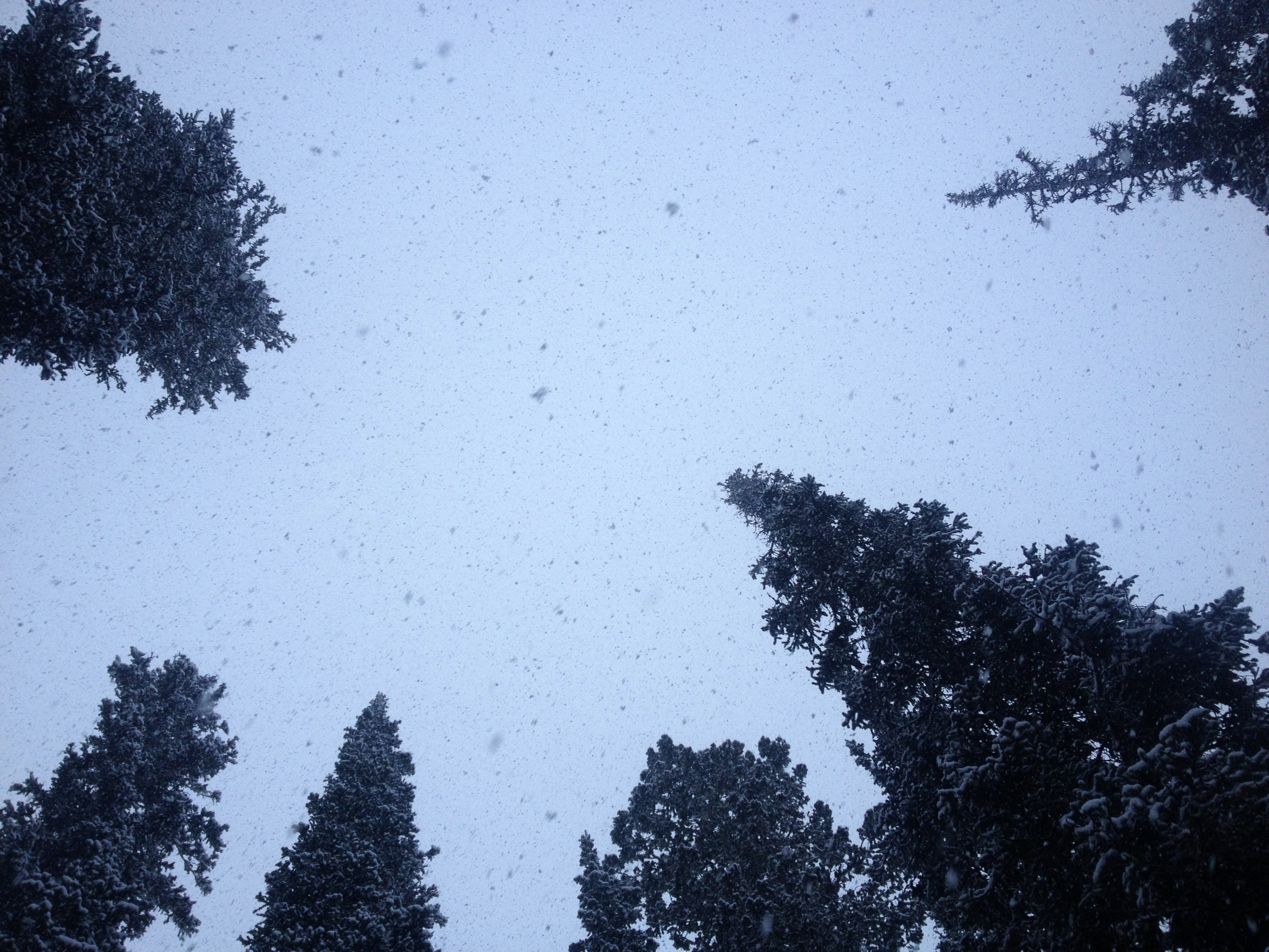
Snow Conditions: Wind crust, caulk, powder, faceted snow, boilerplate crust, breakable wind crust

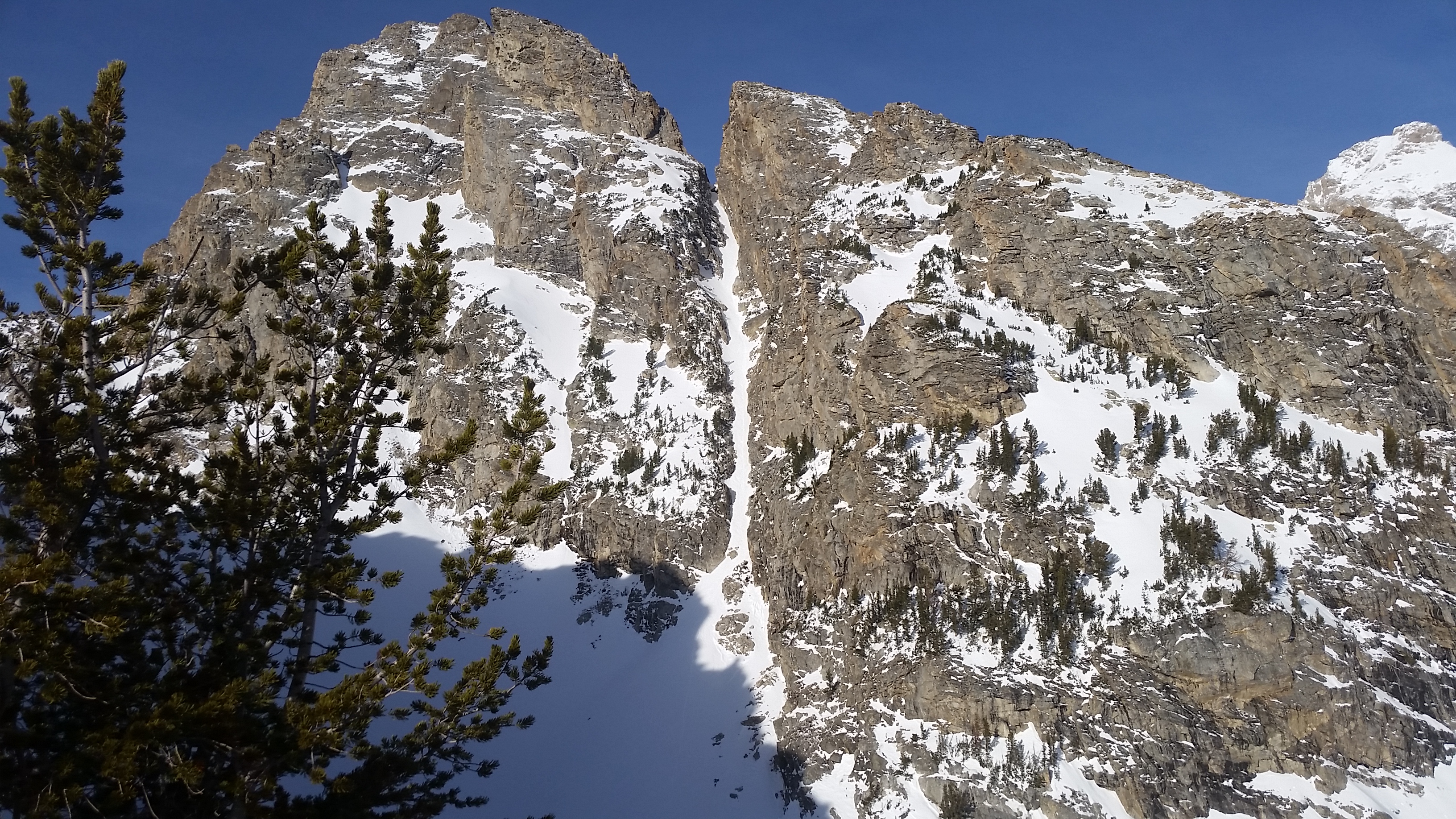
A day after heading up Garnett Canyon to ski The Nugget, I once again was skinning up the canyon for a schuss.  Dane, Zelie, Lexie and I had decided to take a look at West Hourglass off Nez Perce.  I have skied it a couple times, but was hopeful that the conditions would be better than past skis.  It seems to get a lot of wind based on its location in Garnett and is typically wind scoured, but based on the day before, I thought we had a shot for couloir powder.

IMG_1986

IMG_1987

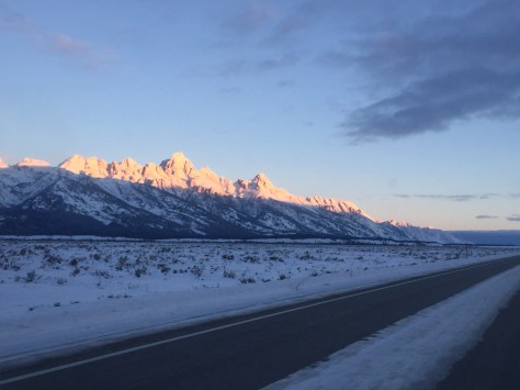
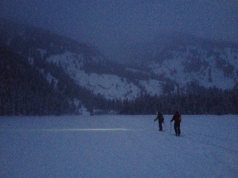
We left Bradley/Taggart at 8:30am and within no time we were in the Meadows where we came upon a group of two skiing down towards us.  They stopped and chatted for a second, saying they bailed on the West Hourglass because of 6″ windslabs and a crust on the lower apron of the run.  We took what they said with a grain of salt and decided to have a look for ourselves.  They beauty of Garnett is that there is always another line you can ski if you decide to bail on your first objective.

IMG_0173

IMG_1990

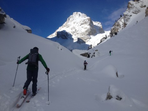
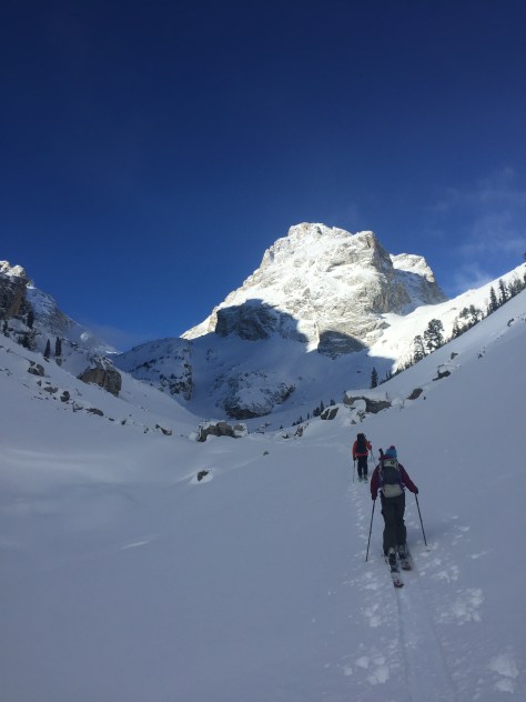
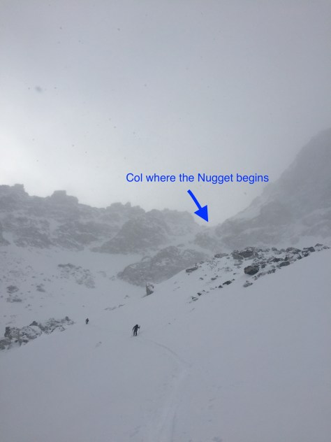
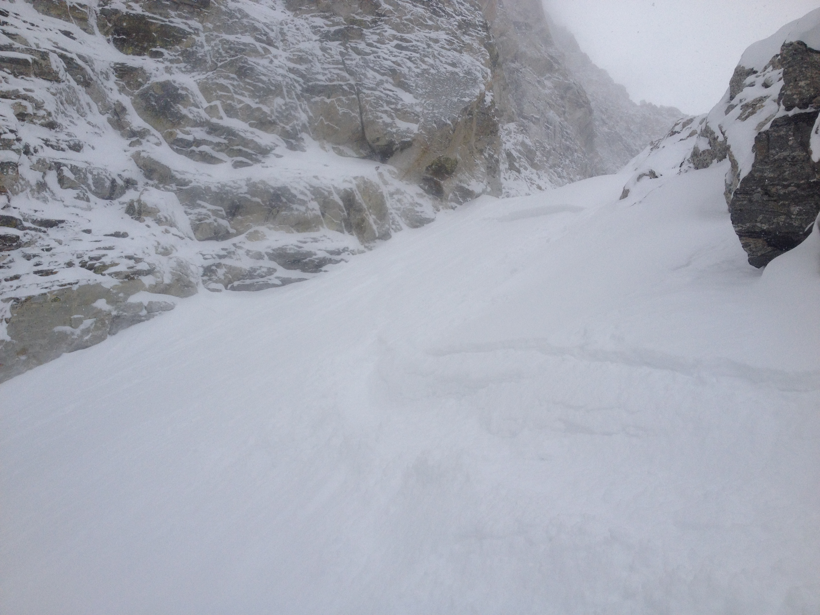
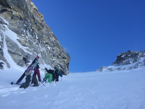
As we worked our way up to the apron of the Hourglasses, we didn’t see the slabs they were talking about, but did notice a pretty solid wind crust.  We decided to continue up and assess the situation as we progressed.  Here, the skinning wasn’t too bad besides a few buff spots and we were at the base of the Hourglasses fairly quickly.

IMG_1995

IMG_1997
East Hourglass looking skiable!

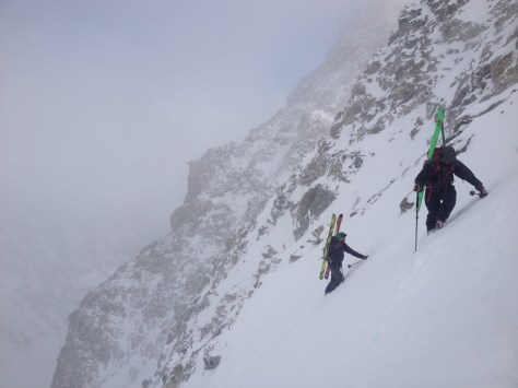
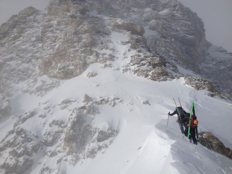
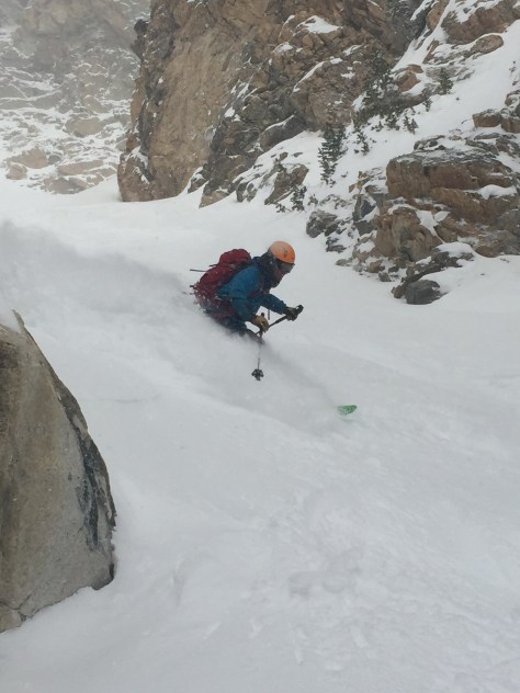
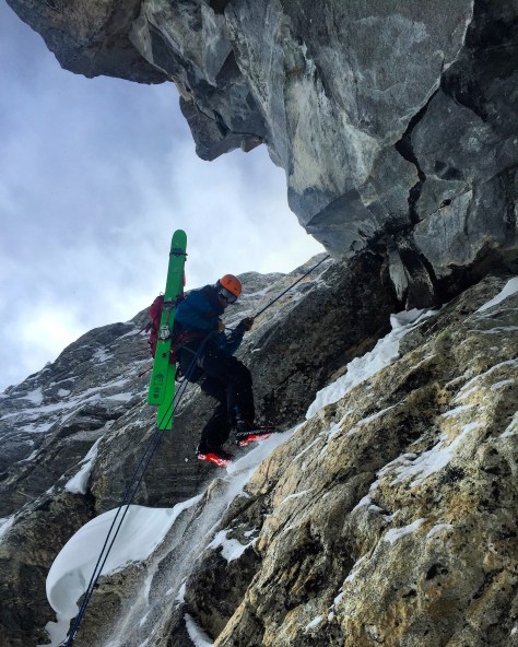
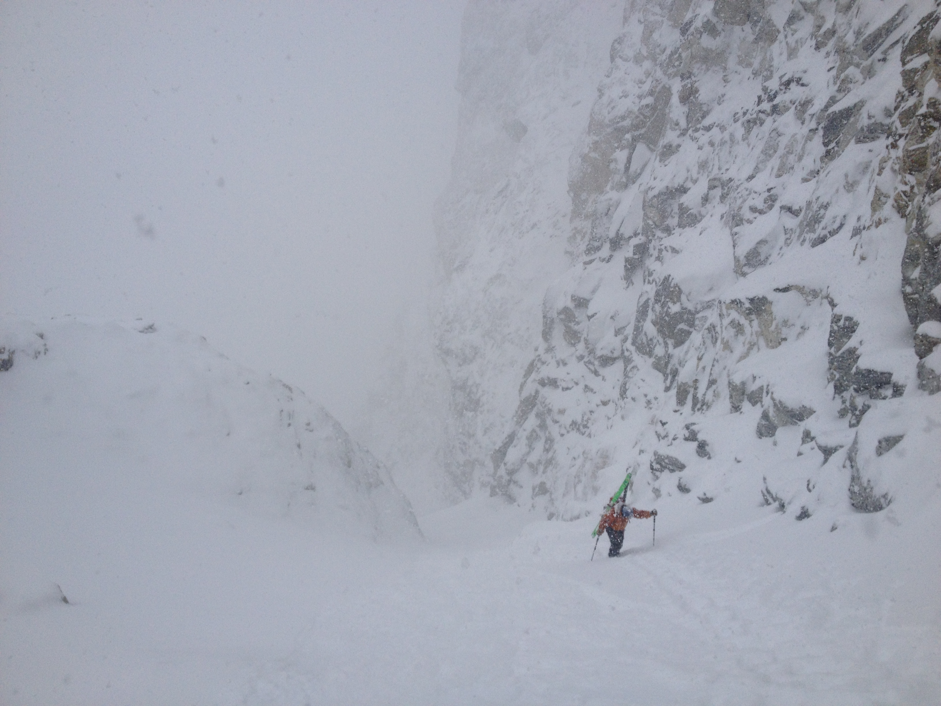
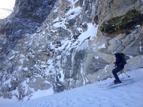
At the base of the West Hourglass, we took our skins off and stashed them near a rock.  When doing this, I lost control of Dane’s rolled skins and they went careening down the apron and out of sight-Oops!  We later found them, but it was a reminder that you never can be too careful with your gear in the mountains.  With that behind us, we started up the initial first pitch.  I would guess it reaches 45 degrees and has a fairly large rollover at the top.  We knew this would be the most dangerous part of the climb and stayed close to each other near the lookers left wall.

IMG_2001
On the up at the first pitch of the couloir

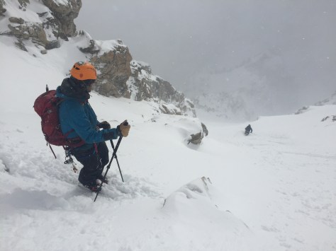
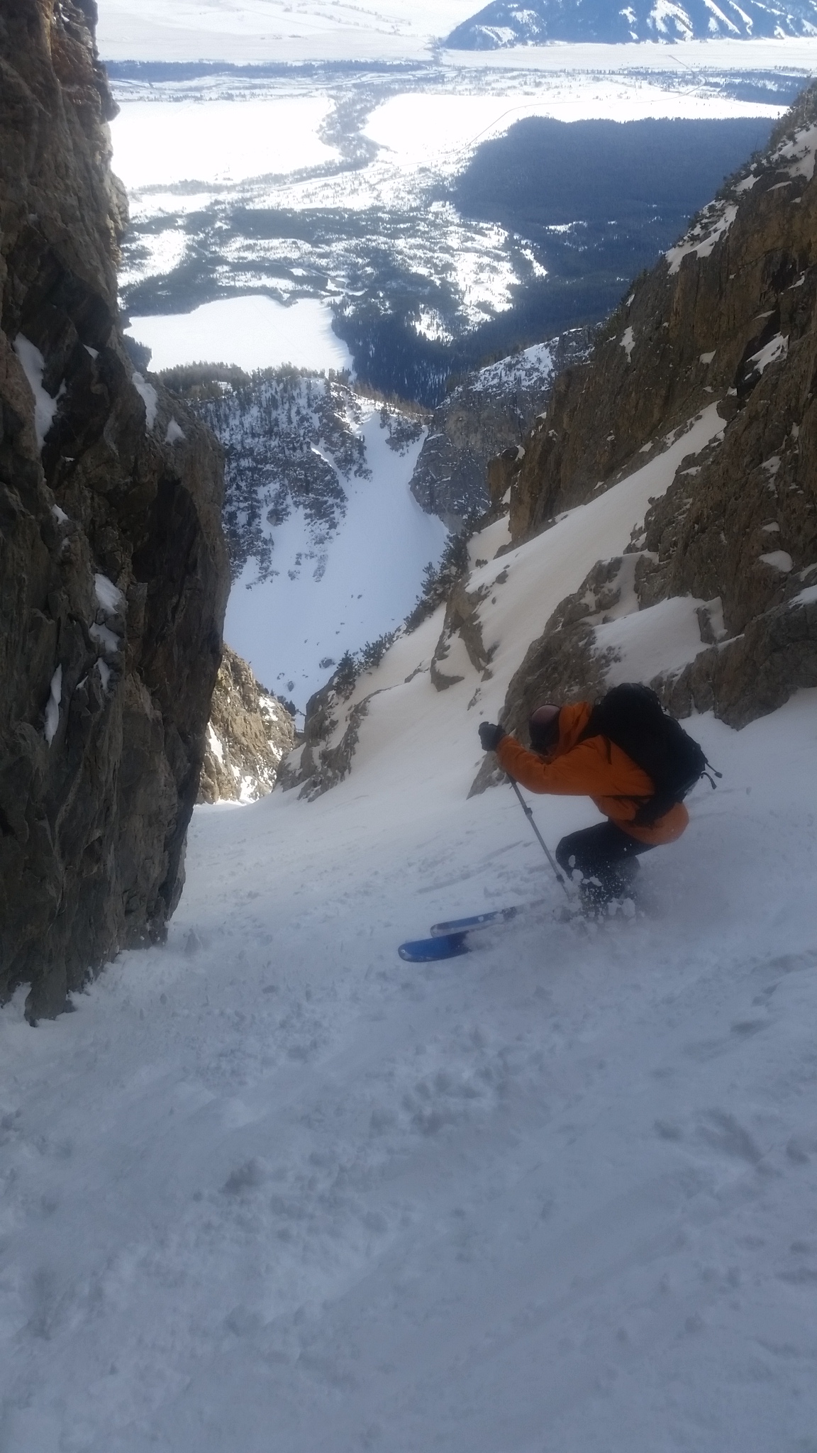
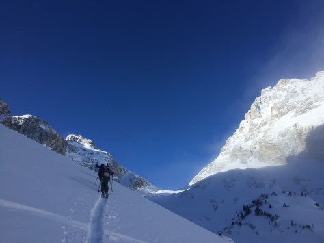
About 100′ from the top of the pitch, Dane tapped out below a safe spot and I continued on solo over the rollover.  It was hard going, but I made it up and over into a safe zone.  The others continued up to me as the wind began to howl, moving snow down the couloir and into the void.

IMG_2005

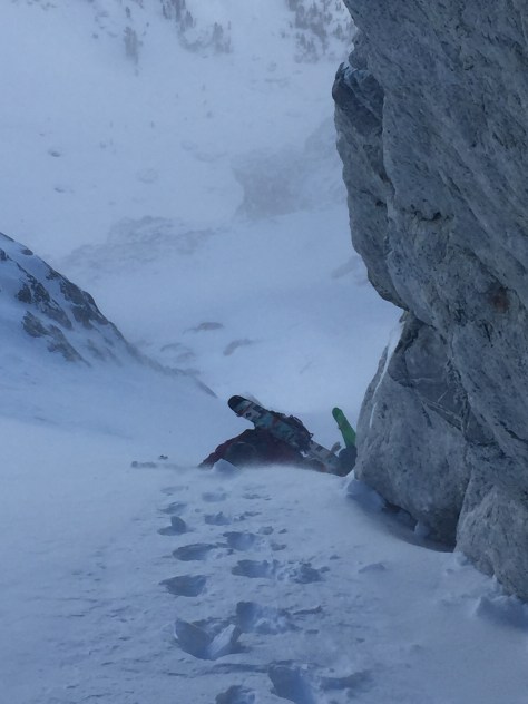
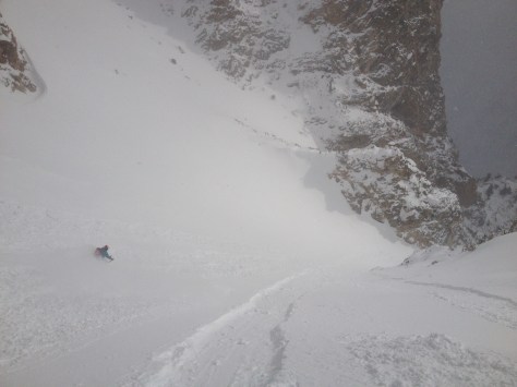
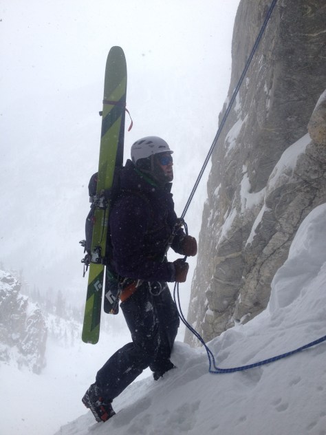
After the group reached my spot, we all took a look up the couloir and saw it was not in great shape.  There was numerous wind ripples in the snow and what appeared to be bulletproof snow throughout much of the middle section.  Regardless, we continued on to the top.  The going was fairly easy, with only the upper section holding deepish snow.

IMG_0192
Nearing the top

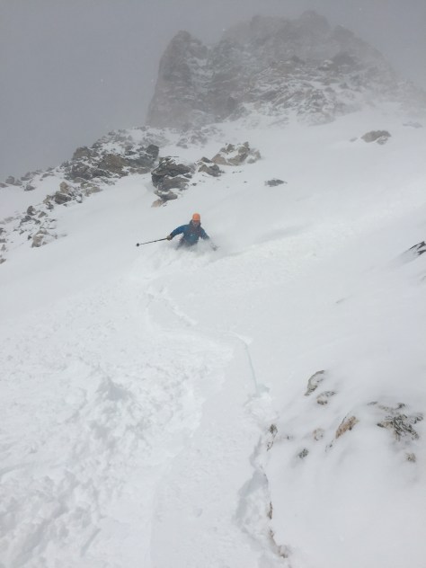
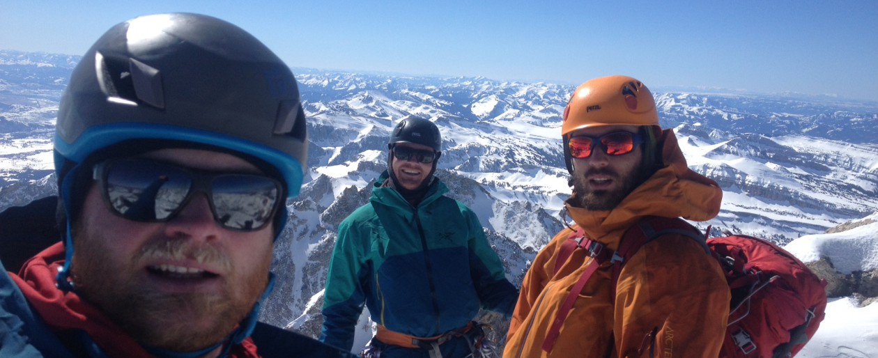
We stopped about 200′ from the true top of the couloir, because it looked to be unskiable at this point in the year.  We took our time getting ready, snapping a few pictures and eventually were ready for some old fashioned survival skiing!

IMG_0197
Having a look at the Grand

IMG_2007IMG_2012

IMG_2013
Zelie, with the top 200′ looking rough

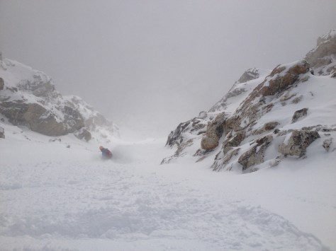
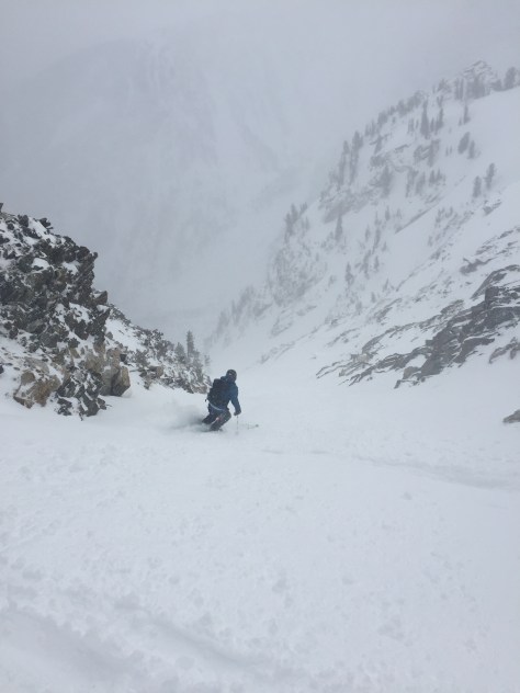
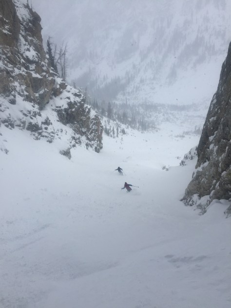
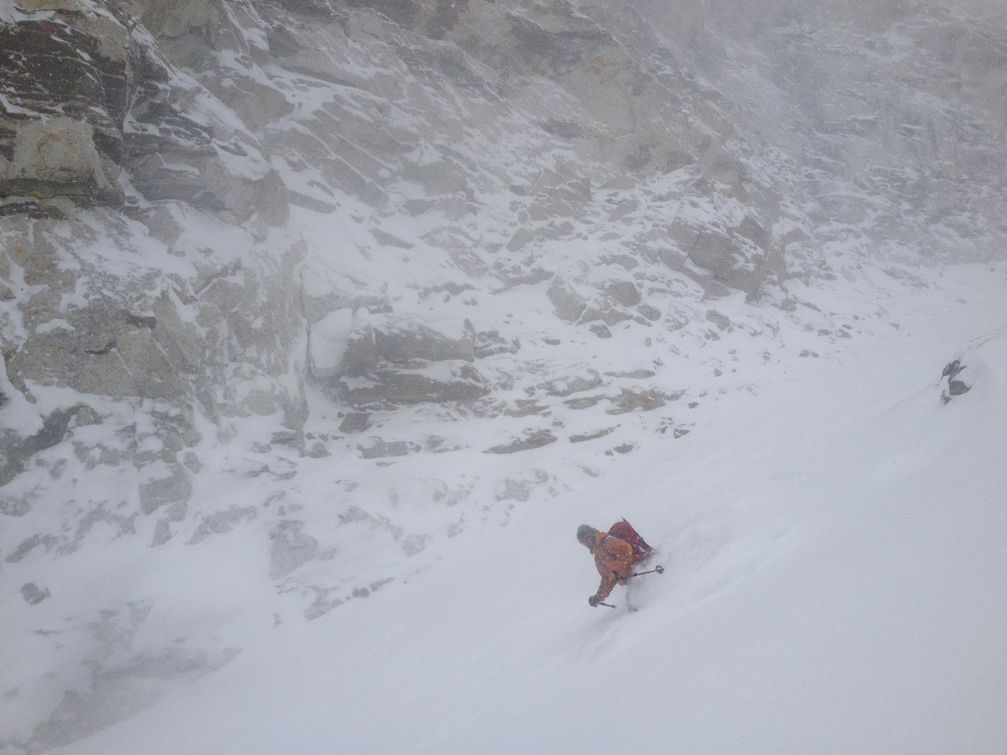
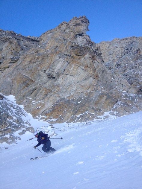
The skiing down wasn’t as bad as I had thought.  In spots is was a little unpredictable, but the wind ripples were soft and the firm snow wasn’t awful.  We made our way down to rollover with anticipation of powder turns and velvet snow…

IMG_2017

IMG_0235

IMG_0242
Lexie navigating the upper/middle section

IMG_2024

IMG_2033

IMG_2044
Looking down the middle portion to the rollover

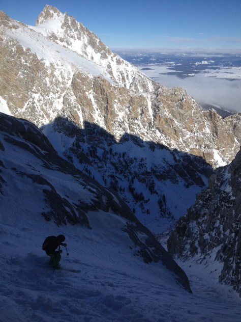
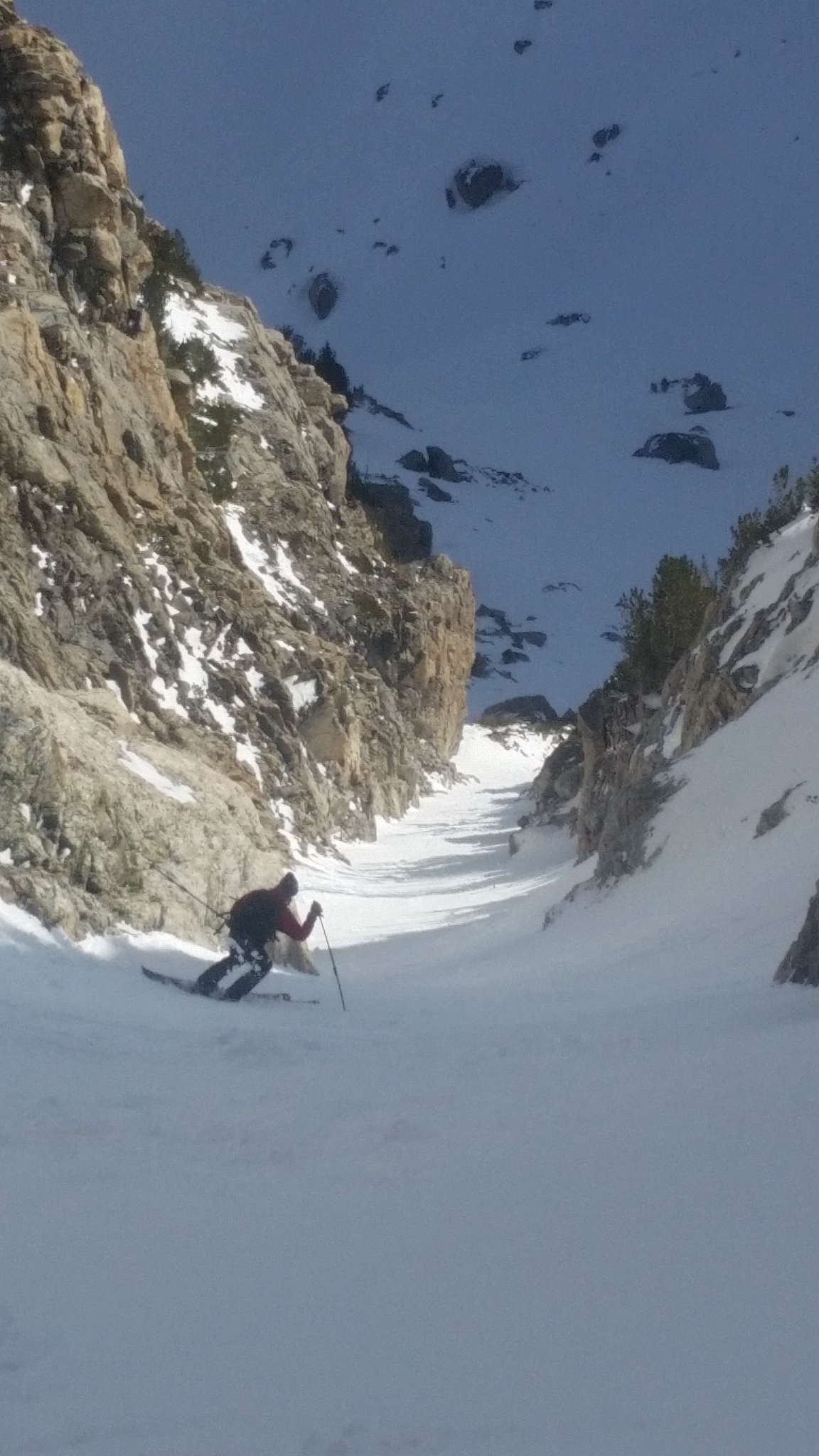
We gathered at the rollover and decided I’d ski it halfway down and then the rest of the group take it down to the gear stash.  While we were not too concerned about the snow moving, this would have been the spot to go if it decided to.  It was very stable and pretty deep on the skiers right side of the pitch-which more than made up for the rest of the lines subpar snow.

IMG_0253
Jumping into the rollover

IMG_2048IMG_2056IMG_2058IMG_2059IMG_2060

IMG_2064
Slash…

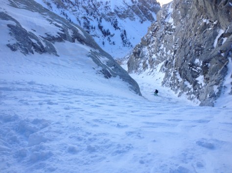
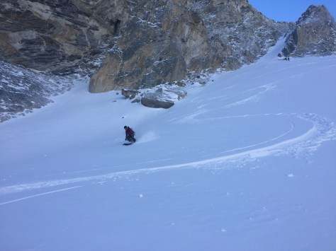
We gathered our gear and made our way down the apron, making a pit stop to grab Dane’s skins which had stopped about 500′ down the slope.  The skiing here was at times great and others terrifying.  The wind crust was inconsistent and very grabby in places.  We all made it down safe, but there were a few dicy turns that kept us on edge.

IMG_0287

IMG_2069IMG_2072IMG_2075

After regrouping in the Meadows, we cruised out of the canyon and made our way back to Bradley Lake.  The snow was decent on the last pitch above the lake, but still a little thin and slightly grabby.  We cruised across the lake and eventually to the truck in 7hrs.  While the snow wasn’t the best, it was still great to get into the park on a double date–who needs dinner and a movie!?  Keep on Adventuring.

IMG_2079

The Nugget

Location: GTNP, Avalanche Canyon, Nez Perce/Cloudveil Dome
Elevation: 11,493′, 5,656′ gain/loss
Distance: 16 miles RT
Difficulty: 4 stars
Time: 7-9 hours

Trip Report:

Date: 1/9/2016
Snow Conditions: Powder, caulk, loose sluff, sun/wind crust 12″ below snow

With some light snow falling over the past couple days and a little more forecasted for Saturday: Dane, Tristan and I set out for a line we have been talking about for a couple years.  The Nugget Couloir, or just simply the Nugget is a technical ski line on the southern wall of Avalanche Canyon.  It terminates at a huge “chokestone” that can only be surpassed via rappel, or a 60′ air (which I don’t believe has happened).

nugget.jpg

With the objective set and snow flurrying, we set out from Bradley/Taggart at 6:40am.  It was fairly warm to start out and we were quickly shedding some layers on the way to Bradley Lake.  We crossed the lake (which has an ice depth of 5″) as twilight began to take affect on the morning.

IMG_9996

We made quick work of the first few thousand feet up Garnett, only having a few issues with the track on some steep sections.  As we approached the Caves in Garnett Canyon, we were greeted with an arctic chill.  The wind was whipping around the canyon with a ferocity that I can’t recall in the past.  We put our layers on, but we were a little sweaty from the warm walk up so it didn’t do much good.  Regardless, we trudged on through the Meadows and into the South Fork of Garnett.

IMG_1894

IMG_1896

We made our way past the apron of the Hourglass’, which was looking a little thin, and continued up above the steep section of the South Fork that is a mini waterfall in the summer.  Here we noticed some cracking in the newly deposited snow, but there was no movement, so we continued on.

IMG_1898
Approaching the “waterfall”
IMG_9997
Trist, trying not to get slid

From here, we worked our way up the canyon in the direction you would to climb the South or Middle Teton in the summer.  After gaining the bench at about 10,500′, we started working our way left towards the col between Nez Perce and Cloudveil Dome.  That is the start of the line, but we had a ways to go until we were skiing….

Col Photo

We worked our way up and into the couloir that ended at the col we were headed for.  The snow was soft and deep here and we were a little concerned about skinning to the top, so we switched over to bootpack mode for the remainder of the climb.  It did get fairly steep towards the top and while we were on the lookout for snow activity, we didn’t see any.  We topped out at 5hrs, into intermittent sun and a lashing wind.

IMG_0008 2IMG_0012 2

We quickly got geared up in harnesses and all our warm clothing in the howling wind and had a look at the line.  It looked a little thin up top, but lower down it looked to be holding some goods, so we had a quick talk about how to ski the top section and had a rip.

IMG_1903
Looking into Nugget from the top

IMG_1905IMG_1906

IMG_0037
First few turn on the Nugget
IMG_1913
Looking down the second half of the upper portion

IMG_1916IMG_1917

IMG_1908
Skiing the bottom half of the upper portion-we cut left towards the narrow section at the rock 500′ down on the left. (Visible in photo)

While we were on high alert for movement, we only saw some small wind slabs and loose sluff here.  We made our way down the first pitch, dodging a few rocks here and there, eventually traversing left to the tight middle section.  Here, we were a little concerned because there was a large hanging snow field above the tight section.  We decided on a few safe ski cuts, but we could not mitigate the skiers left side of the bowl.  We assumed that the snow would move, but mainly low energy slabs.  I skied down into the bowl and stopped below some rocks, only kicking off one small wind slab.  Dane and Trist stomped around near some rocks and finally were able to get something to move that ran down into the narrow section.  This made us feel a little better and decided that dane and Trist should ski down the path of the small “slabalanche”.

IMG_0049
Tristan above the snowfield that lead to the narrow section.

IMG_0059IMG_0060IMG_1918IMG_1919IMG_1927

While we were a little tentative, these turns were top notch! We made our way down into the narrow section and decided on how to proceed.  It looked like there was some constriction/bulge halfway down, so we decided to ski down to that and have a look.

IMG_2404

IMG_1930IMG_1932

IMG_1935
Two turds in a pod!

From here, Tristan skied down to the bulge and found a way through on the right.  He made his way down for a little bit after and pulled off and waited for us to make our way through the constriction.

IMG_0079

IMG_1936

IMG_1938
Dane skiing below the bulge

After this, we knew it was powder skiing all the way to the rappel.  It stayed a little tight for 500′, then opened up to the huge snowfield above the chockstone.  We skied it in several sections, milking the turns and enjoying the exposure that was below us.

IMG_1940IMG_1953IMG_1959IMG_1957IMG_1963IMG_0118IMG_2460

Near the end of the run and the 60′ drop, we grouped up and talked about how we wanted to approach the rappel.  We had heard that the anchor was on the skiers right of the rock, but couldn’t be sure.  Since I had the rope, I gingerly skied down to the rock and looked right.  After a little while, I saw a cord that I assumed was the anchor.  I quickly cut across an open slope and came upon the anchor about 30′ from the chockstone.

IMG_0133
Skiing down to the anchor, with Tristan watching over
IMG_1966
Top portion of the anchor

I clipped into the anchor and dug around a bit for the end while the others skied down.  I went down 3′ and only found what looked to be the carabiners to rappel off, but there was another cord running from that into the snow.  While we couldn’t be sure, we figured it was anchored to the wall as a backup.  We felt good about it and threw out our 70m rope and rappelled off down into the unknown.  We assumed that the rope would reach, but you never know. Thankfully there was about 20′ of rope to spare (I’d bring a 70m if possible, but a 60m would probably work) and we all made it down without issue.

IMG_1967IMG_1984IMG_0148

We were pumped!  This had been a line on our minds for years and we finally skied it, in POW no less.  We ate some much needed food and then skied down to the traverse out of Avalanche Canyon-still finding some solid powder down low.

IMG_1974IMG_1976IMG_0093

We pulled into the trailhead at 8hrs 15min, tired and happy.  It was a great day and one I won’t forget for a while…!

West Hourglass

IMG_5165
The Dawn of pow

Location: GTNP, Garnet Canyon, Nez Perce, West Hourglass Couloir
Elevation, gain/loss: 11,132’, 5,287’ gain/loss
Distance: 8 miles RT
Difficulty: 3 stars
Time:  6-7 hours

Trip Report:

Date: 02/20/2015
Snow Conditions: Powder, some sun crust under 6″-10″ of new light density snow.

The return of snow! The feeling of fresh snow returned to us on Friday with the onslaught of fresh snow falling on the Tetons once again. Tristan and I decided last Thursday night to head into the park to try and get some powder turns and a little storm skiing. Leaving the trailhead at 7am we cruised up into the Meadows area in around 2 hours.

IMG_5169
It’s Snowing!
IMG_5180
Tristan and a view of the lower section of the West and East Hourglass

Working our way through the Meadows and into the apron of West and East Hourglass, we made good progress through the spitting snow. There was a persistent crust and some wind packed rollers that became very slick with the new snow. On the way down this made for some interesting / tentative skiing. Switching over to the boot pack, we opted for crampons and soon were knee to waist deep in newly deposited snow in the lower half of the West Hourglass.

IMG_5184
Lower section
IMG_5190
Almost to the top

The middle and top sections were a bit rocky, but to the skiers left, there was plenty of snow for some good skiing. We were happy to be dropping into a storm filled couloir once again. It was a great climb up, and with the return of snow and wind we felt lucky to be there.

IMG_5197
Dropping in!
IMG_5217
Skiing the pow

On the lower section, right at the roll over, I managed to kick off a small soft slap that went roughly 400 feet down into the apron. I had plenty of speed to ski off to the right and get out of the way. It was a reminder that with only a few inches and the right wind, things can get serious pretty quickly. But we were good and happy.

IMG_5228
Fracture line right below the roll over.
IMG_5242
Back in the white room.

Sliver Couloir

2014-12-10 10.37.55

Location: GTNP, Nez Perce Peak
Tags: Backcountry Skiing, Ski Mountaineering
Elevation, Gain/Loss: 11,178’, 5,128’ gain/loss
Distance: 5.5 miles RT
Difficulty: 4 stars
Time:  6-8 hours

Trip Report:

Date: 12/10/2014
Snow Condition: Hardpacked, Breakable Crust, Chalky, Sun affected (corn like)

After a week long hiatus from the park, I finally made time to go out for a ski.  Dane, Noah and I decided on the Sliver Couloir, off Nez Perce Peak.  It is a good early season warmup, with a relatively easy approach and straightforward decent.  We started from Bradley/Taggart around 7:45am and were greeted with a mild inversion that made the first 20 minutes pretty uncomfortable. Once we warmed up, and gained some elevation, the day became very pleasant.

2014-12-10 08.05.24
The morning sun hits the Tetons

We had decided on approaching the Sliver from Shadow Peak, instead of Garnett Canyon because: Bradley Lake was still not crossable and it seems to be the fastest approach to the Sliver.  Some people like booting up the access couloir above the “Platforms” in Garnett, but after doing that a few years ago, I swore off that approach once and for all.  So, we made our way out and to the right, finding the moraine between Bradley and Taggart Lakes quickly.  We continued on the moraine for a bit, making sure not to dump right on the skin track down to Bradley Lake and Garnett Canyon.  We were at the base of Shadow Peak in around an hour and after a painless skin up (sometimes Shadow’s track can be awful), we were on top of Shadow Peak starring at the Sliver Couloir.

Sliver Couloir from Shadow Peak

From Shadow, we downclimbed a mild rocky stretch to our left and made our way to the west facing couloir that takes you into the basin of Nez Perce and the entry to the Sliver.  The snow was chalky and fun all the way down the 500′ pitch, keeping speed toward the end to cross the basin, towards the Sliver.  Once in the basin, we were greeted by a frozen bootpack that looked to go to the top of the Sliver.  This was a nice surprise, even though it felt a little like cheating.  Nevertheless, we got into bootpack mode and started the 1800′ climb to the top of the couloir.  It was relatively easy on the up, only finding trouble where the sun had warmed the snow enough to create failures in the bootpack.  It took us an hour to climb up the couloir, and around 4 hours total from the trailhead.  With the climbing done, we delicately kicked out a platform in the 45 degree slope to click into our skis and ready ourselves for the ski.  We skied it in two sections from the top.  The snow was not great in the upper half, consisting of breakable crust, wind affected hardback and sun affected slush.  We all made some cautious jump turns down the steep, tight upper section to our meeting point in the middle of the couloir.

Dane making the most of the upper section.

The bottom half of the couloir had been warming in the sun for a bit, so it was a lot more predictable and fun.  We skied down from our meeting point one at a time, making some decent turns and finding much softer snow to work with than at the top.  The bottom part of the run is ascetically appealing, giving it an elevator feeling.  The walls are tight, but the slope is moderate (about 35 degrees), so you can really get into a flow and let loose.  We each had a great run down to the bottom of the couloir, pulling out to the right above some cliffs to soak in the sun and take a little break.

Noah working his way down the bottom half.

We rested for a bit and contemplated booting up the west facing couloir we had skied down earlier to get back on top of Shadow, but decided against it.  We skied down to our left, picking our way through boulders until we found some chutes that took us into the northern basin of Shadow.  We traversed southeast and eventually found ourselves on the east side of Shadow Peak.  Here, we found some great snow in the trees and corn-like skiing in the sun.  We worked our way all the way down until we were back at the skin track on the moraine.  We gingerly made our way down the moraine, being careful not to get tangled in the many downed trees.

Noah making his way off the moraine with Shadow in the background.
Noah making his way down the moraine with Shadow in the background.

Once out in the open and off the moraine, we quickly made our way back to the Bradley/Taggart trailhead and the celebratory beverage Noah had brought for each of us.  All in all, it was a very fun day and had only taken us 6 hours roundtrip.  Looks like there is some snow in the forecast for the weekend, so hopefully we can make it out for another adventure soon.