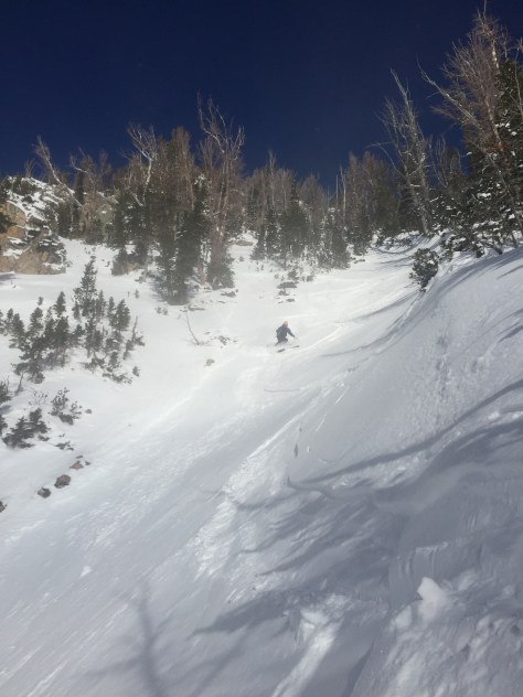
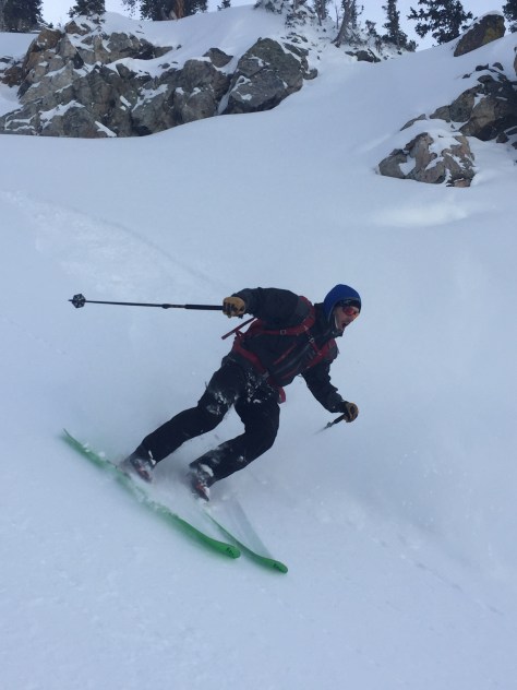
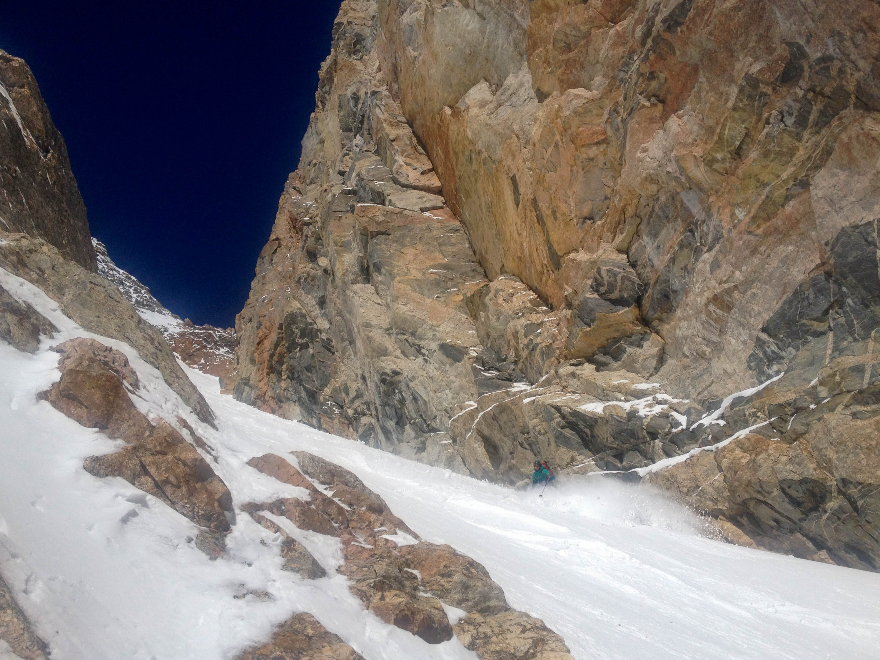
Having made plans with Tyler to ski a quick lap in Grand Teton National Park on Monday a few days before, I slowly got out of bed and began to get ready. I was tired from the past two days (The Nugget, West Hourglass), but figured what’s one more schuss! Based on the conditions in the West Hourglass Sunday, I was hopeful the Four Hour Couloir would ski well. The wind had been coming from the West/Northwest for about two days and the temperature has stayed low, so a South-facing line seemed to make sense. With these thoughts in mind, we took off from the trailhead at 8:20am. We made easy work of the up and were at base of the couloir in 2hrs 30min.
(For a more detailed description of the route, etc take a look at an older post – 4 Hour Couloir.)
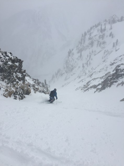
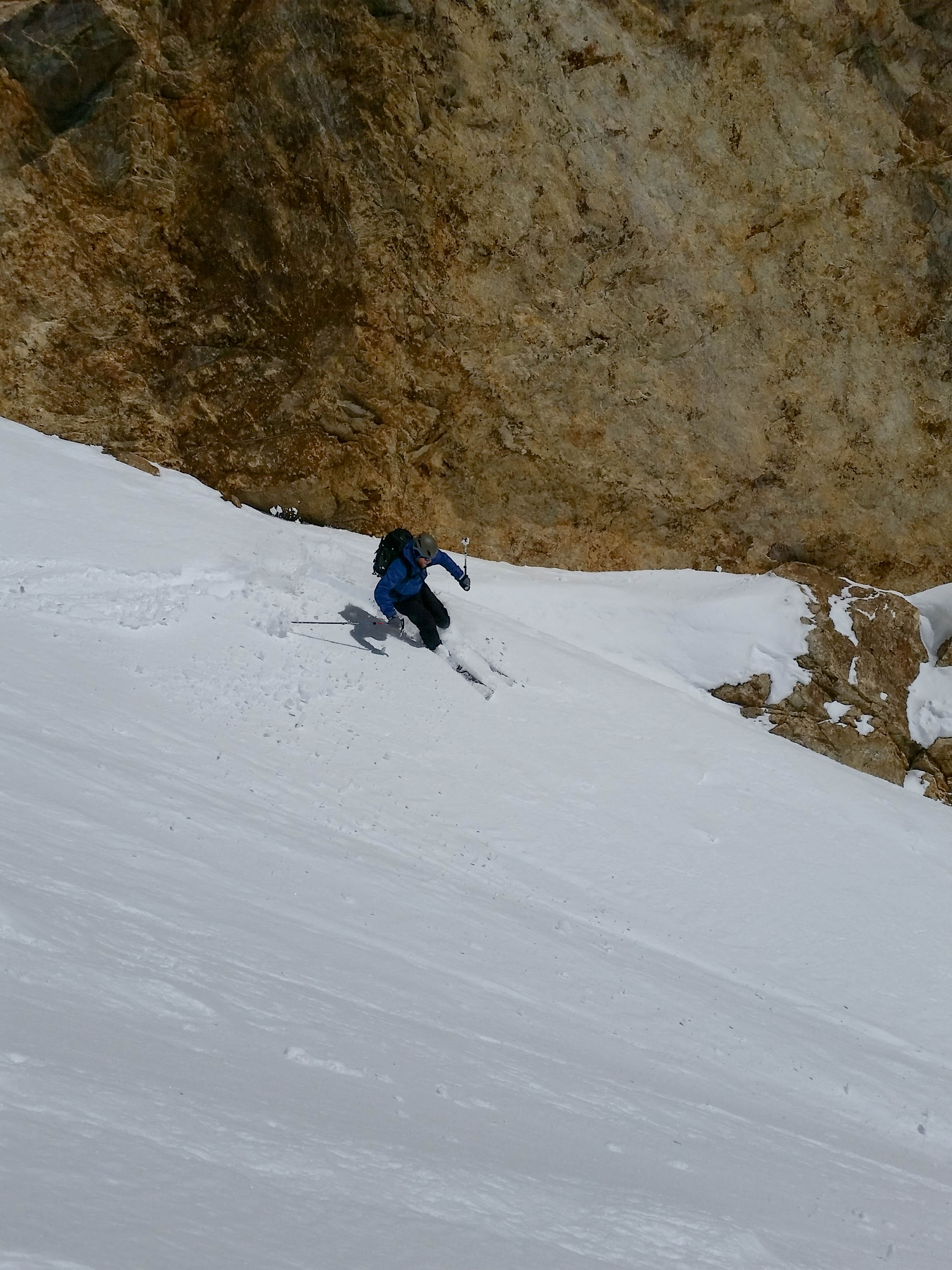
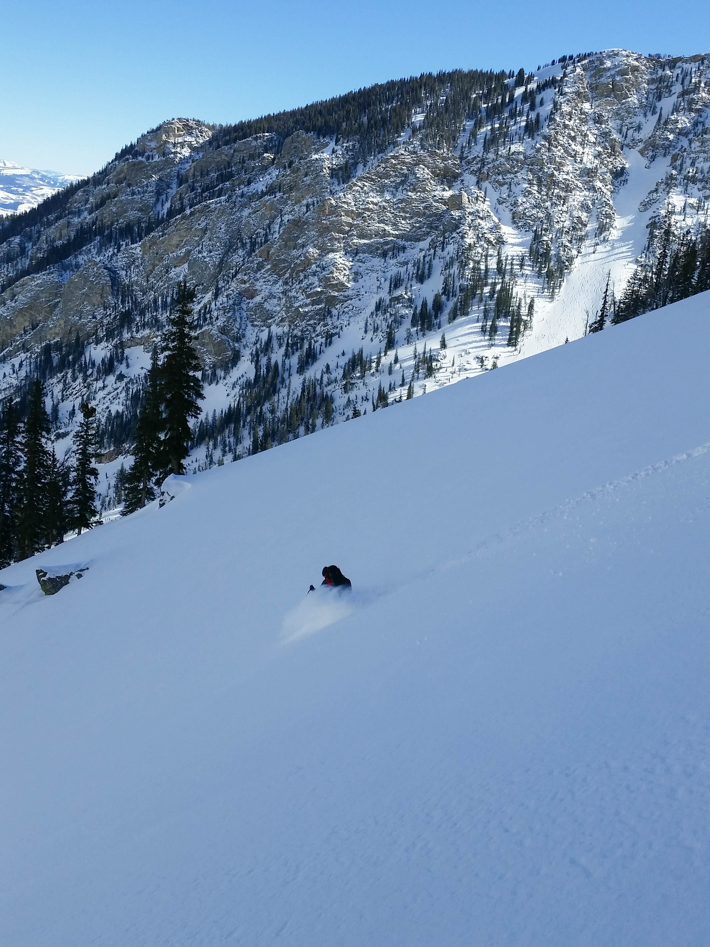
We geared up, took a look at the couloir and decided it was good to go. There was a noticeable sun crust about 5″ below soft powder, but the couloir looked to have flushed a few times recently. Down lower, the snow was soft and fluffy. We milked the last 800′ of powder all the way to the track out of Avalanche Canyon on the south side (which is in and crossed the creek). We cruised back to the truck at 3hrs 59min, happy with the quick lap and decent snow.
Southern aspect of TeewinotBuck and Wister rising above the clouds
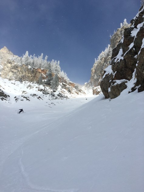
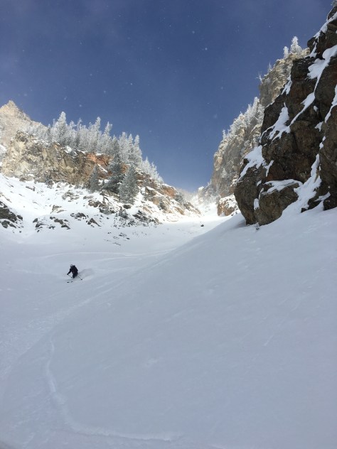
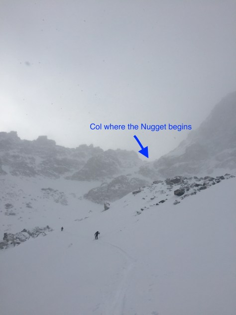
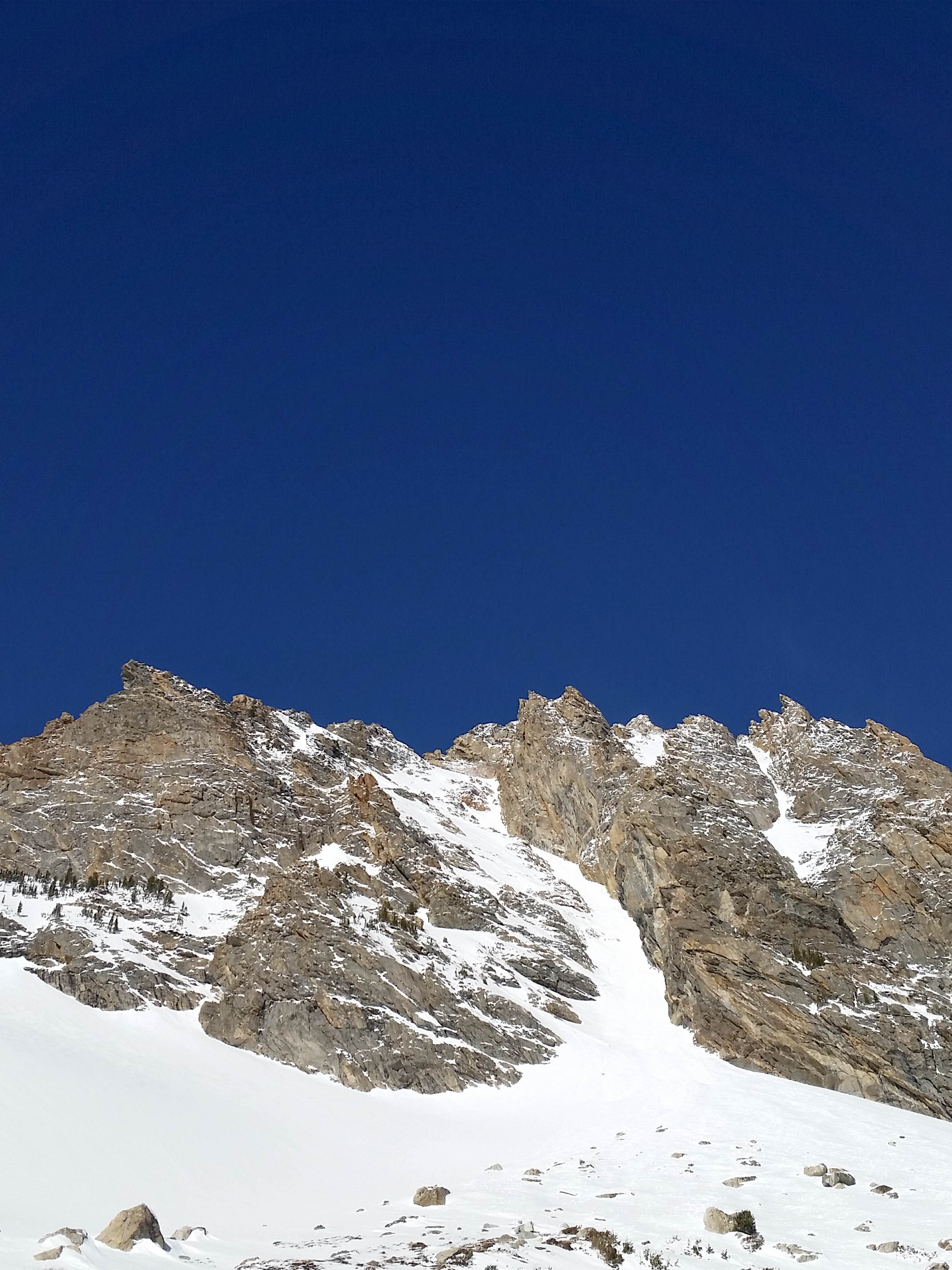
With some light snow falling over the past couple days and a little more forecasted for Saturday: Dane, Tristan and I set out for a line we have been talking about for a couple years. The Nugget Couloir, or just simply the Nugget is a technical ski line on the southern wall of Avalanche Canyon. It terminates at a huge “chokestone” that can only be surpassed via rappel, or a 60′ air (which I don’t believe has happened).
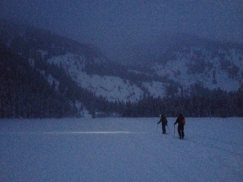
With the objective set and snow flurrying, we set out from Bradley/Taggart at 6:40am. It was fairly warm to start out and we were quickly shedding some layers on the way to Bradley Lake. We crossed the lake (which has an ice depth of 5″) as twilight began to take affect on the morning.
We made quick work of the first few thousand feet up Garnett, only having a few issues with the track on some steep sections. As we approached the Caves in Garnett Canyon, we were greeted with an arctic chill. The wind was whipping around the canyon with a ferocity that I can’t recall in the past. We put our layers on, but we were a little sweaty from the warm walk up so it didn’t do much good. Regardless, we trudged on through the Meadows and into the South Fork of Garnett.
We made our way past the apron of the Hourglass’, which was looking a little thin, and continued up above the steep section of the South Fork that is a mini waterfall in the summer. Here we noticed some cracking in the newly deposited snow, but there was no movement, so we continued on.
Approaching the “waterfall”Trist, trying not to get slid
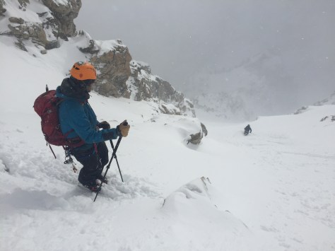
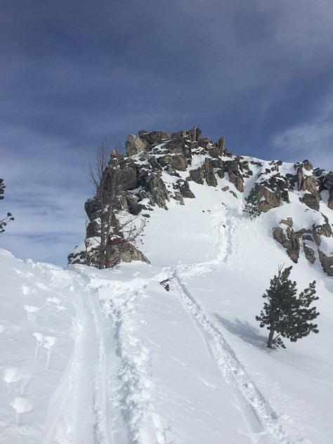
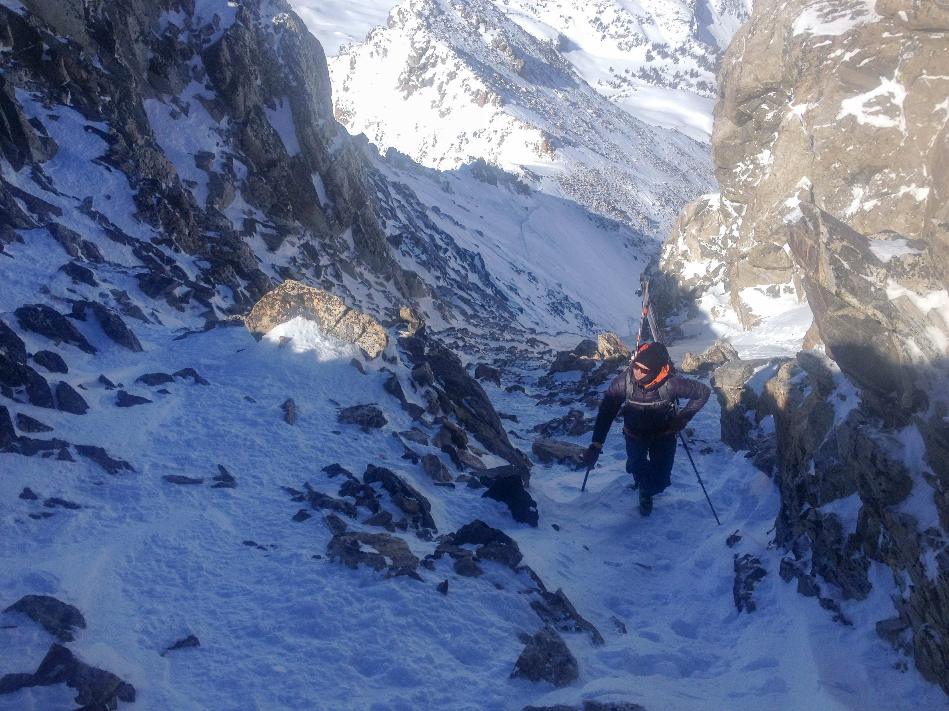
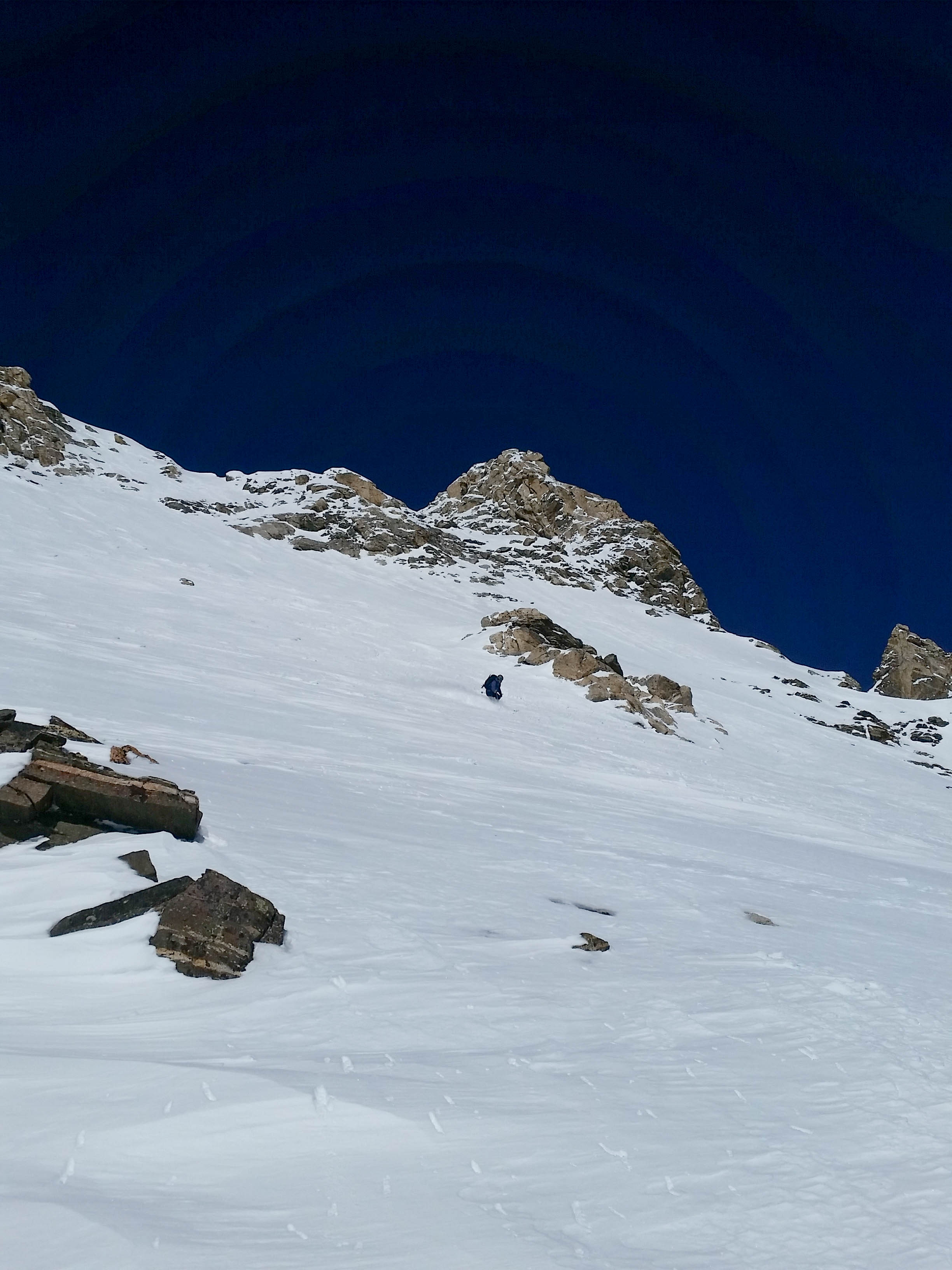
From here, we worked our way up the canyon in the direction you would to climb the South or Middle Teton in the summer. After gaining the bench at about 10,500′, we started working our way left towards the col between Nez Perce and Cloudveil Dome. That is the start of the line, but we had a ways to go until we were skiing….
We worked our way up and into the couloir that ended at the col we were headed for. The snow was soft and deep here and we were a little concerned about skinning to the top, so we switched over to bootpack mode for the remainder of the climb. It did get fairly steep towards the top and while we were on the lookout for snow activity, we didn’t see any. We topped out at 5hrs, into intermittent sun and a lashing wind.
We quickly got geared up in harnesses and all our warm clothing in the howling wind and had a look at the line. It looked a little thin up top, but lower down it looked to be holding some goods, so we had a quick talk about how to ski the top section and had a rip.
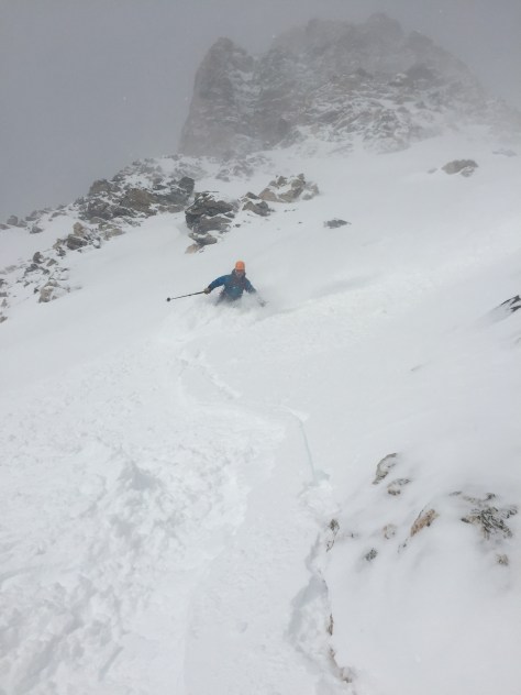
Looking into Nugget from the top
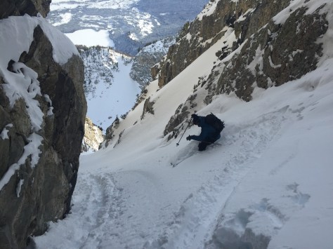
First few turn on the NuggetLooking down the second half of the upper portion
Skiing the bottom half of the upper portion-we cut left towards the narrow section at the rock 500′ down on the left. (Visible in photo)
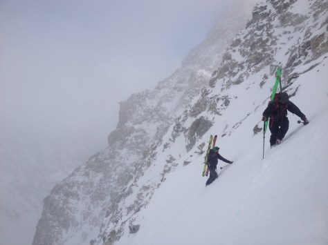
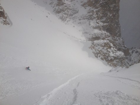
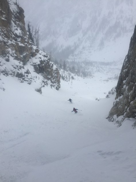
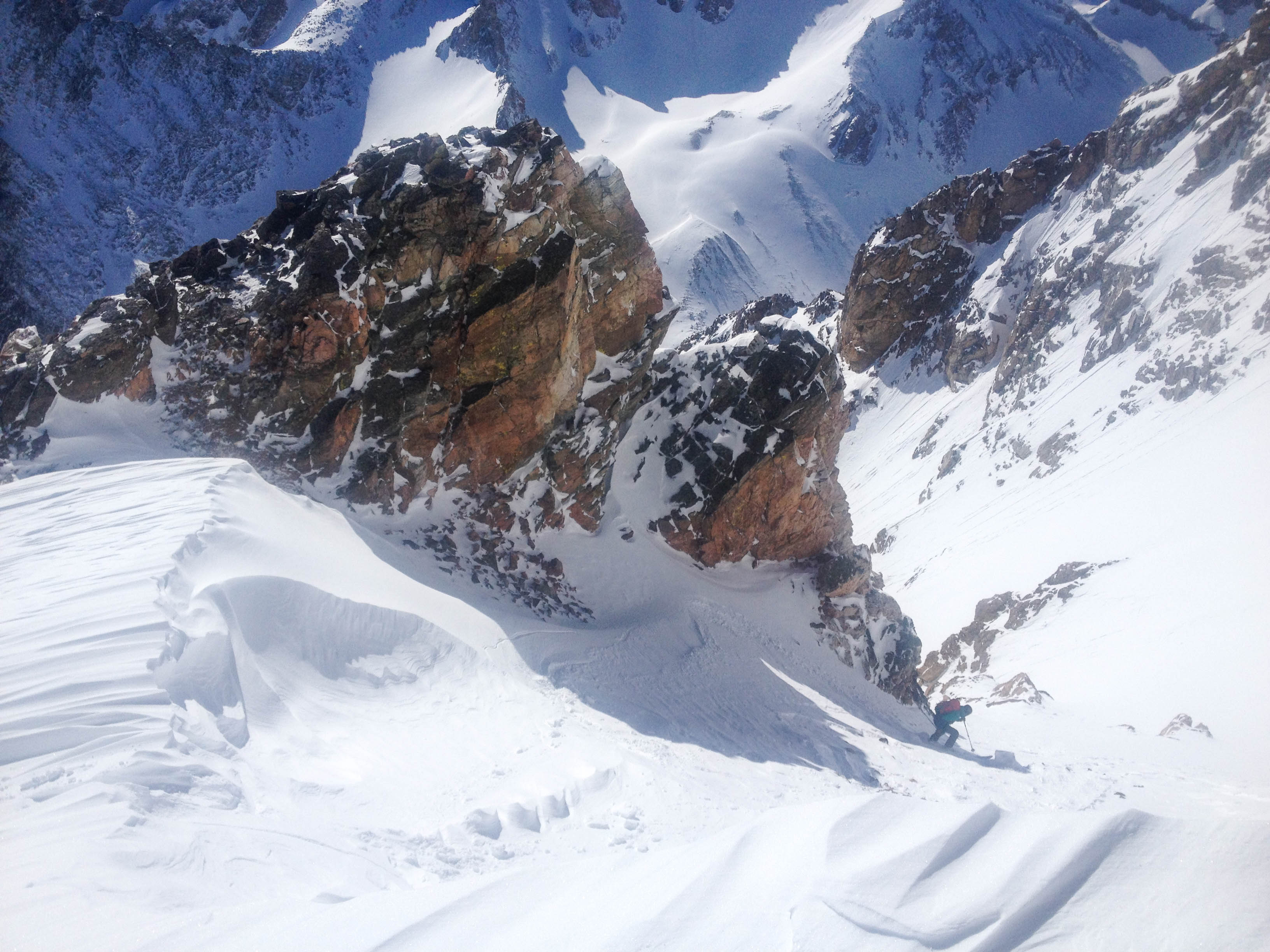
While we were on high alert for movement, we only saw some small wind slabs and loose sluff here. We made our way down the first pitch, dodging a few rocks here and there, eventually traversing left to the tight middle section. Here, we were a little concerned because there was a large hanging snow field above the tight section. We decided on a few safe ski cuts, but we could not mitigate the skiers left side of the bowl. We assumed that the snow would move, but mainly low energy slabs. I skied down into the bowl and stopped below some rocks, only kicking off one small wind slab. Dane and Trist stomped around near some rocks and finally were able to get something to move that ran down into the narrow section. This made us feel a little better and decided that dane and Trist should ski down the path of the small “slabalanche”.
Tristan above the snowfield that lead to the narrow section.
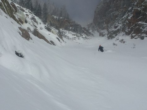
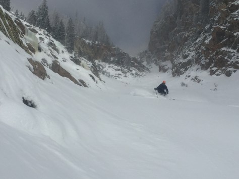
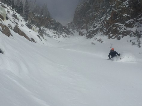
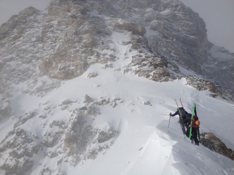
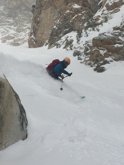
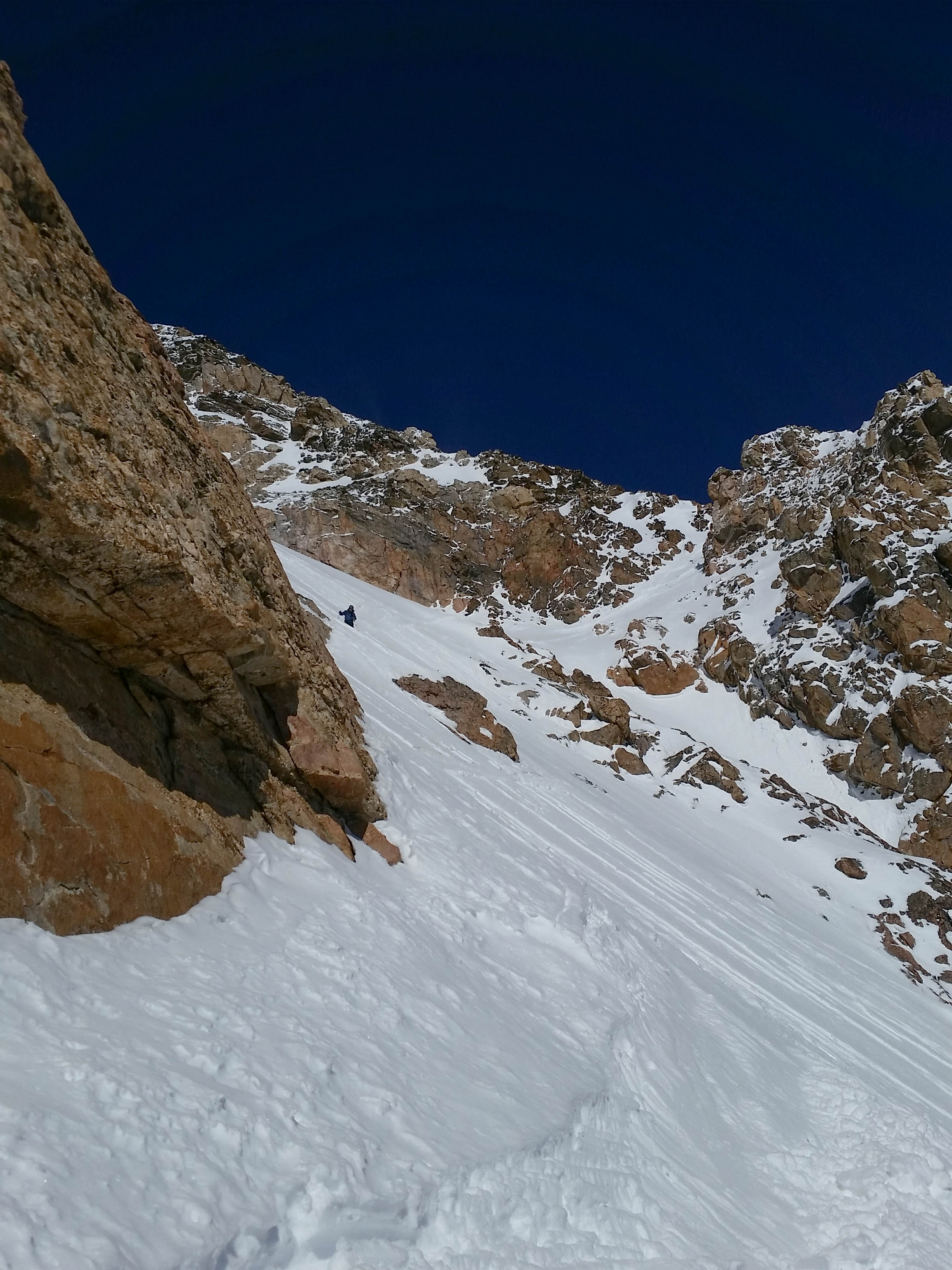
While we were a little tentative, these turns were top notch! We made our way down into the narrow section and decided on how to proceed. It looked like there was some constriction/bulge halfway down, so we decided to ski down to that and have a look.
Two turds in a pod!
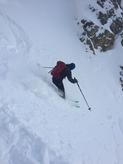
From here, Tristan skied down to the bulge and found a way through on the right. He made his way down for a little bit after and pulled off and waited for us to make our way through the constriction.
Dane skiing below the bulge
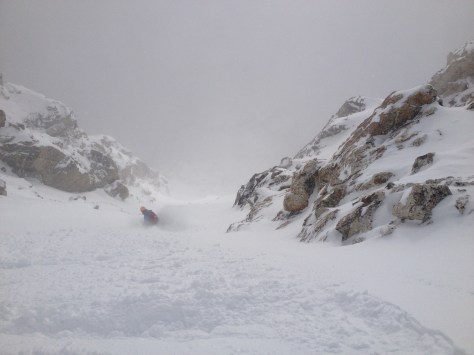
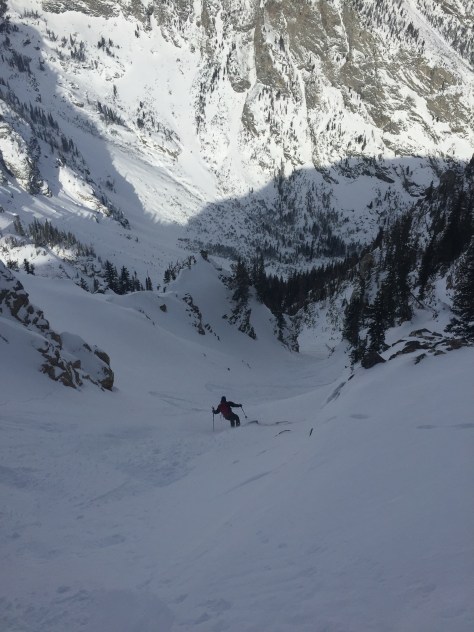
After this, we knew it was powder skiing all the way to the rappel. It stayed a little tight for 500′, then opened up to the huge snowfield above the chockstone. We skied it in several sections, milking the turns and enjoying the exposure that was below us.
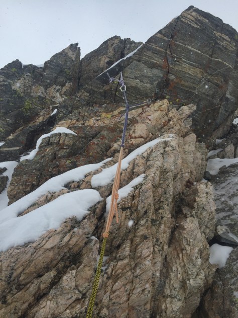
Near the end of the run and the 60′ drop, we grouped up and talked about how we wanted to approach the rappel. We had heard that the anchor was on the skiers right of the rock, but couldn’t be sure. Since I had the rope, I gingerly skied down to the rock and looked right. After a little while, I saw a cord that I assumed was the anchor. I quickly cut across an open slope and came upon the anchor about 30′ from the chockstone.
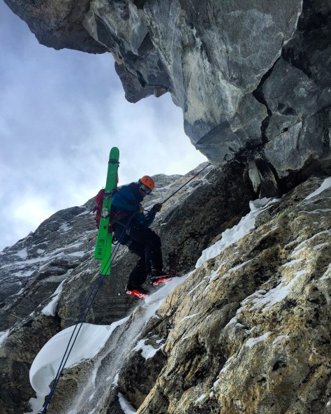
Skiing down to the anchor, with Tristan watching overTop portion of the anchor
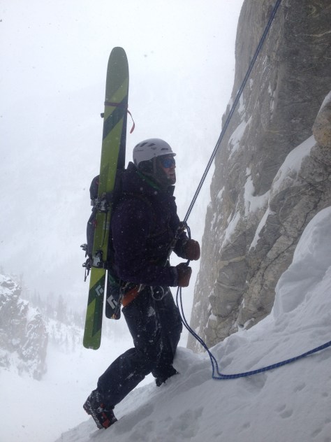
I clipped into the anchor and dug around a bit for the end while the others skied down. I went down 3′ and only found what looked to be the carabiners to rappel off, but there was another cord running from that into the snow. While we couldn’t be sure, we figured it was anchored to the wall as a backup. We felt good about it and threw out our 70m rope and rappelled off down into the unknown. We assumed that the rope would reach, but you never know. Thankfully there was about 20′ of rope to spare (I’d bring a 70m if possible, but a 60m would probably work) and we all made it down without issue.
We were pumped! This had been a line on our minds for years and we finally skied it, in POW no less. We ate some much needed food and then skied down to the traverse out of Avalanche Canyon-still finding some solid powder down low.
We pulled into the trailhead at 8hrs 15min, tired and happy. It was a great day and one I won’t forget for a while…!
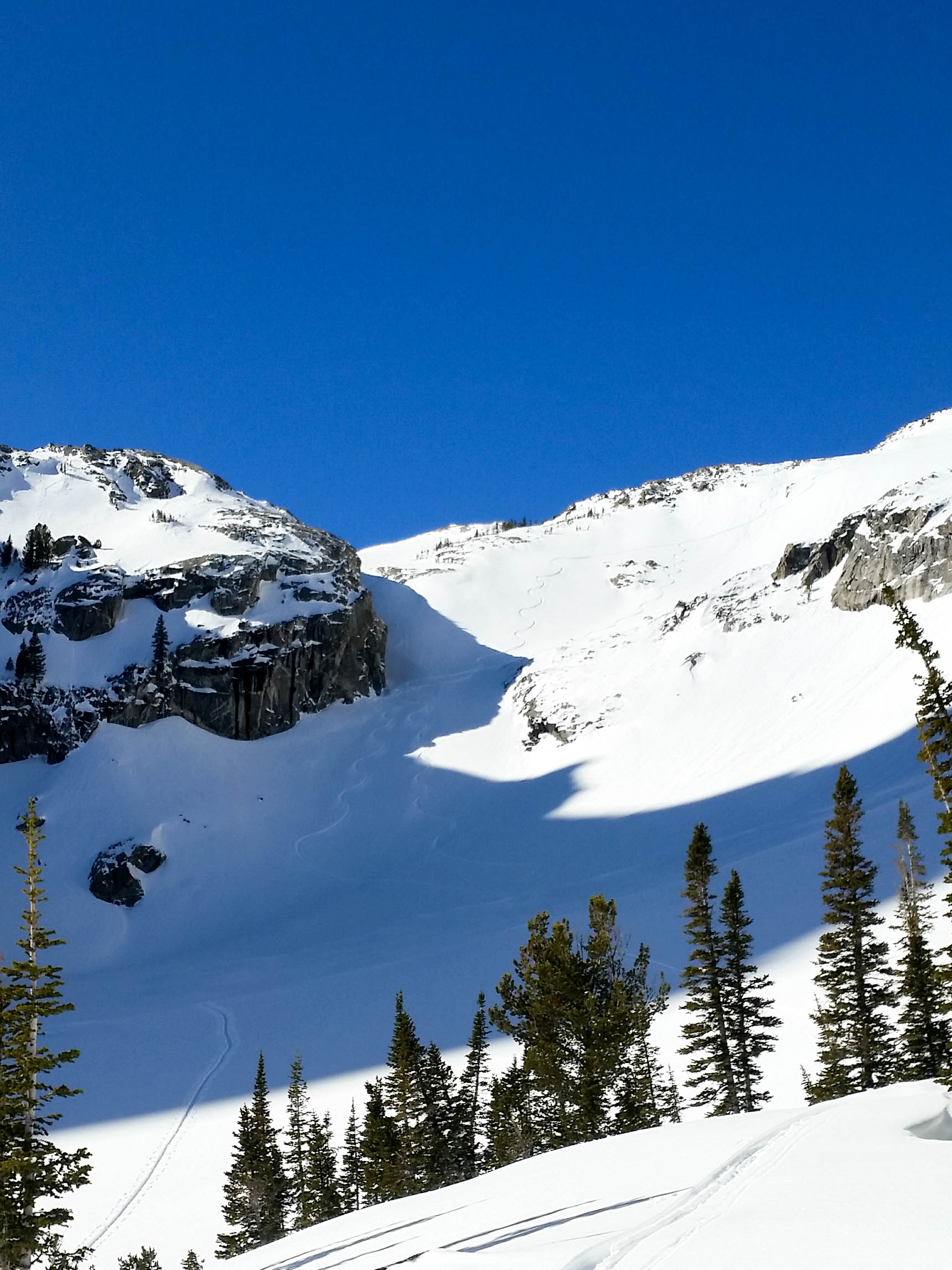
After a successful trip up the Sliver Couloir the day before, Tristan and I decided to head into the park Monday to take a look at Turkey Chute off 25 Short. We had seen two tracks in the line the day before and a track out of Avalanche Canyon-across Taggart Lake. With this in mind, we knew there was a good chance we could tackle this objective with relative ease. We left the Bradley/Taggart Trailhead at 8:45am and made quick time up to the skiers summit of 25 Short (for full details on the route up, look at a previous post).
We looked around at all the ski lines in Avalanche Canyon for a bit, making mental notes on all the routes that looked good to go. There are at least 4 lines in this zone that I have been looking at for a couple years and hopefully this will be the year for a few of them.
We then worked our way over to the entrance of Turkey Chute, making sure to not pass it (directly South of the true 25 Short summit). We took a little time transitioning over to ski mode and scrambled down into the chute.
Looking at the entrance of Turkey Chute from the South.Looking down the line from the entrance.
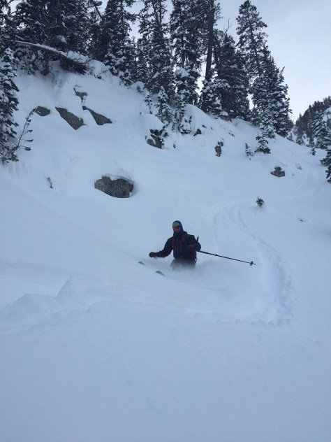
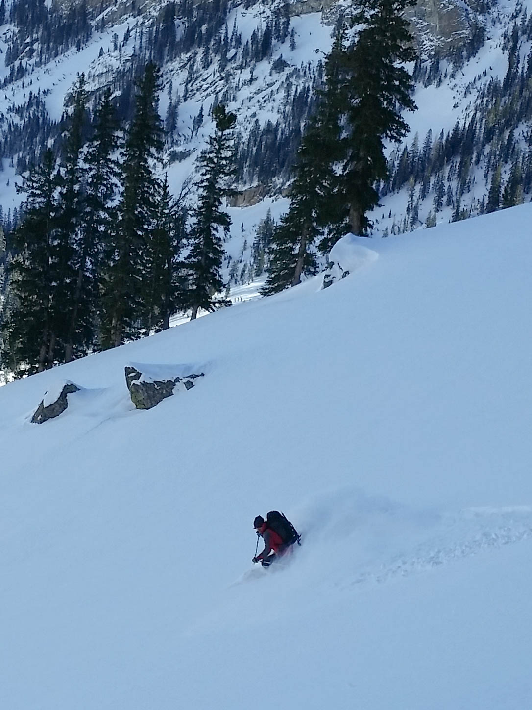
Once in the line, we dug a few hand pits and didn’t see anything of concern. We decided to ski the upper portion of the line in one stretch and then have some fun in the lower section. The snow was very good: deep, supportive, stable and fluffy. We milked the turns all the way down, letting the skis run towards the bottom, keeping an eye out for hidden rocks.
Trist giving the thumbs up after digging his pit.
After making it down safely, we made some fun turns to the canyon floor and began the traverse out of Avalanche Canyon. It wasn’t that bad, considering how awful it can be and only took us 30minutes to Taggart Lake. We decided to skin from here and made our way across the lake. It was in great shape, completely frozen and quick to cross.
We made it back to the truck in 4hr 26min, already thinking about the next objective. All in all, Turkey Chute is a great early adventure or introduction to GTNP backcountry skiing. We were pleased with the day and great conditions!
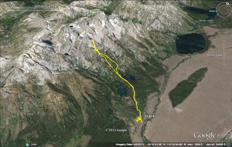
Date: 12/27/2015
Snow Conditions: Powder, Consolidated Powder, Mild Wind Crust @ 10500′ and some sun affect snow around 10700′
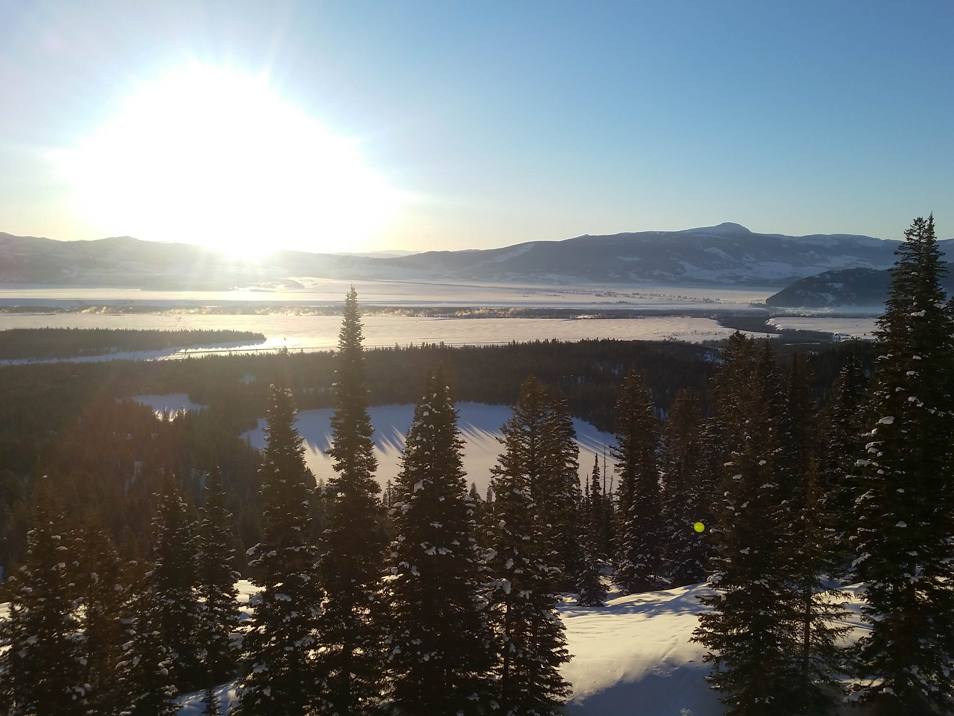
The storm that rolled through Jackson over Christmas was once again a present from Mr. Santa. Around 100″ fell over a 15 day period and in an instant the winter began. Over the past couple of weeks, I was able to have some great days in and around JHMR and Teton Pass, but I was yearning to get into the park to poke around a bit.
Skiing the POW around JHMR
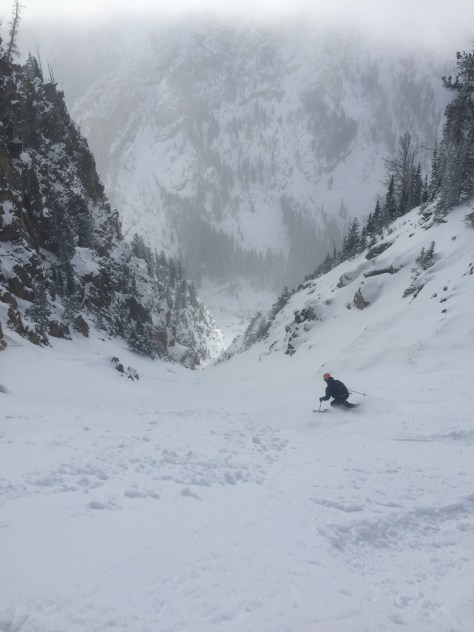
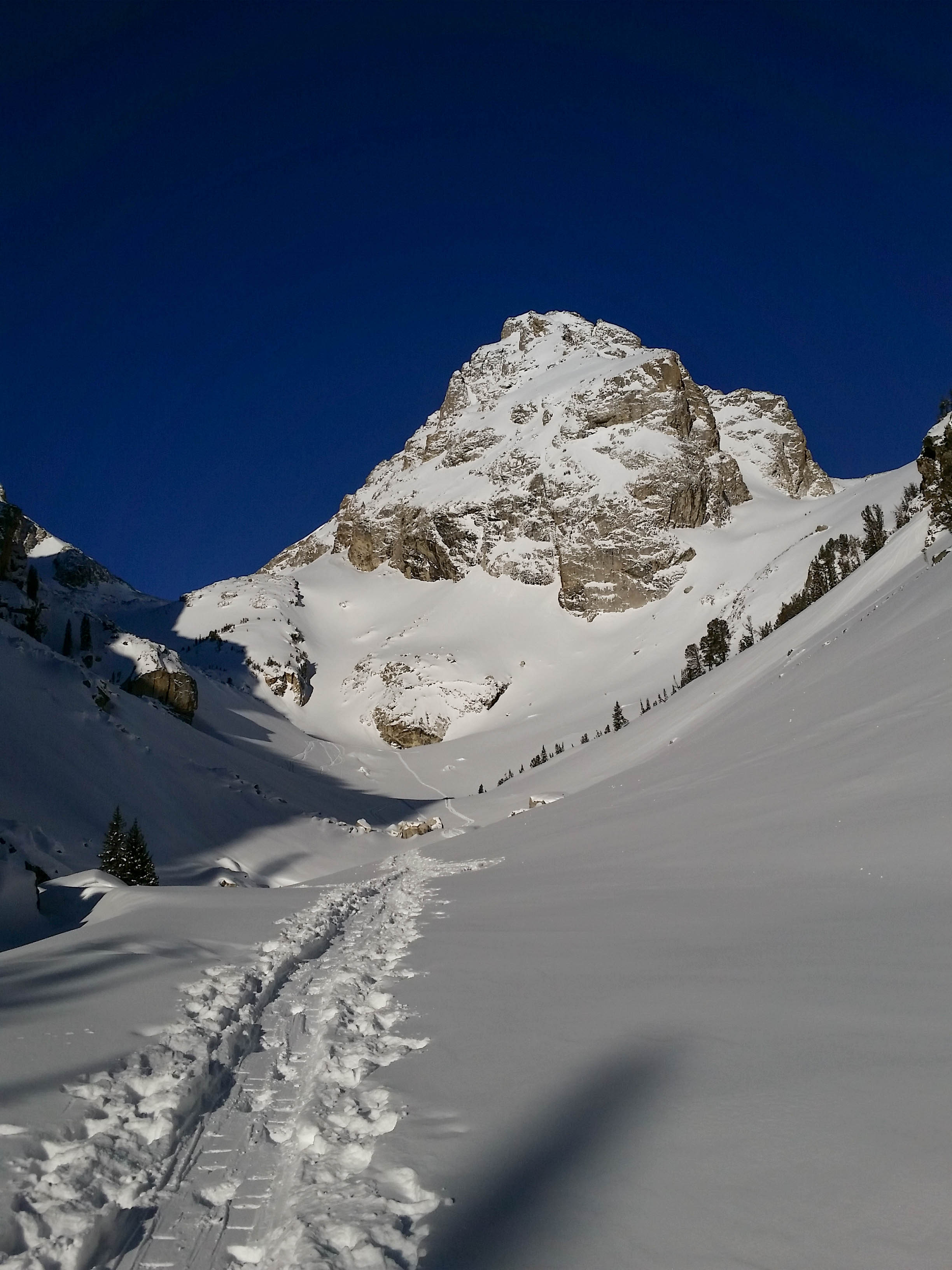
The Bridger-Teton National Forest Avalanche Center has been calling for Considerable to High avalanche danger over much of the past two weeks and yesterday was no different. With this in mind: Dane, Tristan, Stu and myself set out for Shadow Peak at 8am from Bradley/Taggart trailhead. Our ideal objective was skiing the Sliver Couloir off Nez Perce, then heading down the 4 Hour Couloir to Avalanche Canyon, but we were not sure what we would find.
We made good time up to the 4 Hour Couloir entrance (see former post for details) and continued on to the top of the “skiers summit” of Shadow Peak. Here we had our first good look at the Sliver and we liked what we saw.
For starters, the couloir looked as if it had flushed a few times during the storm cycle. Also, we could make out a couple minor crowns on the two larger “snow fields” on the left of the Sliver. These two signs, along with our observations over the past few weeks lead us to believe it could be skied safely, but we would only know once we got into the line. We made our way down to the col between the skier summit and true summit of Shadow and got ready to ski the west facing slope that drops down in the cirque of Nez Perce. Here we dug a few hand pits and found a few areas of concern around 24″ down, but after a couple ski cuts–we decided to rip it.
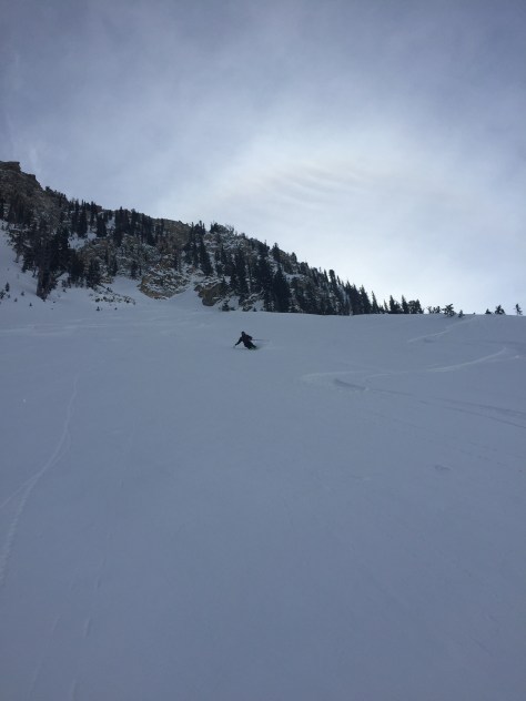
West Facing slope, leading to the Nez Perce cirque
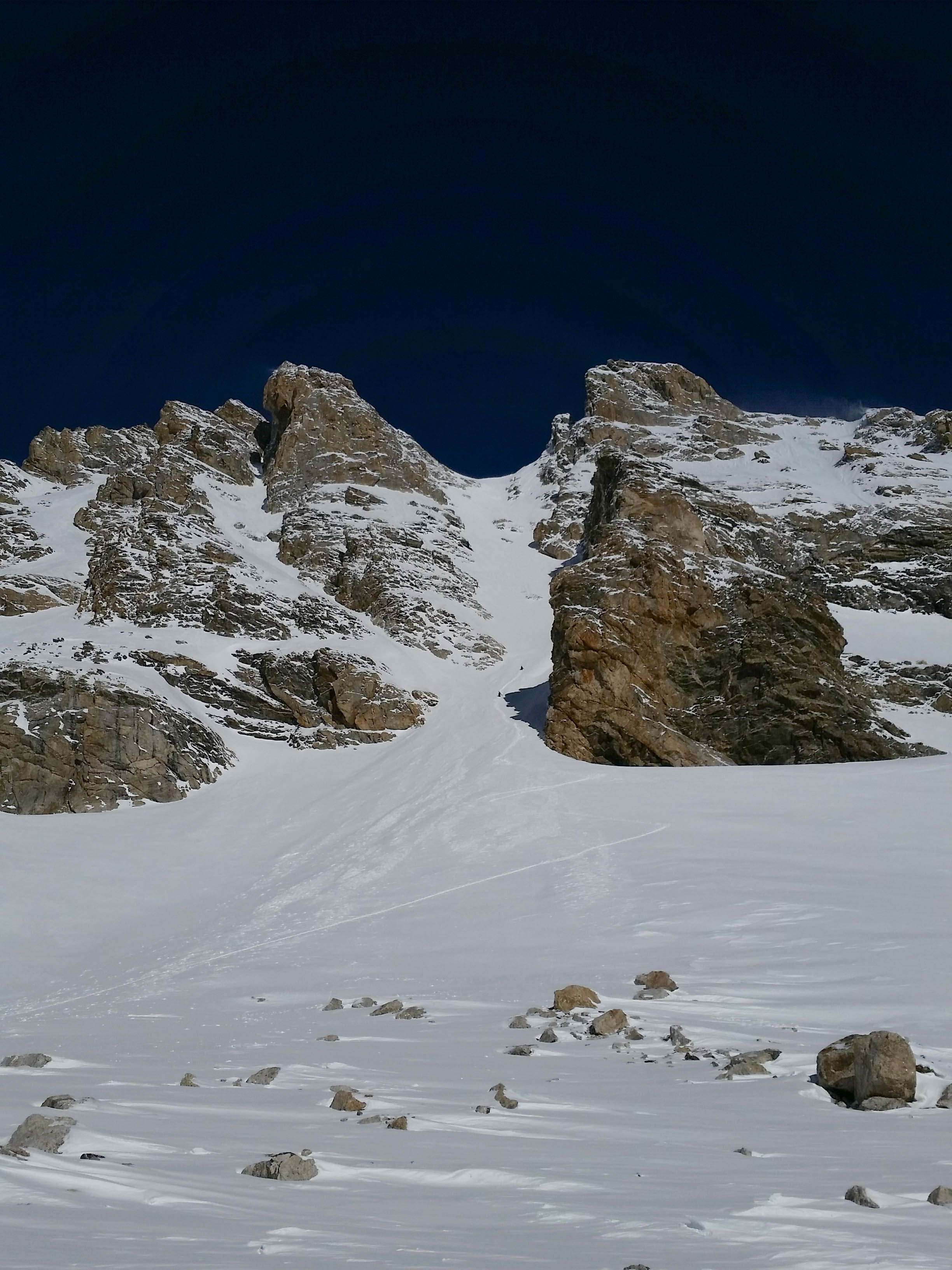
The snow in this zone was deep, stable and very supportive. We made our way across the cirque and then transitioned to skin mode to make our way to the entrance of the couloir. We worked our way up to the rock bulge below the Sliver and dropped our skins and some unneeded layers and began our way into the couloir. We noticed the temperature was rising a bit at this elevation, but the snow didn’t seem to be affect too much at this point. We worked our way up the couloir for about 500 feet, stopping on occasion to dip a few hand pits and discuss the situation.
Nearing the top.
At around 10700 feet, we noticed the snow warming–with the first 2″ noticeably sun affected. This was a little concerning, but we thought that it was not a major concern, just something to be conscious of on the way down. The last third of the couloir was waist deep powder with some faceted/surgery snow towards the bottom. This made the bootpacking difficult, but with four of us, we were able to take turns slogging through the snow until finally we were at the top! We geared up and talked a little about how we wanted to tackle the line. We thought that the best move was to be extra cautious and make numerous stops along the way down. With everyone in agreement, we had ourselves some fun all the way down to the bottom….
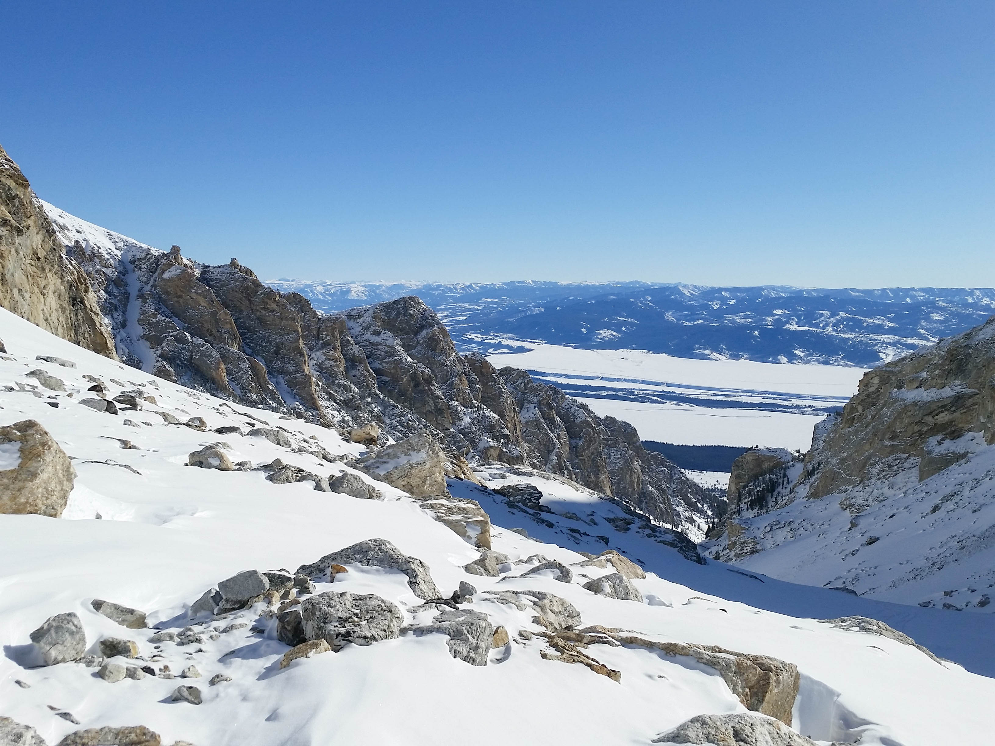
After making it down, we gathered our stashed gear and skied the apron down to the west facing slope we had skied down from earlier. From here, our plan was to skin up to Shadow and then have a look at the 4 Hour Couloir and possibly ski that.
Skiing the Apron.Skinning up to Shadow col.
We made quick work of the up and had a break in the sun at the “skiers summit” of Shadow to eat some much needed food and transition to ski mode. After about 15 minutes, we skied down the fun upper face of Shadow and made our way into the 4 Hour Couloir. We were a little concerned with the south facing aspect, considering all the warming we had witnessed in the Sliver. We dug around for a bit, finding numerous areas of concern within the snowpack and after some discussion, decided to bail and ski the north facing trees of Shadow down to the bench. There were too many concerns for us to feel like we could safely ski the line and figured, the season is just beginning….
The snow was great throughout this zone and we milked the turns for as long as possible until traversing right (South) to the skin track up Shadow. We cruised back after gaining the skin track and pulled into the parking lot at 7hr 36min. For all our poking around, we felt good about the day and great about our ability to ski a fun couloir safely. More to come very soon!
With a small storming dropping a few inches on us recently and a weather window opening, Dane and I decided to tackle a larger line off the South Teton. Amor a Vida, meaning Love Life in Spanish, is a beautiful couloir off of the South Teton. I had booted up it a few years back, but with warming temperatures that day, did not connect the South Face of the South Teton to the couloir. Dane and I got an early start, leaving Bradley-Taggart around 6:20am and made quick work of the skin into the Meadows.
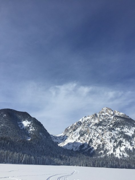
Tetons.Not a bad way to start the day.The Middle, watching over Garnet Canyon.
We worked our way up to the left and into the South Fork of Garnet Canyon, very surprised that the track was in great shape and the wind was calm. As we came up below the Ellingwood and Chouinard Couloirs, we noticed a few guys slowly making progress up the Ellingwood. The snow looked deep, so we were hopeful that pour couloir was holding some similar snow.
Chouinard (left) and Ellingwood (right) Couloirs off the Middle Teton.A look down Garnet Canyon.
We proceeded up canyon, making our way through the mine field of rocks that litter the South Fork. There is enough coverage to skin through this section, which is great, but you have to be careful with each step. We found ourselves below the North Face of the South Teton, with a ramp of snow leading us towards the ridge and the Northwest Couloir.
Dane, working his way up to the ridge and the Northwest Couloir.
Just below the ridge, we switched over to bootpack mode and quickly gained the ridge and made our way into the Northwest Couloir. The snow was pretty consolidated, which made for a relatively easy climb up.
Dane, starting up the Northwest Couloir.Almost to the top. (photo: Dane Etter-Garrette)
Once out of the couloir, we were greeted with sunshine and a calm day in the high alpine. We still had about 100′ of climbing until we were at the summit, but were excited to be in the sun. We made our way through some deep snow and over a few rocks, until we were standing on top of the South Teton. The weather was perfect and we both felt great about the climb and ski ahead.
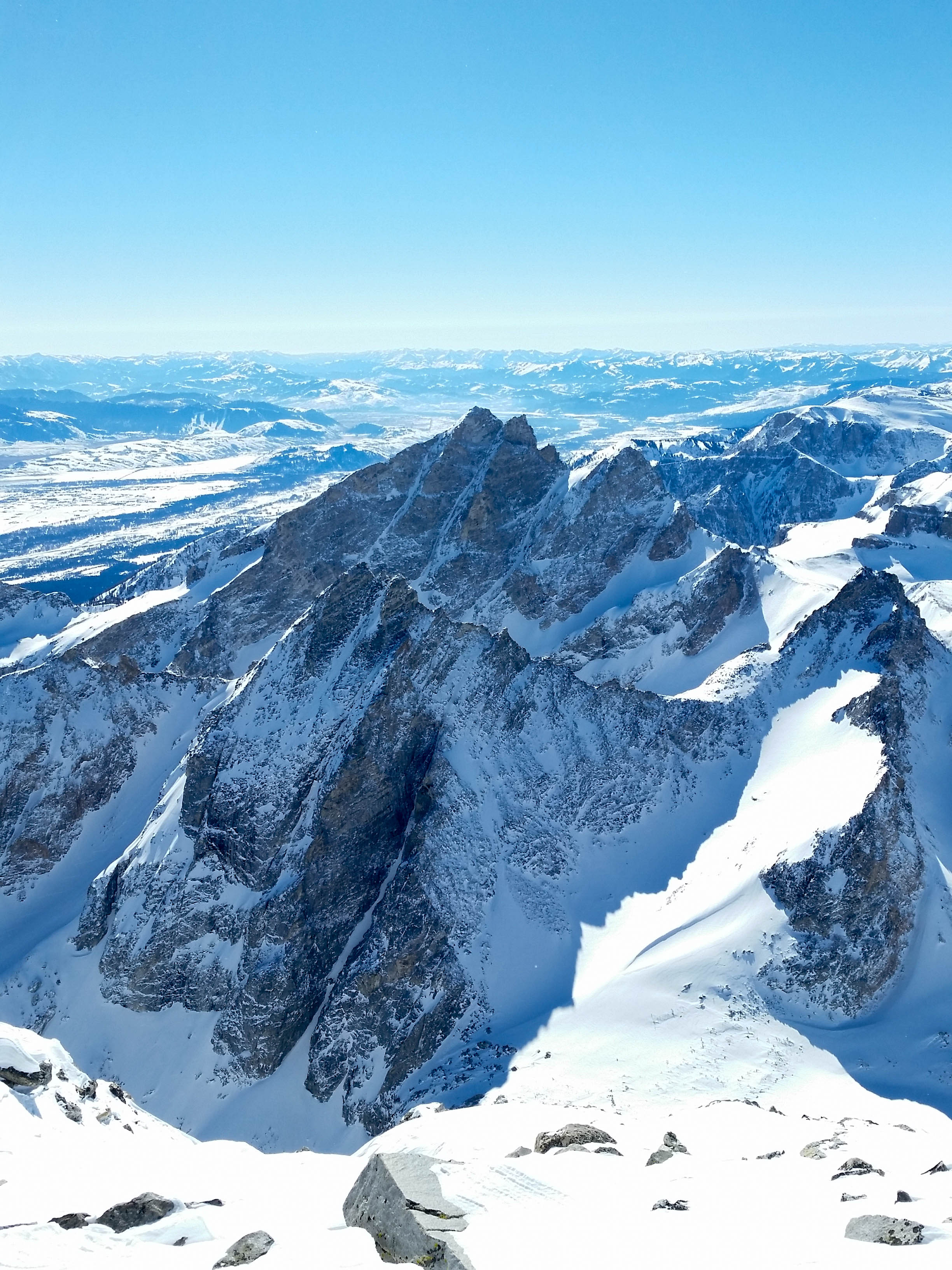
The Middle and Grand.Mount Wister, with Veiled Peak on the right and the North Face of Buck in the background.Snowfield, skiers left of the summit (funnels into Southeast Couloir).
We geared up and discussed our options for getting to the South Face. Dane had skied the Southeast Couloir last year and thought that we could ski the snowfield directly left of the summit down and then cut hard right to get onto the South Face. We skied two turns down the snowfield to get a look and determined that the coverage was a little low for that entry onto the South Face. We made our way back up to the summit and to the right of a rock bulge separating the snowfield and a scree field that lead to the South Face. After making our way through the snow covered scree, we got a good look at the South Face and the lower entry to the Southeast Couloir.
A look into the Southeast Couloir. It doesn’t look to go through right now.
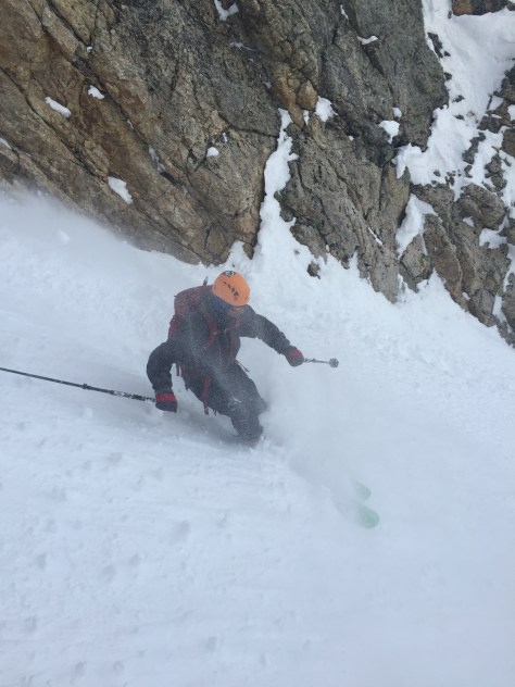
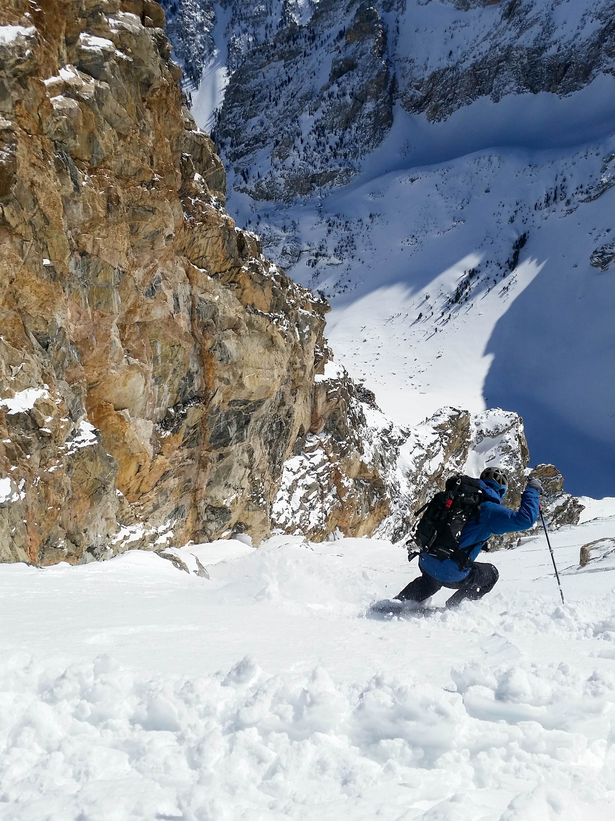
The South Face looked skiable, but we could tell that the snow was going to be varied; sun crust, wind crust, breakable crust, and powder. Dane skied onto the face and tested out the steep upper pitch with a quick ski cut, then made his way through some rock bands to a safe spot on the right.
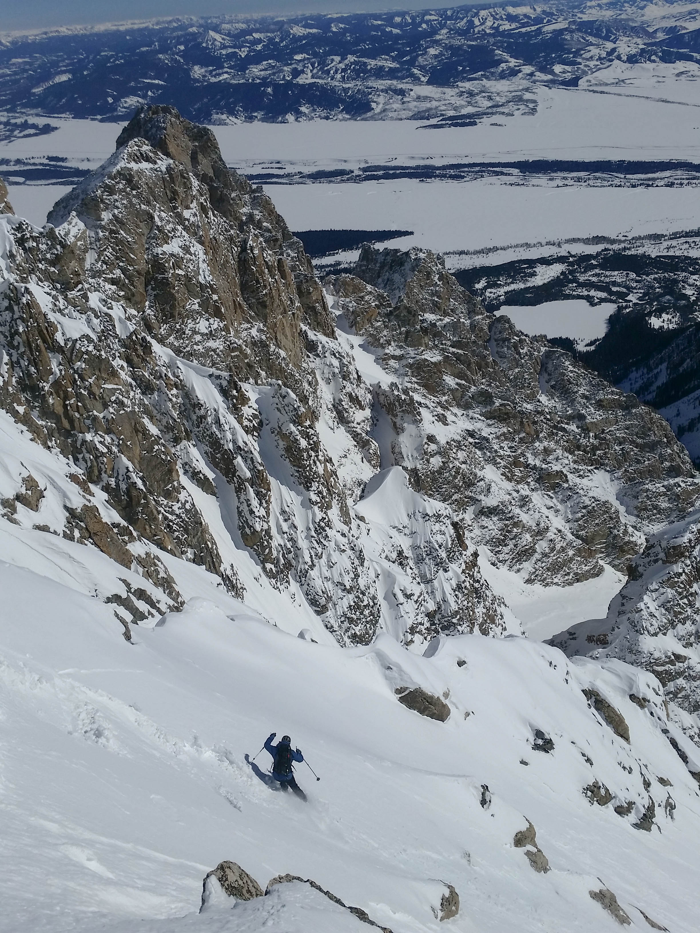
First turns on the South Face.“You’ve got a pretty face.”Making my way through the upper rock bands (photo: Dane Etter-Garrette)
From here, we made some fun pow turns down the face and towards the entry to Amor a Vida. Even with the avalanche danger low, the exposure (1000′ cliff) below the South Face makes you focus on your every move.
Staring down the South Face. The entry to Amor a Vida is the first large rock outcropping on the right of the South Face. (photo: Dane Etter-Garrette)Dane, making his way to the entry of Amor a Vida.Decent snow on the South Face.
We got to the entry, but had to double check that it was in fact the Amor a Vida Couloir. After a quick check, we confirmed that we were in the right spot and worked our way down the rock filled entry.
The entry into the Amor a Vida Couloir.
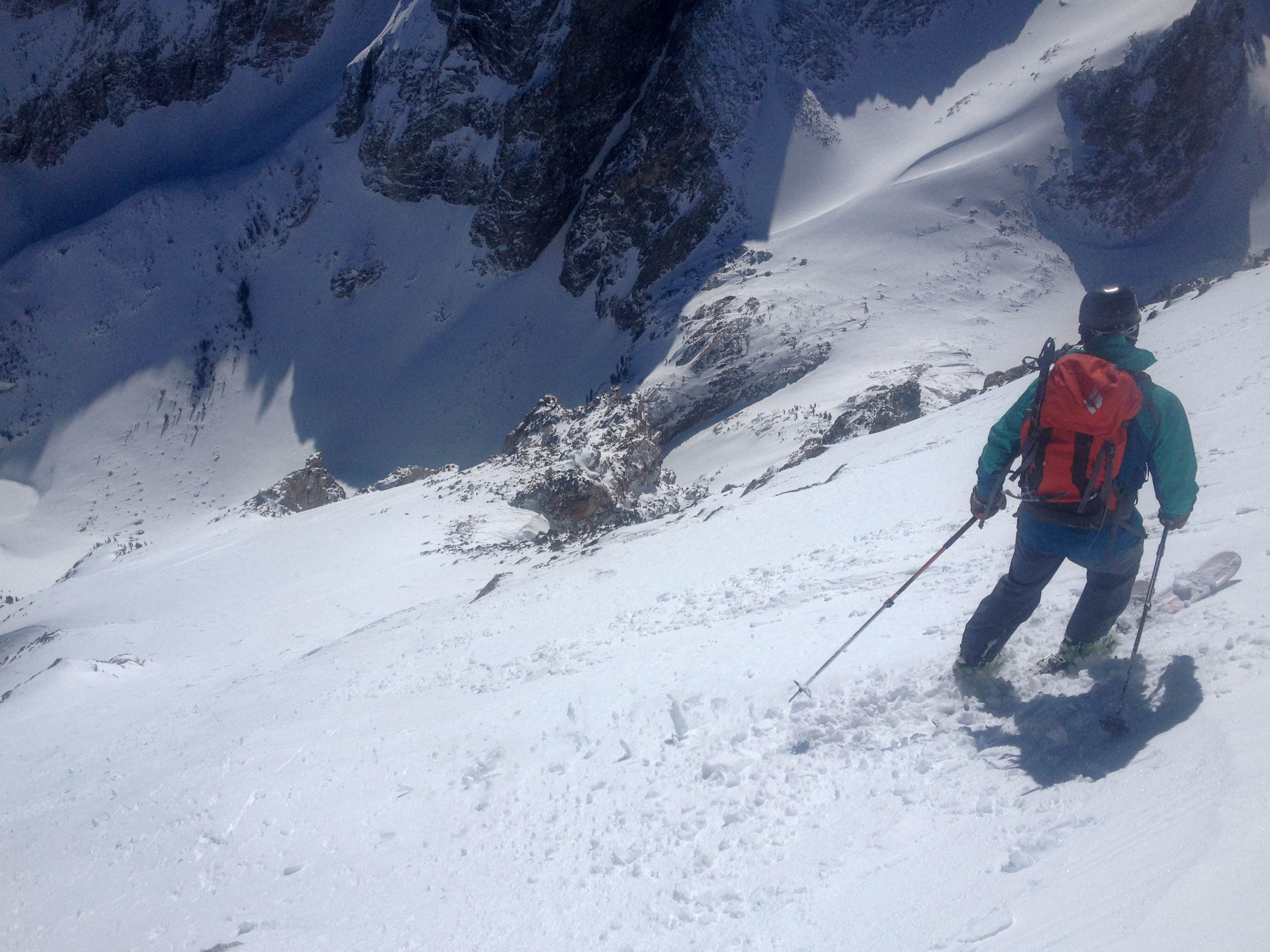
Once into the couloir, we tried to get a look at the tight upper section of the couloir proper (skiers left). It looked like it went, but was barely a ski length wide, so we opted to cross right over a few rock bands and approach the couloir from the snowfields. This exposed us to large hanging snowfields above, but we felt pretty good about the snow and quickly worked our way down through the rock bands.
Dane, cutting across and down the upper snowfield of the Amor a Vida.
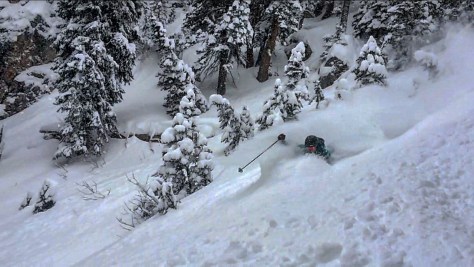
From here, we worked our way down and to our left into the main path of the couloir. Amor a Vida is one of the most amazing couloirs in the Tetons, with massive overhanging rock walls, a great pitch and some fun skiing. We had a blast getting down the run, taking it in numerous sections to ensure we were taking it all in. The couloir was predominately powder in the main path, with a few pockets of crust, but overall it was amazing skiing!
Working our way down to the left, into the main path of the Amor a Vida.The Amor a Vida was skiing good!Beautiful couloir. (photo: Dane Etter-Garrette)Slash.Dane, towards the middle of the couloir.Making my way down.. (photo: Dane Etter-Garrette)Dane, nearing the bottom of the couloir.
After making it down the 1600′ couloir safe, we still had about 2500′ of skiing until we hit the Avalanche Canyon traverse. We milked the turns and were just pumped to have skied such a fun run. We made it back to the trailhead in 8hrs and were already looking forward to more adventures in this special place we call home.