

Location: GTNP, Avalanche Canyon, Nez Perce/Cloudveil Dome
Elevation: 11,493′, 5,656′ gain/loss
Distance: 16 miles RT
Difficulty: 4 stars
Time: 7-9 hours
Trip Report:
Date: 1/9/2016
Snow Conditions: Powder, caulk, loose sluff, sun/wind crust 12″ below snow
With some light snow falling over the past couple days and a little more forecasted for Saturday: Dane, Tristan and I set out for a line we have been talking about for a couple years. The Nugget Couloir, or just simply the Nugget is a technical ski line on the southern wall of Avalanche Canyon. It terminates at a huge “chokestone” that can only be surpassed via rappel, or a 60′ air (which I don’t believe has happened).

With the objective set and snow flurrying, we set out from Bradley/Taggart at 6:40am. It was fairly warm to start out and we were quickly shedding some layers on the way to Bradley Lake. We crossed the lake (which has an ice depth of 5″) as twilight began to take affect on the morning.
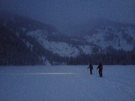
We made quick work of the first few thousand feet up Garnett, only having a few issues with the track on some steep sections. As we approached the Caves in Garnett Canyon, we were greeted with an arctic chill. The wind was whipping around the canyon with a ferocity that I can’t recall in the past. We put our layers on, but we were a little sweaty from the warm walk up so it didn’t do much good. Regardless, we trudged on through the Meadows and into the South Fork of Garnett.


We made our way past the apron of the Hourglass’, which was looking a little thin, and continued up above the steep section of the South Fork that is a mini waterfall in the summer. Here we noticed some cracking in the newly deposited snow, but there was no movement, so we continued on.


From here, we worked our way up the canyon in the direction you would to climb the South or Middle Teton in the summer. After gaining the bench at about 10,500′, we started working our way left towards the col between Nez Perce and Cloudveil Dome. That is the start of the line, but we had a ways to go until we were skiing….
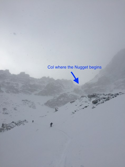
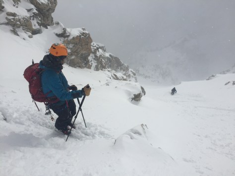
We worked our way up and into the couloir that ended at the col we were headed for. The snow was soft and deep here and we were a little concerned about skinning to the top, so we switched over to bootpack mode for the remainder of the climb. It did get fairly steep towards the top and while we were on the lookout for snow activity, we didn’t see any. We topped out at 5hrs, into intermittent sun and a lashing wind.
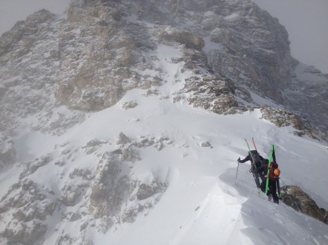
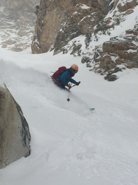
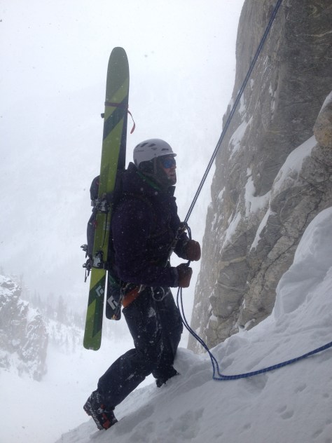
We quickly got geared up in harnesses and all our warm clothing in the howling wind and had a look at the line. It looked a little thin up top, but lower down it looked to be holding some goods, so we had a quick talk about how to ski the top section and had a rip.


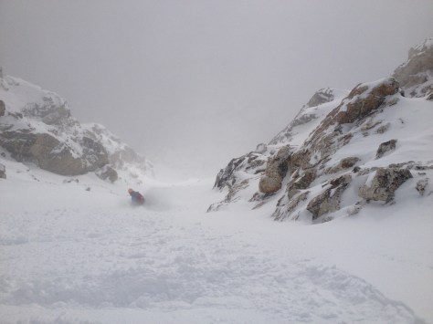


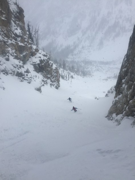
- Skiing the bottom half of the upper portion-we cut left towards the narrow section at the rock 500′ down on the left. (Visible in photo)
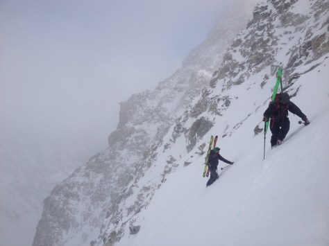
While we were on high alert for movement, we only saw some small wind slabs and loose sluff here. We made our way down the first pitch, dodging a few rocks here and there, eventually traversing left to the tight middle section. Here, we were a little concerned because there was a large hanging snow field above the tight section. We decided on a few safe ski cuts, but we could not mitigate the skiers left side of the bowl. We assumed that the snow would move, but mainly low energy slabs. I skied down into the bowl and stopped below some rocks, only kicking off one small wind slab. Dane and Trist stomped around near some rocks and finally were able to get something to move that ran down into the narrow section. This made us feel a little better and decided that dane and Trist should ski down the path of the small “slabalanche”.


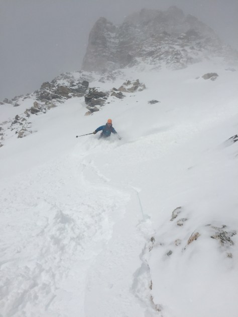
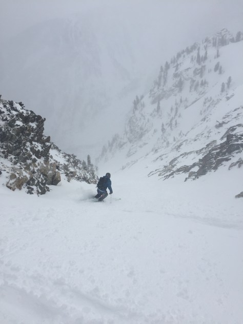
While we were a little tentative, these turns were top notch! We made our way down into the narrow section and decided on how to proceed. It looked like there was some constriction/bulge halfway down, so we decided to ski down to that and have a look.


From here, Tristan skied down to the bulge and found a way through on the right. He made his way down for a little bit after and pulled off and waited for us to make our way through the constriction.


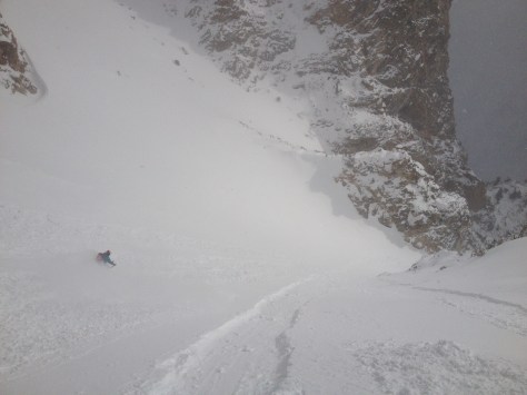
After this, we knew it was powder skiing all the way to the rappel. It stayed a little tight for 500′, then opened up to the huge snowfield above the chockstone. We skied it in several sections, milking the turns and enjoying the exposure that was below us.


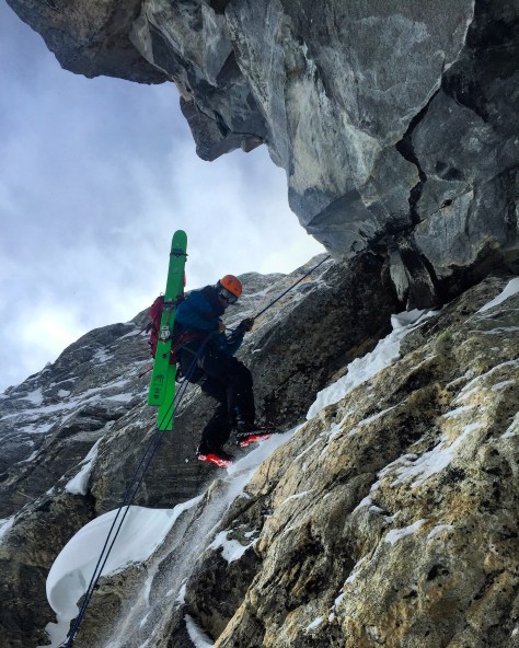
Near the end of the run and the 60′ drop, we grouped up and talked about how we wanted to approach the rappel. We had heard that the anchor was on the skiers right of the rock, but couldn’t be sure. Since I had the rope, I gingerly skied down to the rock and looked right. After a little while, I saw a cord that I assumed was the anchor. I quickly cut across an open slope and came upon the anchor about 30′ from the chockstone.

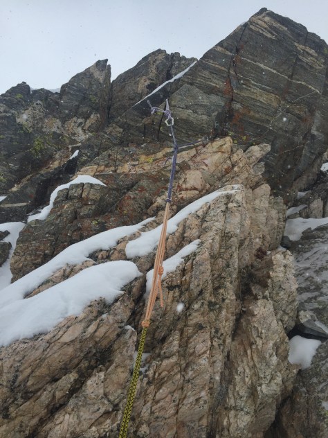
I clipped into the anchor and dug around a bit for the end while the others skied down. I went down 3′ and only found what looked to be the carabiners to rappel off, but there was another cord running from that into the snow. While we couldn’t be sure, we figured it was anchored to the wall as a backup. We felt good about it and threw out our 70m rope and rappelled off down into the unknown. We assumed that the rope would reach, but you never know. Thankfully there was about 20′ of rope to spare (I’d bring a 70m if possible, but a 60m would probably work) and we all made it down without issue.

We were pumped! This had been a line on our minds for years and we finally skied it, in POW no less. We ate some much needed food and then skied down to the traverse out of Avalanche Canyon-still finding some solid powder down low.


We pulled into the trailhead at 8hrs 15min, tired and happy. It was a great day and one I won’t forget for a while…!
