Category Archives: Trip Report

Banana Couloir


Location: GTNP, Prospector Mountain, Open Canyon, Granite Canyon Trailhead
Elevation, Gain/Loss: 11,163’, 5,220’ gain/loss
Distance: 12 miles RT
Difficulty: 4 stars
Time:  7-9 hours

Trip Report:

Date: 1/21/2015
Snow Condition: 10″ of Consolidated Powder with areas of faceted snow and some small pockets of unstable snow at lower elevation.

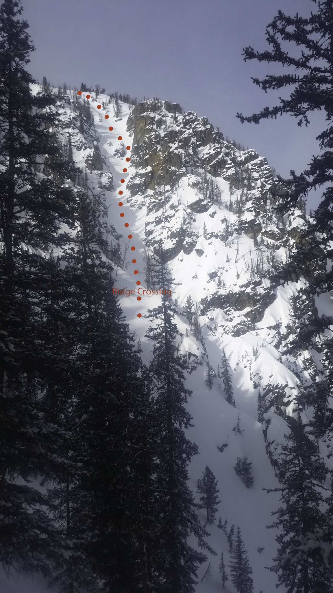
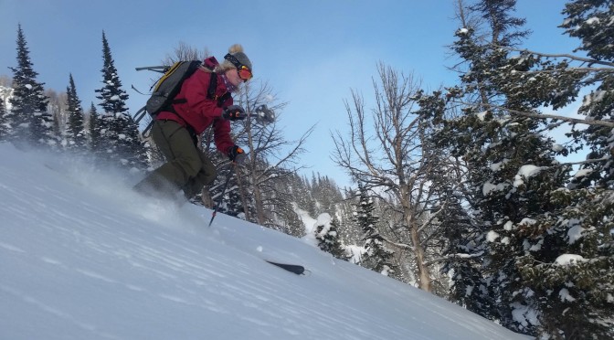
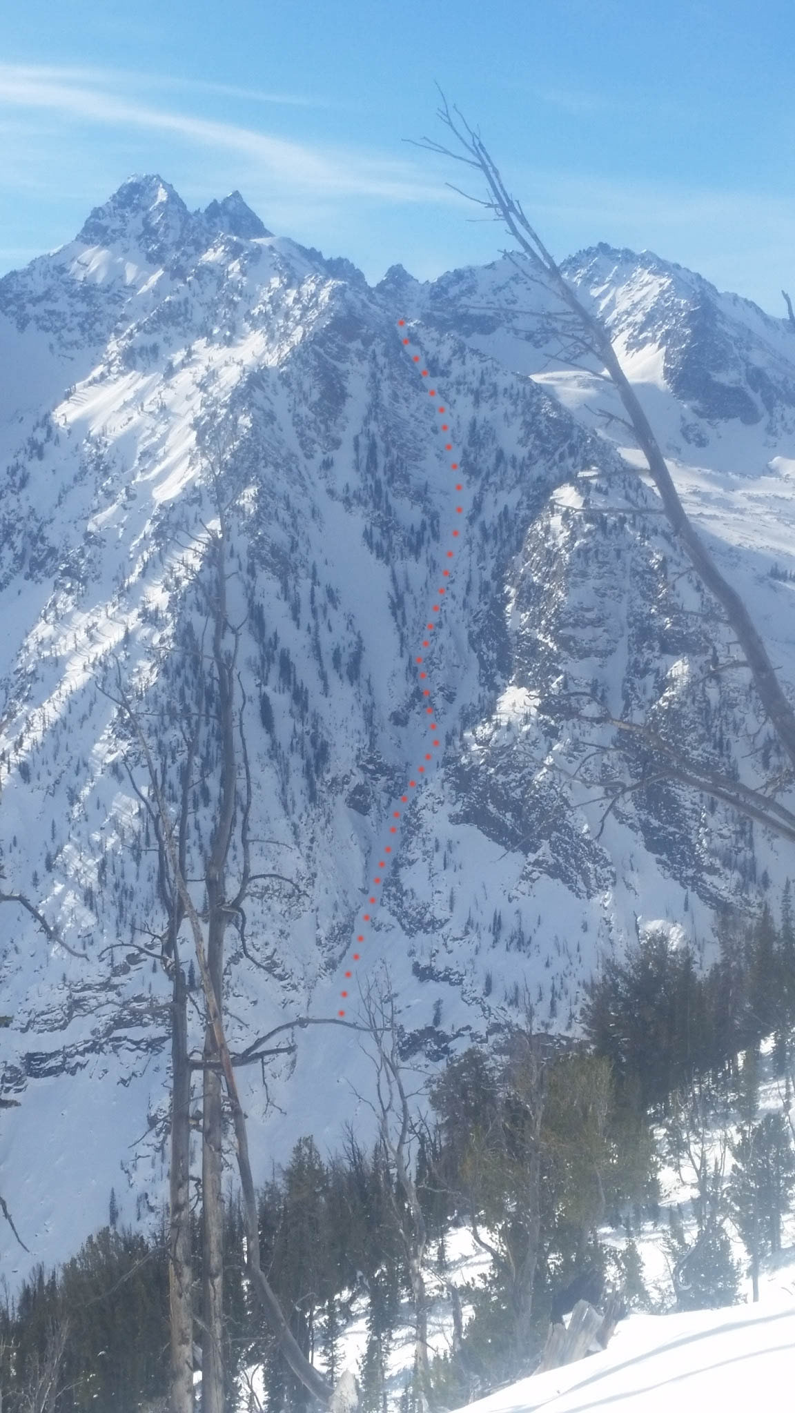
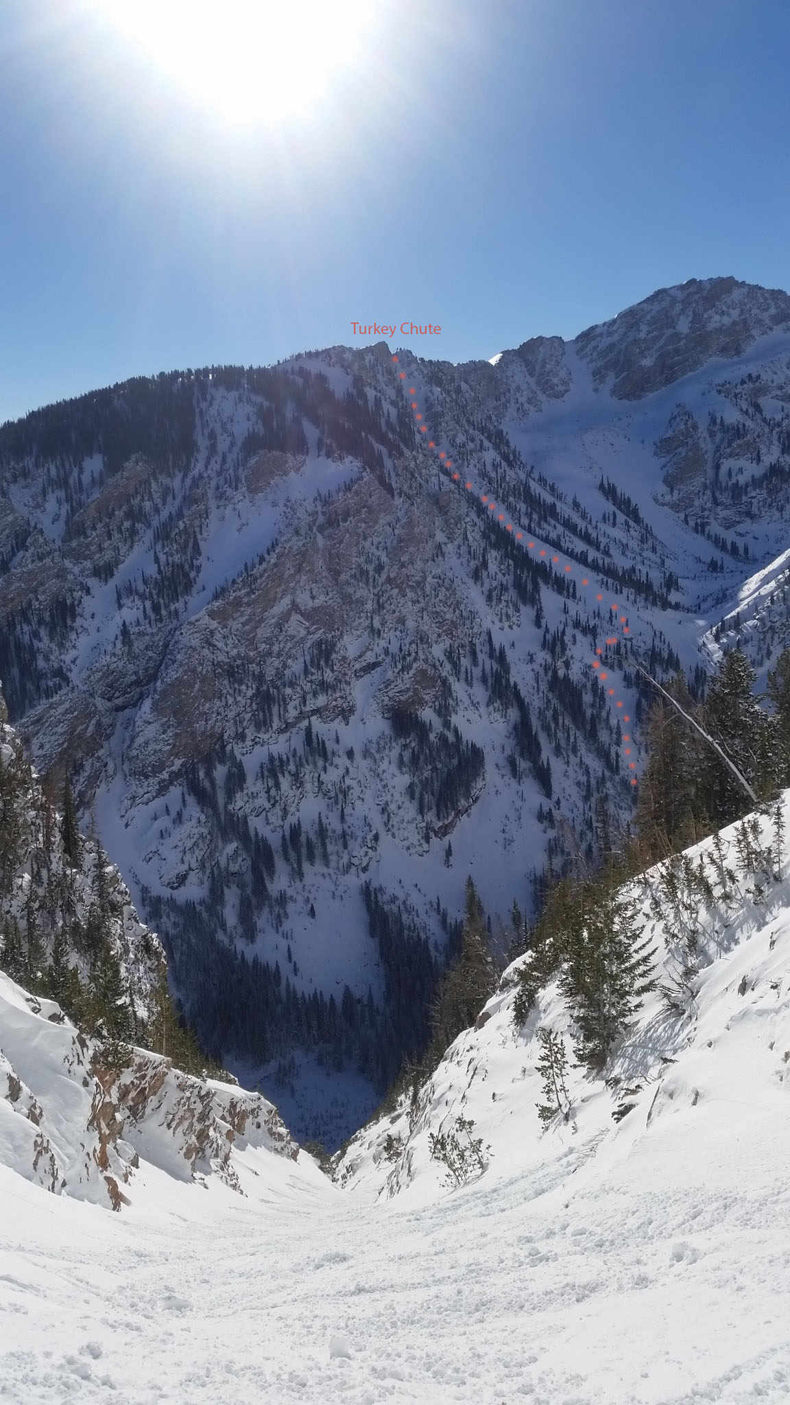
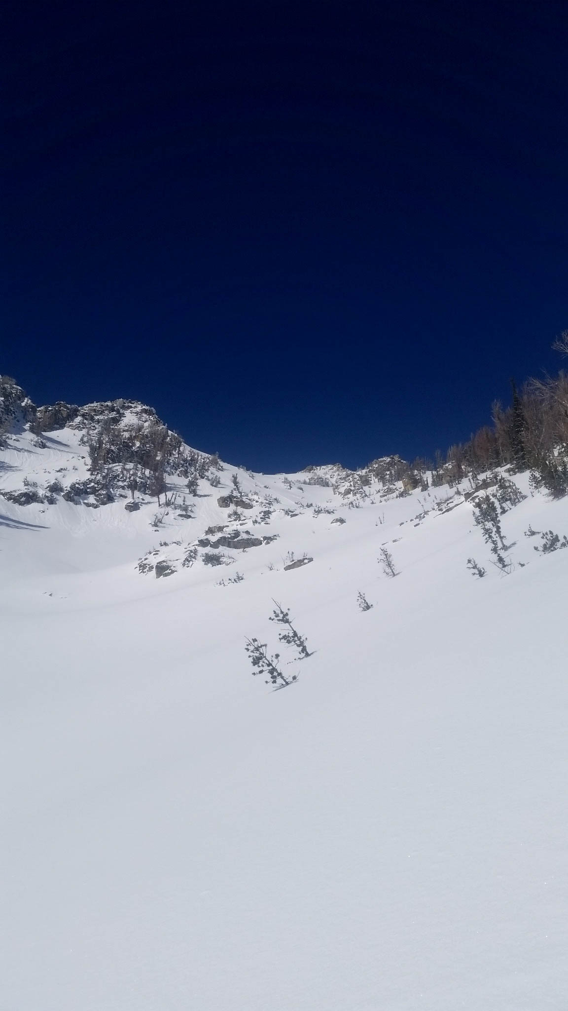
The Banana Couloir is a ski mountaineering run that many have stared at during the winter months, wondering what it would be like to ski such an aesthetically pleasing line.  I have been guilty of looking up at this East/Southeast facing couloir off Prospector Mountain for years, always wanting to ski it, but not sure how, or when the right time would be.  Well, after some thought the other night, I rallied my brother Dane and friend Close to head up Open Canyon and give it a try.

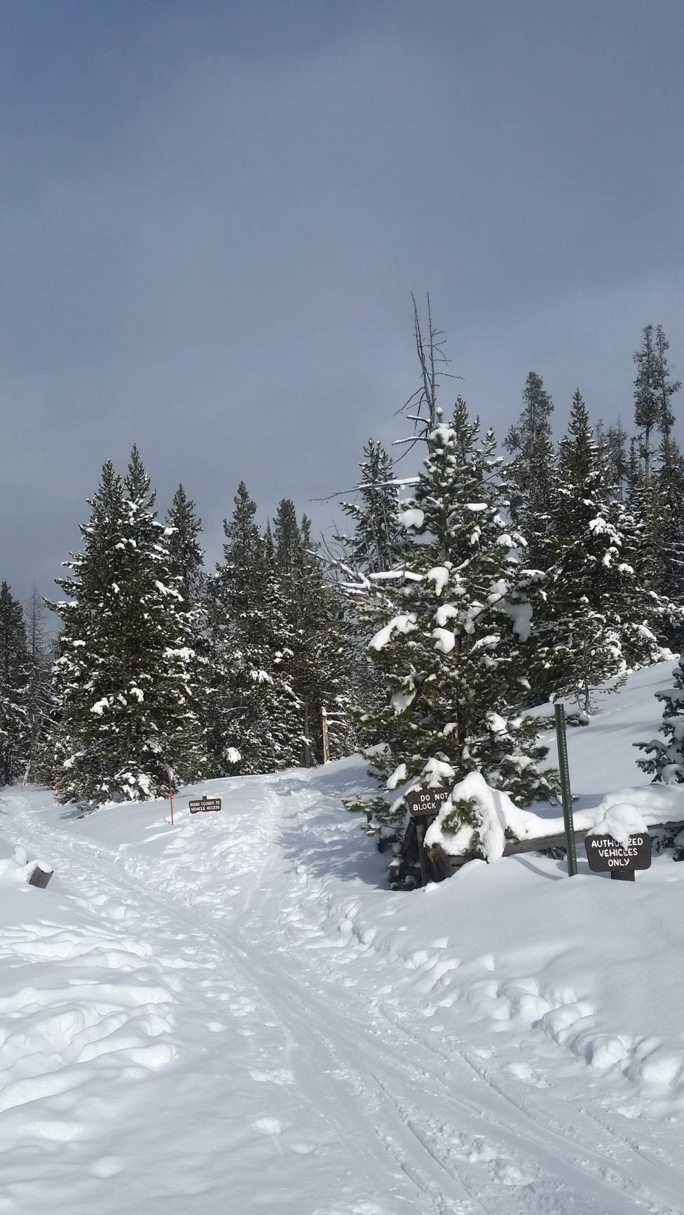
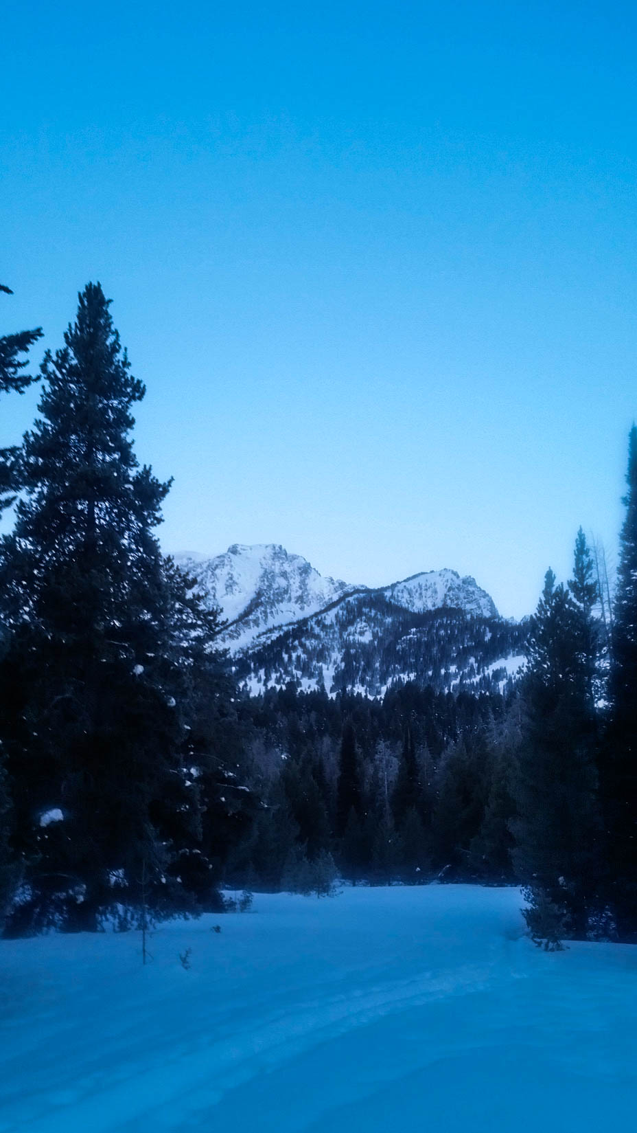
We left Granite Canyon Trailhead at 7am as the first flicker of daylight began to light up the sky.  We had a pretty solid plan for how to navigate the approach to the base of the couloir, but were unsure if it would translate into success.  After pouring over google earth, I found an old road 1.2 miles down Moose-Wilson Rd. that would take us close to the beginning of Open Canyon without much bushwhacking.  It veers off to the left, before Moose-Wilson Rd. makes a hard right and the pavement begins.  This proved to work, with a skin track taking us into the often overgrown and seldom traveled area to the south of Phelps Lake.

Our first glimpse of Banana Couloir.

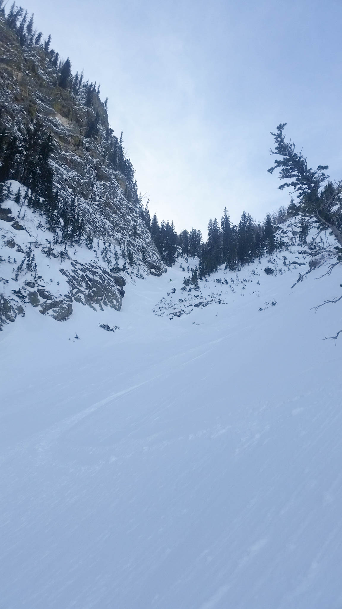
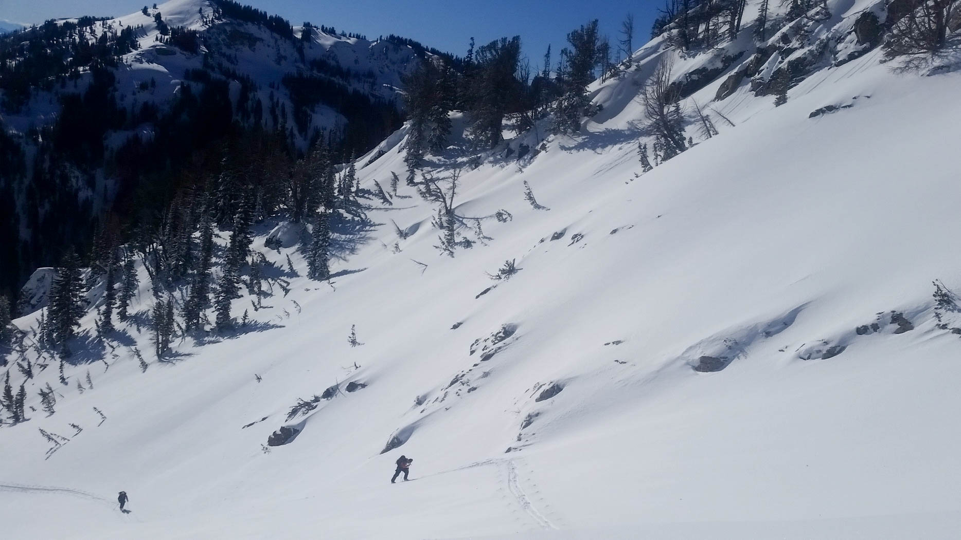
With a visual of our objective, we took a left and started breaking trail towards Open Canyon.  The snow was solid because of the low elevation rain event from a few days before, so we cruised up canyon with relative ease.  We came to a ravine at some point and not thinking, dropped into it and crossed the stream.  In hindsight, we should have just stayed on the right side of this gully, because it was the drainage from Open Canyon and we needed to be on the right side of it to start our climb.

Dane crossing a nice snow bridge.

Despite that minor setback, we made it to what we thought was the base of the couloir in just over 2hrs.  Here we stopped for a few minutes to eat and decided how to tackle the initial steep face.

Base of the Banana Couloir. Looks like it would be a waterfall in the summer.

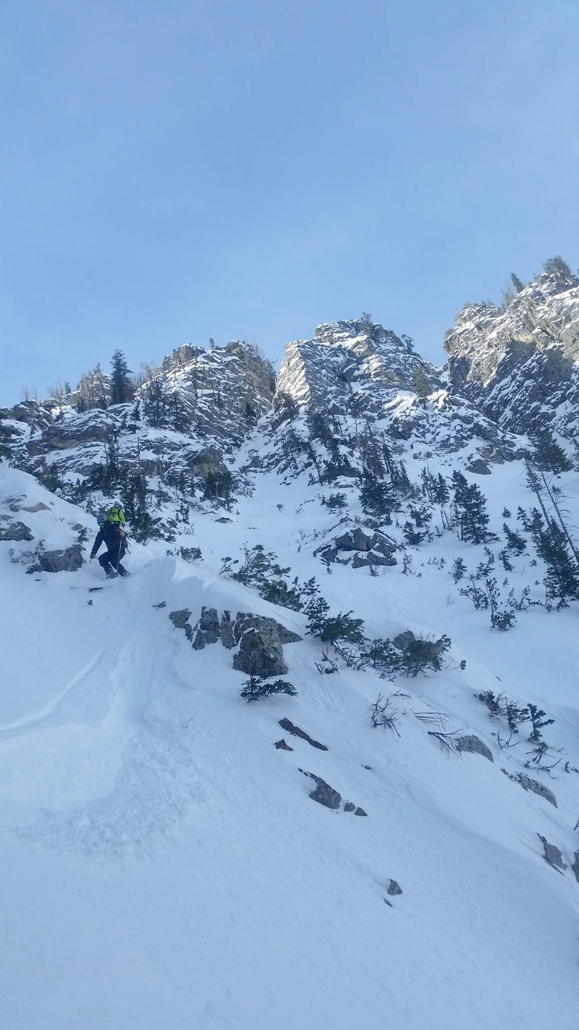
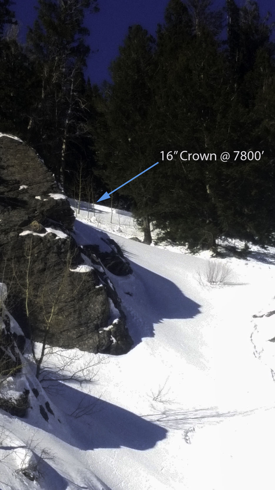
We decided to begin our climb to the lookers left of the “waterfall”, but I think the easiest and safest line up is to the right, through the trees and cliffs.  Upon starting up, we heard numerous whomps as the snow collapsed on a weak layer at about 7600′ in elevation.  This was very concerning to us and we discussed proceeding or not, but decided that the weak layer was only a low elevation (surface hoar) issue.  We continued up cautiously for around 500′, making quick switchbacks on relatively exposed face, maintaining a policy of only one person on the slope at a time.  After a stress filled, painfully slow initial hour of climbing, we seemed to be out of danger, having not heard a whomp for 200′ or so.  The slope got pretty steep and crusted here, so we took off our skis and shouldered them for another 500′ until we reached the top of the steep initial face.  We quickly got back into skin mode and tried to make up some of our lost time as we worked our way up and to the right.  We got our first look at the Banana Couloir from up close not long after and were a little concerned at its size and the distance we still had to cover before reaching the top.  We worked our way up the left side of the massive couloir for around 500′, before crossing the couloir to the safer, less exposed right ridge.

Working our way up and across the Banana Couloir.
Looking up the couloir, about 2000' from the top.
Looking up the couloir, about 2000′ from the top.
Working our way up the ridge.

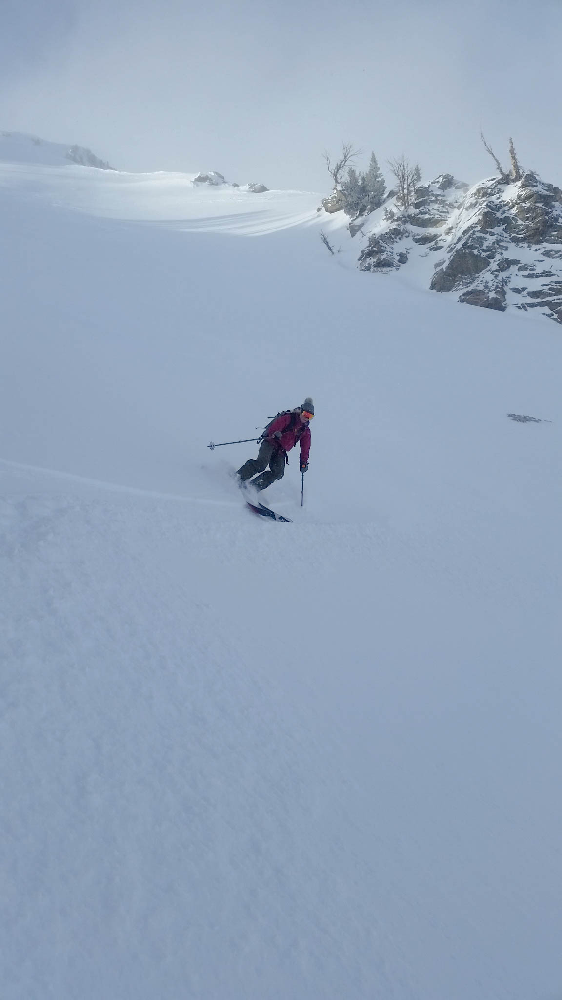
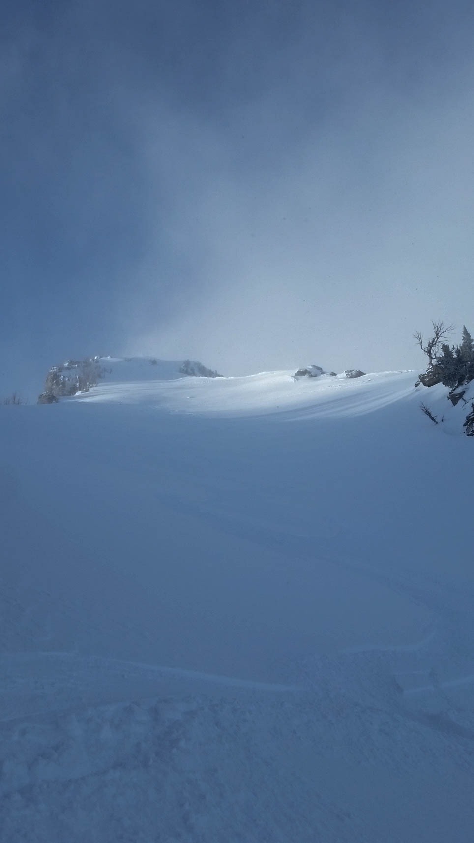
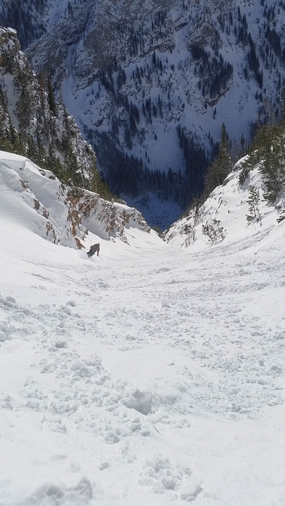
After gaining the ridge, we proceeded up at a frustrating slow pace due to the slick snow conditions and a few points where we had to take off our skis to get over some rock outcroppings.  We struggled up, eventually coming to a steep, exposed section that we had to quickly bootpack through.  After making it through this pinch in the couloir, we could see the summit, but we a little unsure if we would get to the top.  The sun was warming the snow a little faster then we would have liked and none of us felt like going for a 3500′ ride down the couloir in an avalanche.  We set a turn around time of 1:30pm and decided to push for the top at full speed.  We skinned our way up the mellow upper “bowl” for a bit, but had to switch over to bootpacking about 800′ from the top.  The snow was surprisingly stable, but after our experience down low, we were all a little nervous to be on the upper face, exposed to avalanches.

Bootpacking up the final face.

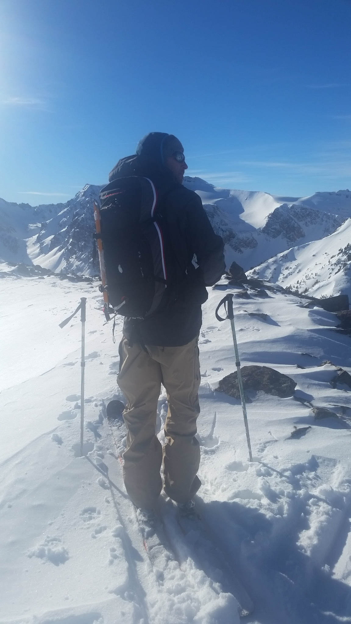
We made great time up the face, making it to the summit just past 1pm, but were all aware that now we had to make it down this large avalanche path safely.  We took a few pictures, admired the entry into the “V Notch Couloir” and quickly geared up for the ski.

View to the North.
View to the North.
Scary entry into the "V Couloir"
Scary entry into the “V Notch Couloir”…it doesn’t ski through

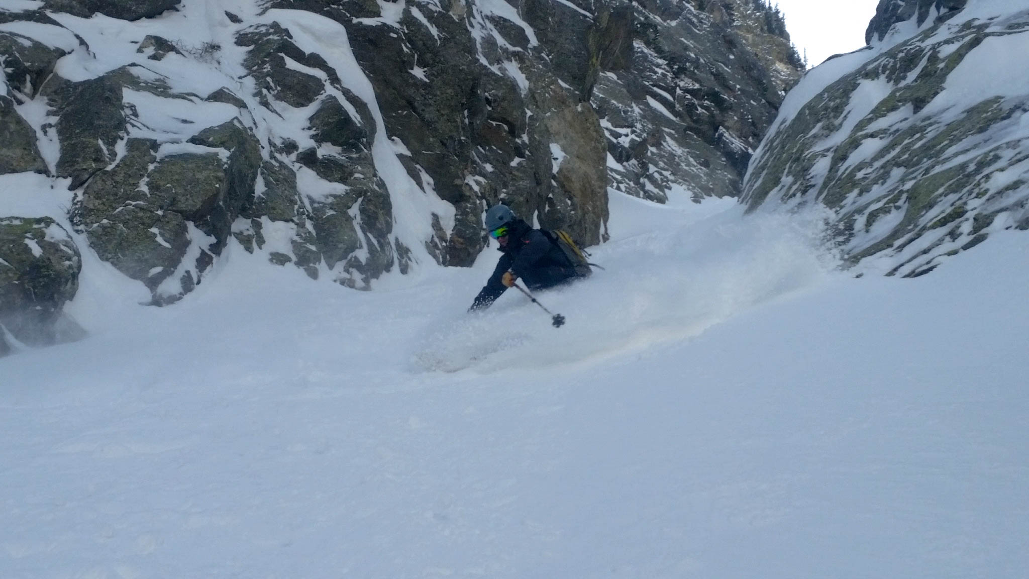
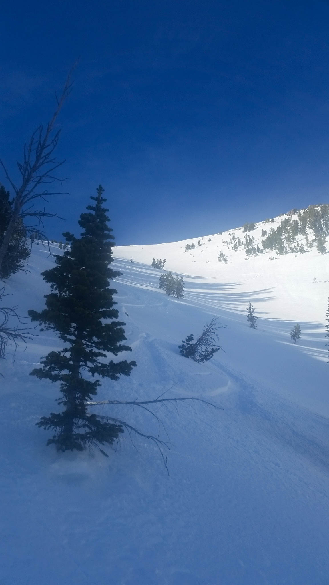
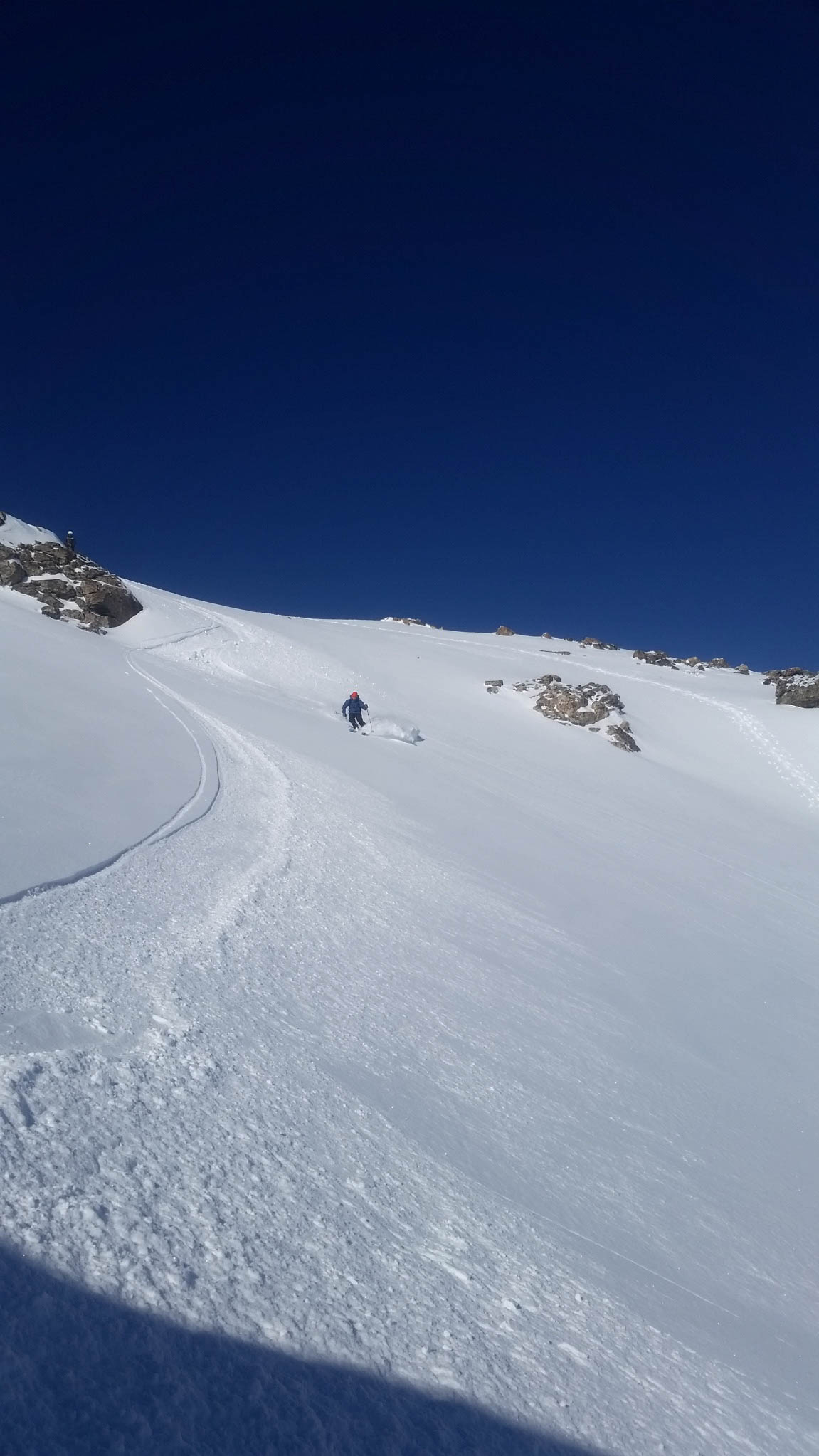
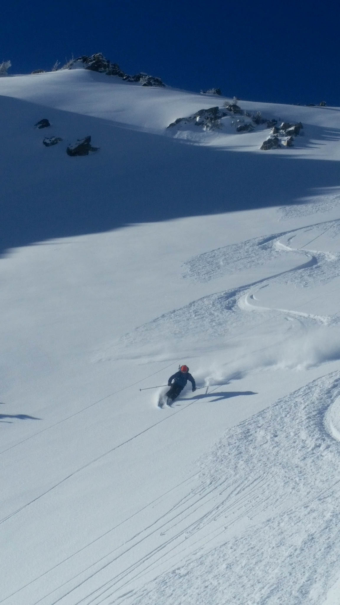
I made two big ski cuts on the rollover with Dane and Close watching, but when nothing budged we cautiously skied the upper section – gaining confidence in the snow with each turn.  The skiing was unreal – fun/bouncy/playful powder with areas of deeper snow on the northeast facing right wall.  We worked our way all the way down in several sections, having a blast and hooting all the way to the last pitch.

First turns from the top.
Dane, harvesting the Banana.
Close making turns towards the top.
Fun turns down the huge couloir.
More powder!
More powder!
Dane, entering the steep middle section.
A look up the Banana Couloir from around 9500'.
A look up the Banana Couloir from around 9500′.
Dane, milking the turns
Close, skiing the lower gut.
A view up from above the last pitch.  What an amazing run.
A view up from above the last pitch. What an amazing run.

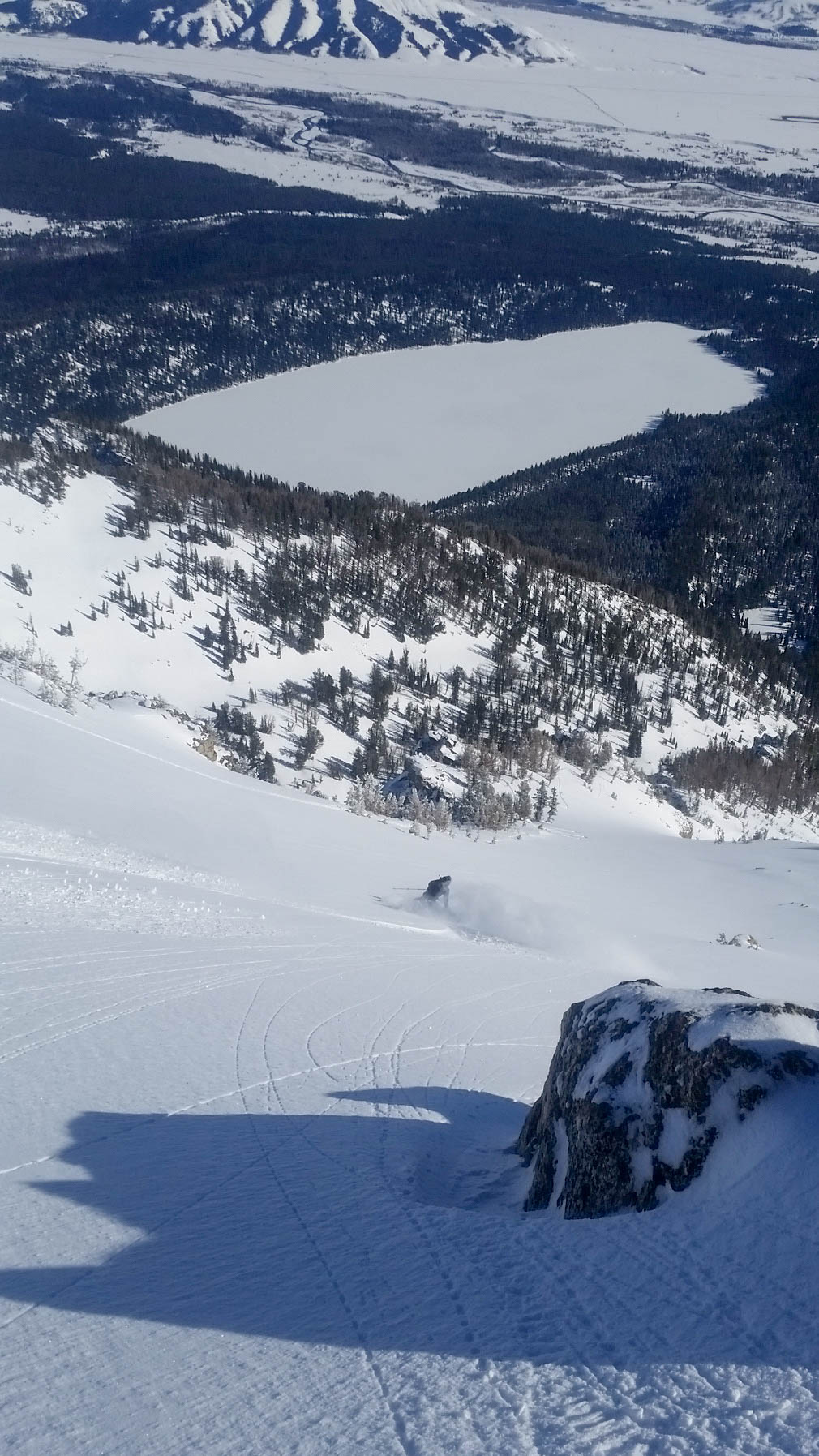
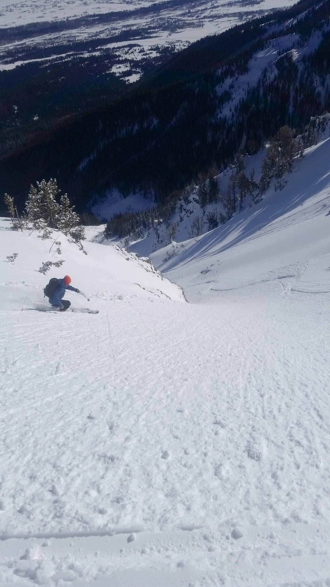
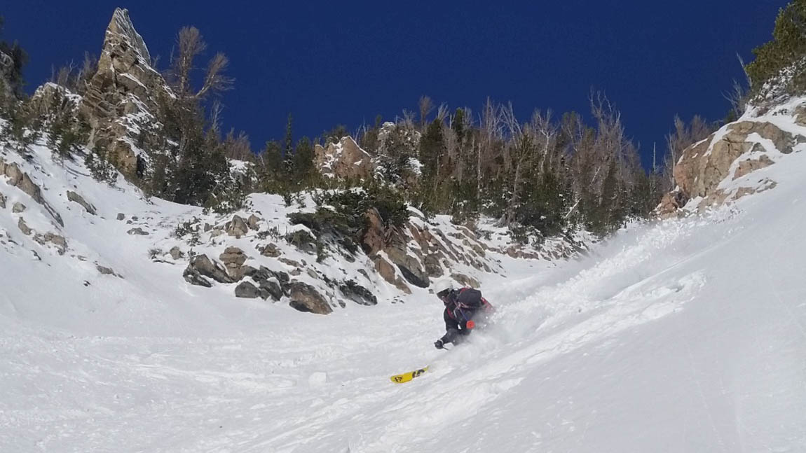
We approached the lower face from skiers left of the waterfall and cautiously made our way down, all to aware of the potential instability the snowpack displayed earlier.  We made it down to a cliffband about 200′ from the bottom of the canyon.  There were two possible ski throughs and I chose a less exposed ski to the left.  I made it down and gave a hoot, signally the next skier should come down to me.  All of a sudden, Dane yelled, “Avalanche!”.  I moved behind a tree and as I did, looked up and could see snow beginning to flow over the cliff.  It didn’t look huge, but saw large blocks of snow from what appeared to be a hard slab rolling over the cliff for what seemed like minutes.  When the snow stopped, I could hear someone yelling from below the cliff (to my left) and nothing from above where Dane and Close had just been.  I called for Dane again and thankfully heard him yell, “I’m safe, but Close got taken down below!”.  I raced down to the debris pile at the bottom of the cliff band and as I approached, saw Close’s pole.  My mind was racing, but was going for my transceiver to search for Close when I heard something from above.  It was Brian, he had been pulled over a small cliff and thankfully found some way to stop himself from being dragged over the much larger cliff edge a few feet in front of him.  He said he was missing his ski and pole, but he was ok.  I looked around in the debris pile for a bit and luckily found his ski half buried, but intact.

Brian making his way down to his ski, very luck to be safe.

Dane gingerly made his way down after Close had retrieved his ski and we collectively let out a sigh of relief.  We knew the snowpack at the lower elevation had some weaknesses, but thought we could mitigate them.  We were wrong, but thankfully we all made it out safe.

The crown of the pocket that ripped out about 50' from where Close made a turn (He was the third one to come down).
The crown of the pocket that ripped out about 50′ from where Close made a turn (He was the third one to come down).

We traversed around to the right (south), keeping high and trying to make it around the lower flanks of Olive Oil and find a skin track out.  Eventually we found a fast one all the way out to Moose-Wilson Rd. and pushed our way back to the truck in 8hrs.  It was a great day, but very easily could have been a tragic one.

Son of Apocalypse

2015-01-17 13.37.39

Location: GTNP, Death Canyon, Prospector Mountain
Tags: Backcountry Skiing, Skiing, Ski Mountaineering
Elevation: 9,413′, 4,262′ gain/loss
Distance: 8 miles RT
Difficulty: 4 stars
Time: 5-6 hours

Trip Report:

Date: 1/17/2015
Snow Conditions: 10″ of consolidated powder, stable with pockets of deeper snow

With around 10″ of snow and more on the way: Chase, Tim and I decided to venture into GTNP during a weather window to try and tackle Son of Apocalypse.  It is one of many north facing couloirs off Prospector Mountain that end up in Death Canyon.  We left town around 8:15am, delighted by the amazing weather and great visibility.  We were moving from the Death Canyon parking area at 9am and made some good time up to Phelps Overlook.  Here, we took off our skins and traversed right (south), following the summer trail until we crossed onto the large field to the west of Phelps Lake.

Field to the west of Phelps Lake.

We made a few fun turns down the field and then straight-lined it for the far end of the field and the snow covered bridge towards the south west of the field.  We transitioned back to skin mode and started moving up and to the right – onto a flank of Prospector Mountain.  In the past, I have gone across the south west corner of Phelps Lake and started skinning up the obvious avalanche path, but we decided to try a different path considering we were going to be breaking trail regardless.

The far avalanche path is the "normal" starting point of the skin.
The far avalanche path is the “normal” starting point of the skin.

We worked our way up, through some tight growth and eventually found ourselves lookers right of the avalanche path and the “normal” skin up.  We crossed the path and continued up the ridge, finding a faint skin track from a few days earlier.  The up was fairly easy and we soon found ourselves on the ridge that eventually leads to the Son of Apocalypse.  We found the little depression in the ridge we were looking for around 4hrs from leaving the truck.  While waiting for the group, I scoped out an alternative entry to the couloir that would provide a lot more spice, but looked doable if the conditions were right.

Alternative entry couloir into Son of Apocalypse.

We changed over to ski mode and made some quick assessments of the snowpack.  It seemed stable, with no areas of concern and we decided on a few ski cuts to test our theory.  This provided no movement, so we proceeded on with cautious optimism.

Tim skiing pow down the first pitch.

The snow proved to be very fun and deep, with minimal sluff or crust.  We cruised down the first pitch and then got into the heart of the couloir, with large rock walls and numerous hanging snow fields rising from each side.

Tim, skiing down the second pitch.
Tim, skiing in the distance down the second pitch.
More couloir powder turns please.

We made our way down the massive couloir, each having a blast and amazed at the amount of snow in the couloir.  We were unsure if the rock band in the middle of the couloir had filled in, but were confident that we could either air/down climb it if necessary.  So with a little trepidation, we reached the crux and found that it has filled in enough to pick our way through it.

Chase and Tim above the crux of the ski.

From here, the couloir eventually pinched into a fairly tight choke toward the bottom of the run, before opening up to the exit apron.  We skied down to the pinch and passed through without incident.

Looking down to the pinch.
Chase, looking nothing like a Colorado skier.
Chase, looking nothing like a Colorado skier coming out of the pinch.

We skied the apron down for a bit and had a look up to Apocalypse Couloir to see if the ice bulge was filled in.  We couldn’t determine if it was, but could tell that if it was skiable, it must be about a ski length wide at most.

Exit of Apocalypse Couloir.

From here, we crossed the stream and found the summer trail out of Death Canyon, which proved to be quite fast (up on the north side of the canyon).  We eventually put our skins back on and made our way across the field from earlier and up to Phelps Overlook.  We took one last look at Prospector Mountain and Death Canyon before turning our backs on the zone and making our way back to the truck.

Son of Apocalypse.
Son of Apocalypse.

The traverse/ski back was fairly fast, with us arriving at the truck in 5hrs 40min.  We felt pretty lucky to have skied a couloir like that in deep snow and even more fortunate that the snow was completely stable.  We knew that days like this were few and far between in the Tetons and soaked in the joy as we made the drive back to town.

Albright Peak

2015-01-03 15.25.06-30

Location: GTNP, Death Canyon, Albright Peak
Tags: Backcountry Skiing, Skiing
Elevation: 10,236′, 4,065′ gain/loss
Distance: 7 miles RT
Difficulty: 3 stars
Time: 4-5 hours

Trip Report:

Date: 1/3/2015
Snow Conditions: 8″ of bouncy powder with a playful sun/wind crust underneath (barely noticeable).  North facing pockets of deep powder.

After recovering from the holiday season, Zelie and I decided to venture into the park for a mellow skin up Albright Peak to see what the conditions were like in the park.  We made it to Death Canyon parking area at around 10:30am and were moving shortly after.  We made our way up the road until the fork for Death Canyon/Mavericks and made our way left to our destination.

The fork: Death Canyon (Whimpy's, Albright, Stewarts Draw) left, Mavericks right.
The fork: Death Canyon (Whimpy’s, Albright, Stewarts Draw) far left (out of frame), Mavericks far right.

We continued past the summer trailhead and made our way onto the Valley Trail until the skin track forked right and into the open field below Wimpy’s Knob that signals the start of the climb. For some reason, this is one of my least favorite skin tracks in GTNP.  It seems to always be set in the most asinine manner; usually steep with numerous switchbacks – but most importantly, it gets a good amount of sun and is always a bit slick.  So, with this in the back of my mind, we worked our way through the field and began our climb.  It was not as bad as usual, but it was not ideal.  We worked our way up for around 1.5hrs and eventually came to the final slope that leads to the top of Wimpy’s Knob.  Here, we began left about 300′ from the summit of Wimpy’s.  We crossed through some trees and above some rock outcroppings, eventually coming to the ridge that connects Wimpy’s to Albright.  We continued along the ridge until the East face of Albright was above us to our right and we needed to cross the slope to get to the south ridge and the normal boot pack up the 300′ top portion of the face.  Here, the wind had created a thick crust, which made the skinning tough, but we made it across to the south ridge and had a decision to make.  The face looked like it had slid during the past storm cycle and was riddled with wind whales.  It looked like the skiing from the top would be mediocre at best, so we opted to just ski from the ridge, about 300′ below the summit.  We geared up and ripped the gut of Albright Peak, working our way down and to the right below some large rocks.

Zelie, making some powder turns down the first section of Albright's East face.
Zelie, making some powder turns down the first section of Albright’s East face.
The upper portion of Albright.

We worked our way down and to the right below a rock band, finding some amazing snow on north facing aspects, until we had to ski hard right to avoid the choke towards the bottom of the face.  Here, we found ourselves with an untouched canvas of powder on the lower faces of Albright.

Powder time, excellent!

We milked the powder all the way to the bottom, linking some fun turns together on the mellow lower face.  At the bottom, we worked our way left – eventually finding the Valley Trail and our ticket home.  The track was pretty quick on the way out (one of the bonuses of skiing in this zone), making our way to the truck in around 15minutes.  In total, the whole ski took 4hrs 30min, at a very leisurely pace.  It was another great day in the park (we have been spoiled this winter) and left us looking forward to the next ski.

Peak 10,686

10686

Location: GTNP, Waterfall Canyon, Jackson Lake
Tags: Backcountry Skiing, Ski Mountaineering
Elevation, Gain/Loss: 10,686’, 4,127’ gain/loss
Distance: 9 miles
Difficulty: 4 stars
Time:  7-9 hours

Trip Report:

Date: 1/14/2015
Snow Conditions: Faceted Snow, Powder, Breakable Crust, Bouncy Snow

A week of high pressure and some light snow begged me into GTNP to see what the high alpine skiing was like.  After a relatively late alpine start (6:30am from Jackson), Grant and I were off to Colter Bay and the always exhilarating lake crossing.  We were moving at 7:50am, finding the inversion had lifted enough to give us a view of the shore in front of Waterfalls Canyon.

Grant making his way to Waterfalls Canyon right before the fog enveloped us.

After about 15 minutes on the ice, we were engulfed by a fog layer that made it hard to see beyond our ski tips.  As we proceeded in the direction we thought was the shore, we quickly realized that we were zigzagging north to south and needed to pull out a compass.  After many, many failed attempts to go straight and several scary “drops” into trapped surface water, we finally saw a faint shoreline and headed for it.  We reached land around 2hrs from leaving the truck, a far cry from the 45min it usually takes to cross the lake, but we were happy to have made it and ready for the uphill.  At this point, we were not 100% sure which side of Waterfalls Canyon we had landed on, but had a hunch we needed to move left.  So, we gained some elevation and slowly made our way out of the fog and into a beautiful, sunny paradise.

Above the clouds.
Above the clouds.

After determining where we were, we decided that Black Hole Couloir and Eagles Rest Peak were out of the question for the day (our initial objectives), but since we were already on a moraine of Peak 10,686, we decided to continue up and ski one of the many bowls it offered.  The up was constant, gaining 2000′ in just over an hour at one point, but we broke trail and kept moving forward until we reached the final ridge that would bring us to the summit.

Grant, making his way to up the summit ridge.

From this vantage point, we had great views into Waterfalls Canyon and an excellent look into Black Hole Couloir.  It looked like it would have been amazing and a line I would like to ski again soon if the conditions allowed.

Black Hole Couloir.
Black Hole Couloir.

We continued up the ridge for around 500′, until the wind drifts became too large to skin up, so we transitioned to boot pack mode and made our way up the remaining 500′ to the summit.  From here, the east face of Ranger Peak looked very tempting and an unnamed couloir deep in Waterfalls Canyon, on a sub peak of Doane Peak seemed to be a promising objective for another day.

"Unnamed Couloir", Waterfalls Canyon
“Unnamed Couloir”, Waterfalls Canyon

After the sightseeing, we geared up for the ski and decided on the run down.  Since we were a little unsure of the snow pack, we decided on a minor ski cut at the top of the bowl and then some “safe” turns along the ridge until we felt comfortable with the snow.  Surprisingly, the snow was very stable and playful in the top bowl…allowing us to open up some big turns down to a north facing treed aspect.

Grizz getting ready to ski.
The upper bowl of 10,686 was skiing nice.
Getting into the gully.

We skied the bowl down to the main gully and kept high right to avoid the tight “meat grinder”, making playful turns down mini north facing faces.  Here we came around from the north, now facing Jackson Lake, and were able to take a look at our awful skin track across the lake (sorry!).

Zigzags.
Zigzags.

After taking a moment to reflect on our amazing skin track, we continued down to the lake and were greeted by some fantastic turns down wide open mellow powder fields.  We made our way back to the shoreline and prepared for the skin back across frozen Jackson Lake.  The skin back wasn’t too bad, considering its imperfect line, and we made it across in just over an hour.

Views of the Tetons from Jackson Lake.
View of the Tetons from Jackson Lake.

In total, the trip took us 8 hours and 30 minutes, but considering the time spent on the ice, I was content. It was a fantastic day: great skiing, good problem solving and above all another fun rip in GTNP.

4 Hour Couloir

Location: GTNP, Shadow Peak, Avalanche Canyon
Elevation, Gain/Loss: 9877’, 3,673’ gain/loss
Distance: 6 miles RT
Difficulty: 3 stars
Time:  4-5 hours

Trip Report:

Date: 12/31/2014 Snow Condition: Powder, Sun Affected Soft Snow

We had experienced an amazing holiday week in Jackson, with a huge storm cycle bringing upwards to 4 feet of snow to the area in around 10 days.  The turns around JHMR were pretty unbelievable during that time, but the lines were also a little unbelievable, so getting out into the park for a New Years Eve ski seemed like the right thing to do.  With some nasty north/northeast winds trailing the system, most aspects were fairly wind affected, so we thought a south facing shot might have the best chance at skiing well.  Hank, B.Close and I decided on the 4 Hour Couloir, off Shadow Peak.  None of us had skied it before, but we all were excited for the relatively easy approach for a 2100′ couloir.  The approach is very simple.  You follow the normal route up Shadow Peak, but just as it benches out and you are about to go up the northeast facing “bowl” that is the skiers summit, look left. There is an obvious “col” which is the entry point to the 4 Hour Couloir. We made pretty good time up to beginning of the ski, leaving the truck around 9:45am and reaching the couloir in 2hrs 30min.  We enjoyed the views and warmth of the inverted sun on our skin for a bit before we decided to drop in.  While sitting here, we did notice a massive crown on the East face of the Grand.  It looked to have a depth of 6-8ft and ran the length of the entire face, directly above the Otter Body.

The Grand, with a massive crown across it's East face. (Unfortunately, the crown is not visible)
The Grand, with a massive crown across it’s East face. (Unfortunately, the crown is not visible)

While we were getting ready, a group of three came upon us from above.  They had a similar idea for the day and after a quick chat, they took off down the couloir and we slowly got ready, wanting to give them plenty of time to ski the line.  After about 15 minutes, we decided they must be out of harms way and got moving.  The first few turns were a little heavy, with the sun and inverted temperatures doing a bit of damage on the snow, but quickly we found some dry powder snow.

Close making his way down the upper portion of the couloir.

Once into the couloir, the snow was surprisingly good, with dense powder in most places.  We skied it in 4 sections, but could have easily done it in two if we were concerned about the snow stability.  Mostly, we were just having fun skiing a beautiful couloir in the relative warmth of an inverted day and didn’t feel the need to rush the experience.

Hank skiing from the halfway point of the 4 Hour Couloir.
Turkey Chute off 25 Short across Avalanche Canyon.

We continued down, making some great turns and really opening it up as the couloir starts to widen near the bottom.  The snow towards the bottom was some of the best, dense and chalky – which was a nice finish to the great day.

B.Close mid turn (or straight-lining?) towards the bottom
Looking up into the 4 Hour Couloir from Avalanche Canyon.
Looking up into the 4 Hour Couloir from Avalanche Canyon.  The couloir goes up to the right.

After finishing the run, we were greeted with a debris pile from an avalanche that had probably occurred sometime during the last storm cycle.  After making it through all the land mines, we slowly worked our way out of Avalanche Canyon.  I say slowly because the inversion had created snow temperates so low that we were basically walking out, not skiing.  Along the “walk” out, we ran into the group of three who had skied the couloir before us.  They emphatically informed us that they had come across an adolescent black bear 400′ into the couloir.  They said it was hanging out above them in a treed area before it truly tightened into a couloir.  We were shocked, simultaneously glad and a little jealous that they had gone first.  Add bears encounters to the long list of dangers that backcountry skiers face! We continued out at a “blistering” pace, finally crossing Taggart Lake and making it back to the truck in 4hrs 30min.  We enjoyed some laughs and quickly made our way to Dornan’s for a few beverages to start the New Years festivities.